Height geographical mapping system of multi-rotor unmanned aerial vehicle

A multi-rotor UAV and UAV technology, applied in the field of surveying and mapping systems, can solve the problems of poor image splicing and display effects, insufficient expandable functionality, etc., and achieve the effect of convenient operation and strong scalability

Pending Publication Date: 2018-04-10
SHANGHAI ACADEMY OF ENVIRONMENTAL SCIENCES
View PDF8 Cites 11 Cited by
  • Summary
  • Abstract
  • Description
  • Claims
  • Application Information

AI Technical Summary

Problems solved by technology

[0006] However, the above-mentioned existing technologies still have problems such as poor image stitching display effect and insufficient expandable functionality. Therefore, a new type of multi-rotor UAV height geographic mapping system is needed to meet the needs of image, data processing and function expansion. more and more demand

Method used


Image

  • Height geographical mapping system of multi-rotor unmanned aerial vehicle
  • Height geographical mapping system of multi-rotor unmanned aerial vehicle
  • Height geographical mapping system of multi-rotor unmanned aerial vehicle

Examples


Embodiment Construction

[0026] The present invention will be described in further detail below in conjunction with the accompanying drawings and embodiments. It should be understood that the specific embodiments described here are only used to explain the present invention, not to limit the present invention.

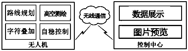
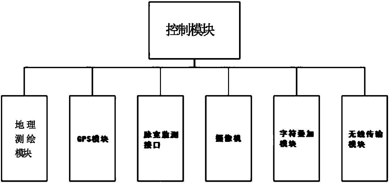
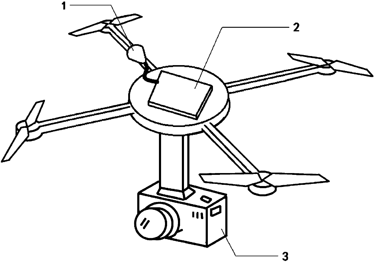
[0027] The multi-rotor drone height geographic surveying and mapping system of the present invention includes a multi-rotor drone, a GPS module 1, a control module, a character superposition module 2, a pulse width detection interface, a geographic surveying and mapping module, and a cloud control center. Among them, the multi-rotor UAV has enough load capacity to install a complete set of devices. It can cooperate with various sensors such as nine-axis sensors, optical flow sensors, GPS sensors, ultrasonic sensors, and barometers, and electronic governors and motors. Realize fixed-point hovering and various flight actions, and provide an interface to allow external device control.

[0028] S...


PUM


Abstract

The invention discloses a height geographical mapping system of a multi-rotor unmanned aerial vehicle. The system comprises a multi-rotor unmanned aerial vehicle, a GPS module, a control module, a character superposition module, a pulse width detection interface, a geographic mapping module and a cloud control center. The geographic mapping module comprises a camera and a three-dimensional laser scanner. The geographic information acquisition and mapping of special terrains can be realized by adopting the system. Meanwhile, the system is convenient in operation and strong in expandability. Theonline mapping information preview can be realized in real time.

Description

technical field [0001] The invention relates to a surveying and mapping system, in particular to a multi-rotor UAV height geographic surveying and mapping system. Background technique [0002] In field activities such as geographic surveying and mapping, boundary surveying, and geological exploration, it is often necessary to collect latitude, longitude, and altitude information of designated locations. The currently commonly used measuring tool is a measuring instrument with a GPS host installed on the top of a hand-held pole. The instrument is manually grasped to the location to be measured, and a handheld communication device is used to communicate with the GPS host and read and record the data to be measured at the current location. However, many measurement sites are in places that are inaccessible to people such as high mountains, dangerous slopes, cliffs, and cliffs. It is time-consuming, laborious, inefficient, and even dangerous to personal safety to measure such si...

Claims


Application Information

Patent Timeline
Patent Type & Authority Applications(China)
IPC IPC(8): G05D1/10G01C11/02
CPCG05D1/101G01C11/02
Inventor 黄沈发王卿东阳徐志豪吴健鄢忠纯
Owner SHANGHAI ACADEMY OF ENVIRONMENTAL SCIENCES
Why Eureka
Try Eureka