Automatic Processing Method of Real Estate Surveying and Mapping
An automatic processing, real estate technology, applied in the field of building surveying and mapping, to ensure complete consistency, accurate area calculation, and avoid missing calculations
- Summary
- Abstract
- Description
- Claims
- Application Information
AI Technical Summary
Problems solved by technology
Method used
Image
Examples
Embodiment
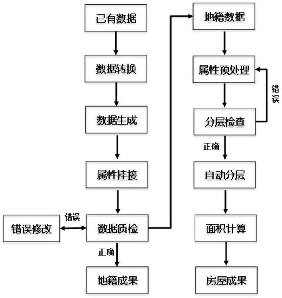
[0033] This method proposes an automatic processing method on the basis of summarizing the difficult problems in the process of rural real estate surveying and mapping, which mainly includes the cadastral data processing part and the housing data processing part.
[0034] 1. Cadastral data processing part
[0035] 1.1 Data conversion: The actual operation of the cadastral data processing part is generally updated on the basis of the existing cadastre database. The original cadastral data is mostly in .shp format. This method provides an automatic reading part, which can easily convert the .shp space And attribute data are automatically converted to .dwg format, which is convenient for the next step.
[0036] 1.2 Batch generation of parcels and houses: For the changed part of the original cadastral data, the operation team will update and measure the changed part, and at the same time investigate the ownership of parcels and houses, etc., and pass the survey information obtaine...
PUM
 Abstract
Description
Claims
Application Information
 - R&D
- Intellectual Property
- Life Sciences
- Materials
- Tech Scout
- Unparalleled Data Quality
- Higher Quality Content
- 60% Fewer Hallucinations
Browse by: Latest US Patents, China's latest patents, Technical Efficacy Thesaurus, Application Domain, Technology Topic, Popular Technical Reports.
© 2025 PatSnap. All rights reserved.Legal|Privacy policy|Modern Slavery Act Transparency Statement|Sitemap|About US| Contact US: help@patsnap.com


