
Method for extracting levee line data based on high-resolution digital terrain

A digital terrain, high-resolution technology, applied in image data processing, extraction from basic elements, image analysis, etc., can solve the problems of high sensitivity of embankment damage, poor method adaptability, low efficiency, etc., to achieve the detection of changes in different periods. , to achieve the effect of automatic extraction and high calculation efficiency

Active Publication Date: 2018-07-24
CHANGJIANG RIVER SCI RES INST CHANGJIANG WATER RESOURCES COMMISSION
View PDF10 Cites 2 Cited by
  • Summary
  • Abstract
  • Description
  • Claims
  • Application Information

AI Technical Summary

Problems solved by technology

[0006] Aiming at the shortcomings of conventional high-resolution DEM to extract embankment line data, such as low efficiency, manual intervention, and high sensitivity to embankment damage, resulting in poor adaptability of the method, the present invention proposes an embankment based on high-resolution digital terrain Line data extraction method, which uses the ring detection method to construct a fully automatic extraction method for embankment line data, which can efficiently realize large-scale, high-precision embankment line data extraction, and meet the high-efficiency, large-scale, high-precision and automation of embankment centerlines extraction request

Method used


Image

  • Method for extracting levee line data based on high-resolution digital terrain
  • Method for extracting levee line data based on high-resolution digital terrain
  • Method for extracting levee line data based on high-resolution digital terrain

Examples


Embodiment Construction

[0036] The technical solutions in the present invention will be clearly and completely described below in conjunction with the accompanying drawings in the present invention.

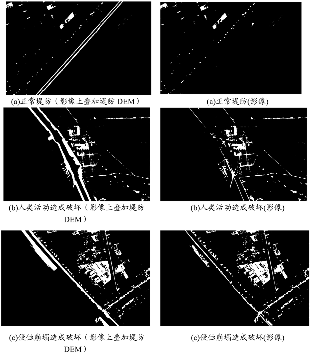
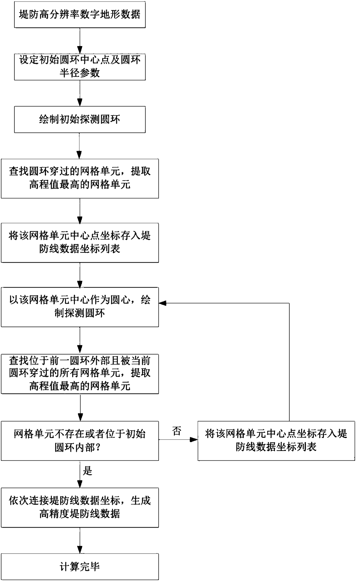
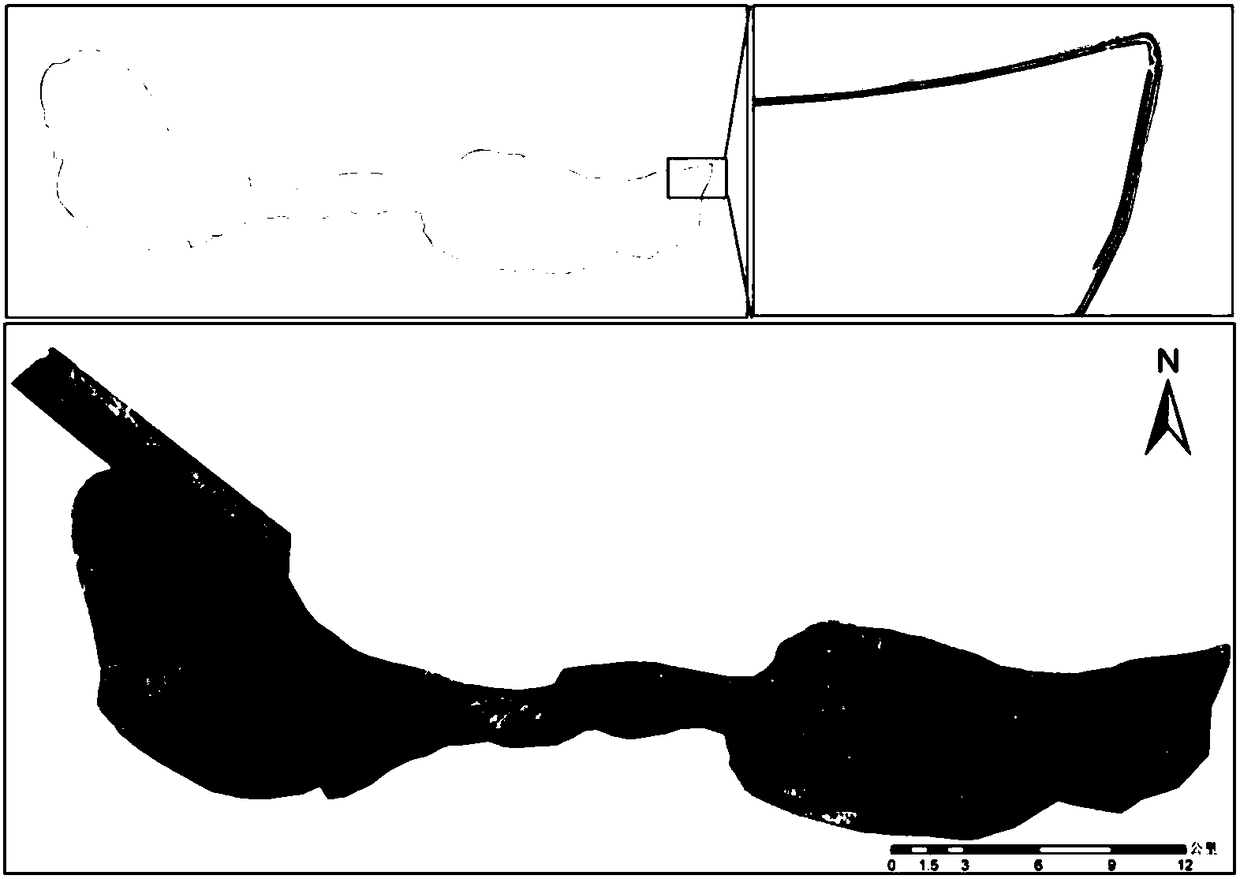
[0037] figure 1 Shown is a schematic flow chart of one embodiment of a method for extracting embankment line data based on high-resolution digital topography in the present invention, figure 2 An example of image and DEM data of a certain area is given (the lower part is the image of the area where the dike is located, and the upper part is the DEM of the embankment). The image is mainly used for comparison and description of the current situation of the embankment. It is 1 meter long, nearly 50km wide from east to west, 20km wide from north to south, and 120km long. This example provides a closed dike, that is, the two ends of the dike are connected. image 3 A schematic diagram of elevation anomalies in the DEM caused by human activities, erosion, etc. is given, and the present invention aims to sol...


PUM


Abstract

A method for extracting levee line data based on high-resolution digital terrain automatically constructs a detection ring on the digital terrain along the advance direction of the levee for the leveehigh-resolution digital terrain data, searches out a grid unit with the highest elevation value in intersecting grids of the ring and the digital terrain, continues to construct the detection ring with the grid unit as the center of the ring until the levee digital terrain detection is completed, and constructs the high-precision levee line data by connecting the center point of the ring, therebyrealizing the automatic extraction of the levee line data. Compared with a traditional manual field mapping method, the method greatly improves the efficiency of data production of the levee line. Compared the least cost path analysis method, the matrix method, the vertical line method and the point matching normal line method are common to the current levee line data extraction, the method wellsolves the problem of the line data extraction abnormality caused by the damage to the levee. The method has great advantages in both line data extraction precision and extraction efficiency, and is asuperior levee line data extraction method.

Description

technical field [0001] The invention relates to the technical field of water conservancy information, in particular to a method for extracting embankment line data based on high-resolution digital topography. Background technique [0002] Dikes are an important measure for flood control. At present, the length of dikes built in my country has reached more than 200,000 kilometers, and they have played an important role in flood control and disaster relief. The specifications and shapes of dikes, such as the minimum elevation of the dike, the width of the crest, and the slope of the embankment, usually have a set of design specifications. In China, the latest design specifications for dikes are the national standards "Code for Design of Dike Engineering" released in 2013 ( GB 50286-2013). With the extension of the service life of the embankment, the flood control capacity of the embankment will decrease due to flood erosion, subsidence of embankment foundation, human activiti...

Claims


Application Information

Patent Timeline
Patent Type & Authority Applications(China)
IPC IPC(8): G06T11/20G06T7/00
CPCG06T7/0004G06T11/203
Inventor 沈定涛张煜叶松曹波宋丽陈文龙魏思奇
Owner CHANGJIANG RIVER SCI RES INST CHANGJIANG WATER RESOURCES COMMISSION
Learn More