
Method for performing field surveying and mapping by using unmanned aerial vehicle aerial photography

A kind of aerial photography and UAV technology, applied in the field of UAV surveying and mapping, to achieve the effect of uniform color tone, clear image and convenient operation

Inactive Publication Date: 2018-09-18
浙江鼎测地理信息技术有限公司
View PDF2 Cites 11 Cited by
  • Summary
  • Abstract
  • Description
  • Claims
  • Application Information

AI Technical Summary

Problems solved by technology

[0003] Most of the current aerial photogrammetry uses small civil aircraft, but after a survey and mapping, there will be a lot of flying costs. A low-cost, easy-to-operate aerial survey and mapping method is urgently needed.

Method used


Image

  • Method for performing field surveying and mapping by using unmanned aerial vehicle aerial photography

Examples


Embodiment

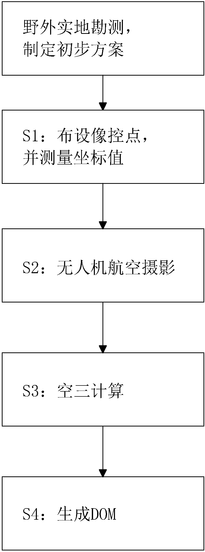
[0037] A method for field surveying and mapping using UAV aerial photography, referring to figure 1 , the specific steps are as follows: Before starting, it is first necessary to conduct field surveys, analyze relevant data, and formulate a preliminary surveying and mapping plan.

[0038] S1: Arrange more than two image control points per square kilometer in the work area. Image control points are generally selected in places with small elevation fluctuations, relatively fixed all year round, and easy to accurately locate and measure. Generally, it is selected at the intersection of small linear features with good room angle and intersection angle (30°-150°), obvious corner points of features, and the center of point-like features with aerial photography images less than 0.2mm. The images of the image control points are relatively clear, which is easy to judge and measure three-dimensionally. After the image control points are determined, use red paint or other easy-to-observe...


PUM


Abstract

The invention discloses a method for performing field surveying and mapping by using unmanned aerial vehicle aerial photography, and belongs to the field of unmanned aerial vehicle surveying and mapping. The method is characterized in that the method comprises the following steps: S1, arranging control points in a work zone, and measuring coordinate values of the control points; S2, acquiring aerial photographic image data by using an unmanned aerial vehicle according to the arranged control points; S3, importing the aerial photography image data of the unmanned aerial vehicle, POS (Point-of-Sale) data and the measured coordinate values of the control points into surveying and mapping software for aerial triangulation calculation; S4, importing the aerial triangulation calculation result and aerial photography image data into the surveying and mapping software to generate a DOM (Digital Orthoimage). The method has the effects of easiness in operation and low cost.

Description

technical field [0001] The invention relates to the field of drone surveying and mapping, in particular to a method for field surveying and mapping using drone aerial photography. Background technique [0002] Aerial photogrammetry is an important technical means to quickly obtain geographic information. It is a way to measure and update national topographic maps and establish geographic information databases. It plays an irreplaceable role in the process of acquiring and updating spatial information, especially for large-scale and large-scale The acquisition and update of medium-scale data is inseparable from aerial photogrammetry. [0003] Most of the current aerial photogrammetry uses small civil aircraft, but after a survey and mapping, there will be a lot of flying costs. A low-cost, easy-to-operate aerial survey and mapping method is urgently needed. Contents of the invention [0004] The purpose of the present invention is to provide a method for field surveying an...

Claims


Application Information

Patent Timeline
IPC IPC(8): G01C11/00G01C11/04
CPCG01C11/00G01C11/04
Inventor 钟云山
Owner 浙江鼎测地理信息技术有限公司
Learn More