Virtual three-dimensional map establishing method

A virtual three-dimensional and map technology, applied in the field of establishing virtual three-dimensional maps, can solve problems such as incomplete three-dimensional maps, and achieve the effects of reducing professional requirements, saving traffic, and improving integrity and practicability.

Inactive Publication Date: 2018-09-21
王乐陶
View PDF3 Cites 24 Cited by
  • Summary
  • Abstract
  • Description
  • Claims
  • Application Information

AI Technical Summary

Problems solved by technology

[0008] In view of the above defects or improvement needs of the prior art, the present invention provides a building visual positioning method and equipment, which uses the building video acquired by aerial photography to extract the video frame of the building, and matches the video frame to obtain the building The two-dimensional point coordinates of the image matching points are converted into the three-dimensional coordinates of the buildi

Method used


Image

  • Virtual three-dimensional map establishing method

Examples


Embodiment Construction

[0044] In order to make the object, technical solution and advantages of the present invention clearer, the present invention will be further described in detail below in conjunction with the accompanying drawings and embodiments. It should be understood that the specific embodiments described here are only used to explain the present invention, not to limit the present invention. In addition, the technical features involved in the various embodiments of the present invention described below can be combined with each other as long as they do not constitute a conflict with each other.

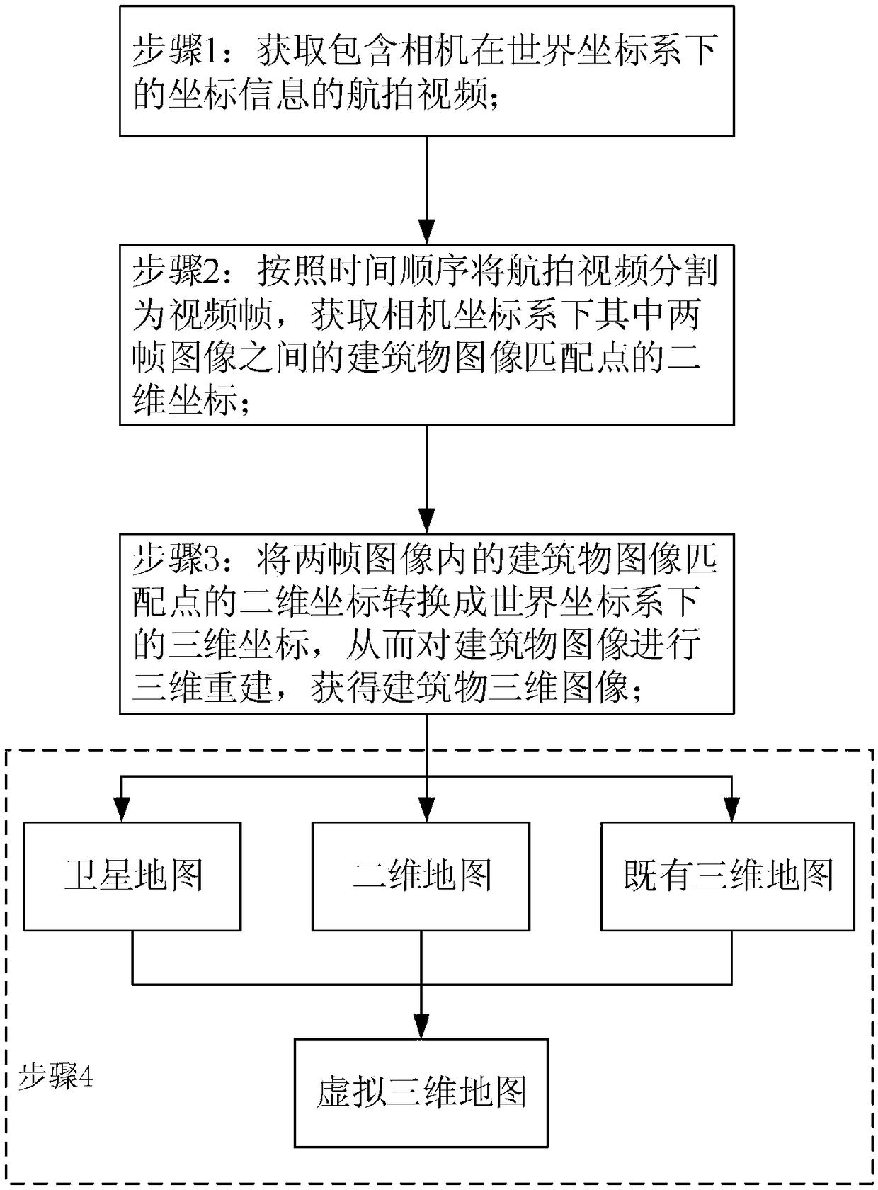
[0045] see figure 1 The method for establishing a virtual three-dimensional map provided by the present invention mainly includes the following steps:

[0046] Step 1: Obtain the aerial video of the target building in the target area, and the aerial video contains the coordinate information of the synchronously recorded camera in the world coordinate system;

[0047] Step 2: Divide the aerial ...


PUM


Abstract

The invention provides a virtual three-dimensional map establishing method and belongs to the field of electronic maps. The method comprises the steps that 1, an aerial video of a target building in atarget region is acquired, wherein the aerial video contains coordinate information, synchronously recorded, of a camera under a world coordinate system; 2, the aerial video is divided into video frames according to a time order, and two-dimensional coordinates of building image matching points in two frame images under the camera coordinate system are acquired; 3, the two-dimensional coordinatesof the building image matching points in the two selected frame images are converted according to internal parameters and external parameters of the camera in combination with the coordinate information of the camera under the world coordinate system, three-dimensional coordinates of the building image matching points under the world coordinate system are obtained, then three-dimensional reconstruction is performed on the building images, and building three-dimensional images are obtained; and 4, the building three-dimensional images are transplanted to corresponding positions in a satellitemap or a two-dimensional map or an existing three-dimensional map, and the virtual three-dimensional map containing the target building is obtained.

Description

technical field [0001] The invention belongs to the field of electronic maps, and more specifically relates to a method for establishing a virtual three-dimensional map. Background technique [0002] Electronic map (Electronic map), that is, digital map, is a map that is stored and consulted digitally using computer technology. Early electronic maps used bitmap storage, and the map scale could not be enlarged or reduced, which was inconvenient to use. With the development of computer technology and the advancement of various drawing and compression technologies, the current electronic map can already be stored in the form of vector image, and the scale of the map can be enlarged, reduced or rotated without affecting the display effect. [0003] With the diversification of user needs, the network 3D electronic map not only provides users with map retrieval functions such as map query and travel navigation through intuitive geographical simulation representations, but also in...

Claims


Application Information

Patent Timeline
IPC IPC(8): G06T15/00G06T17/05
Inventor 王乐陶曾思远徐启明
Owner 王乐陶
Why Eureka
Try Eureka