Linked agricultural harvesting system based on unmanned aerial vehicle
A drone and linkage technology, applied in agriculture, motor vehicles, harvesters, etc., can solve problems such as crop loss, achieve the effect of relieving harvesting pressure and increasing harvesting yield
- Summary
- Abstract
- Description
- Claims
- Application Information
AI Technical Summary
Problems solved by technology
Method used
Image
Examples
Embodiment 1
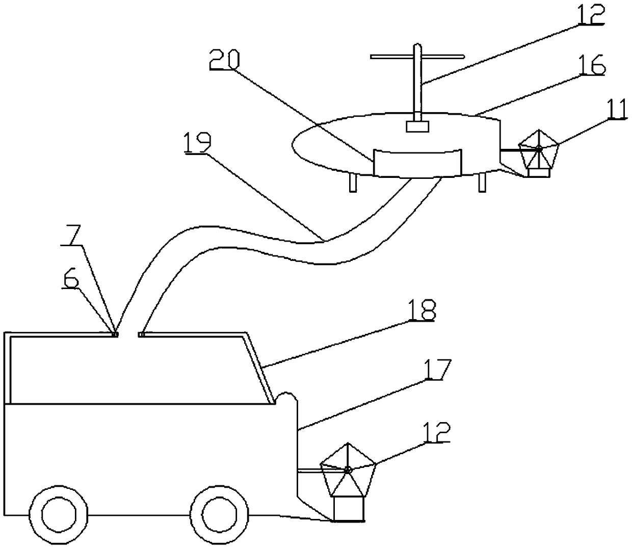
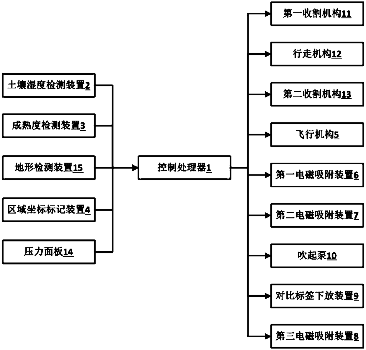
[0021] refer to Figure 1-2 .
[0022]This embodiment provides a UAV-based linkage agricultural harvesting system, including a UAV main body 16, a harvester main body 17, a control processor 1, and an information collection mechanism. The UAV main body 16 includes a first harvesting mechanism 11. Flying mechanism 5, the harvester main body 17 includes a second harvesting mechanism 13, a running mechanism 12, the first harvesting mechanism 11, the flying mechanism 5, the second harvesting mechanism 13, the running mechanism 12 and the control processor 1 connection; the flying mechanism 5 is arranged inside the drone main body 16 for driving the drone main body 16 to fly, and the traveling mechanism 12 is arranged inside the harvester main body 17 for driving the harvester main body 17 walking; the first harvesting mechanism 11 is located at the bottom of the drone main body 16, and is used for the drone main body 16 to harvest crops, and the second harvesting mechanism 13 is ...
Embodiment 2
[0031] refer to Figure 1-2 .
[0032] In the second embodiment of the present invention, the implementation content is basically the same as that of the first embodiment, except that the flying mechanism 5 is connected with a positioning device.
[0033] As a preferred mode of the present invention: the flight mechanism 5 is connected with a GPS positioning device, the GPS positioning device is connected with the area coordinate marking device 4, and the GPS positioning device is used for according to the area coordinate marking device 4. The marked area positions provide flight navigation information for the flight mechanism 5 .
[0034] Specifically, the area coordinate marking device 4 provided at the bottom of the drone is used to mark the coordinates of the area where the maturity has not reached the first fixed threshold, and the location of the area is positioned by setting the GPS positioning device. At this time, the main body of the drone 16 The internal GPS posit...
PUM
 Abstract
Description
Claims
Application Information
 - R&D
- Intellectual Property
- Life Sciences
- Materials
- Tech Scout
- Unparalleled Data Quality
- Higher Quality Content
- 60% Fewer Hallucinations
Browse by: Latest US Patents, China's latest patents, Technical Efficacy Thesaurus, Application Domain, Technology Topic, Popular Technical Reports.
© 2025 PatSnap. All rights reserved.Legal|Privacy policy|Modern Slavery Act Transparency Statement|Sitemap|About US| Contact US: help@patsnap.com


