Check patentability & draft patents in minutes with Patsnap Eureka AI!

Surveying and mapping data acquisition device for unmanned aerial vehicle

A technology of data collection and unmanned aerial vehicles, which is applied in the direction of measuring devices, surveying and mapping and navigation, unmanned aircraft, etc., can solve the problems of device damage, limited rotation angle, and affecting shooting effects, etc., to protect the device and prevent device damage Effect

Inactive Publication Date: 2018-11-23
RIZHAO POLYTECHNIC
View PDF14 Cites 3 Cited by
  • Summary
  • Abstract
  • Description
  • Claims
  • Application Information

AI Technical Summary

Problems solved by technology

It automatically adjusts the focal length according to the distance between the actual shooting object and the drone, records the focal length of the current shooting object picture, makes the shooting object clear and real, improves the shooting range of the shooting object, improves the range of the drone mapping object, and reduces the post-image blur It is difficult to process and calculate, but the horizontal and vertical rotation angles of the device are limited, which affects the shooting effect. At the same time, the device does not have cushioning performance when it falls, which is easy to cause damage to the device

Method used


Image

  • Surveying and mapping data acquisition device for unmanned aerial vehicle
  • Surveying and mapping data acquisition device for unmanned aerial vehicle
  • Surveying and mapping data acquisition device for unmanned aerial vehicle

Examples


Embodiment 2

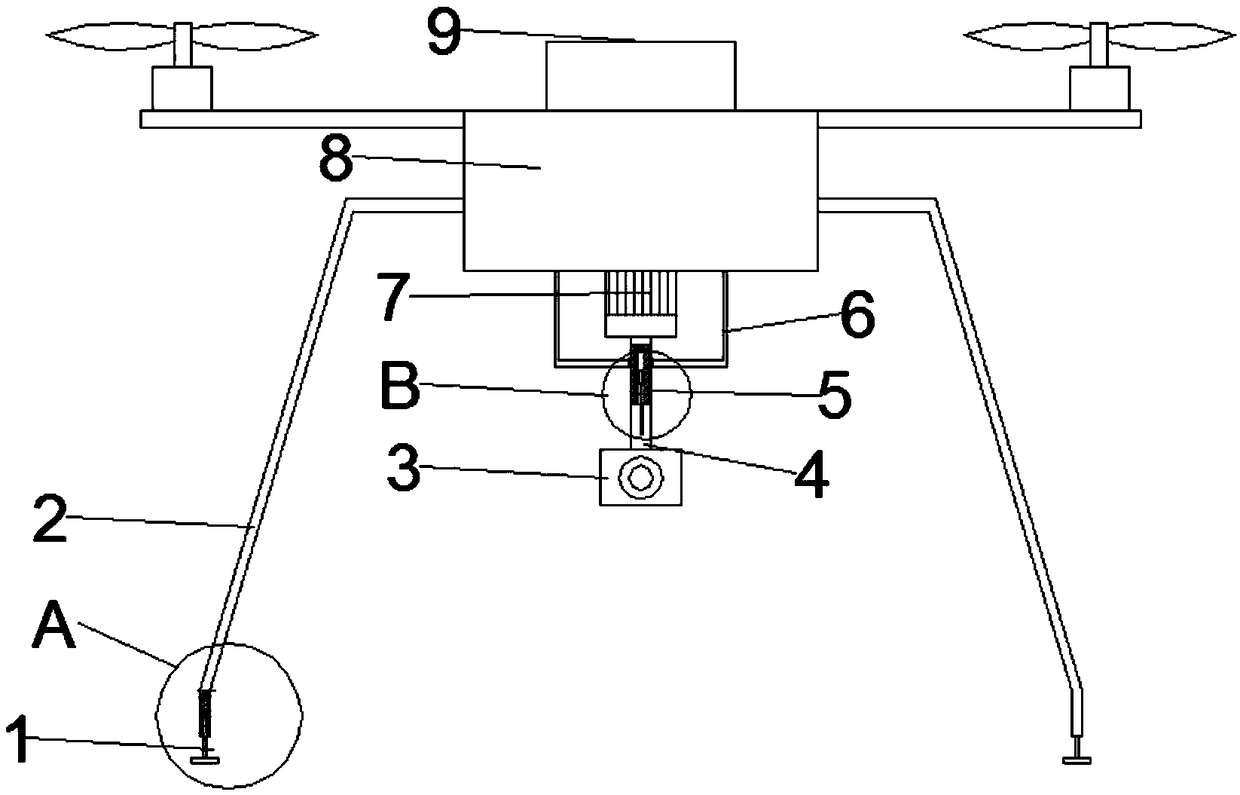
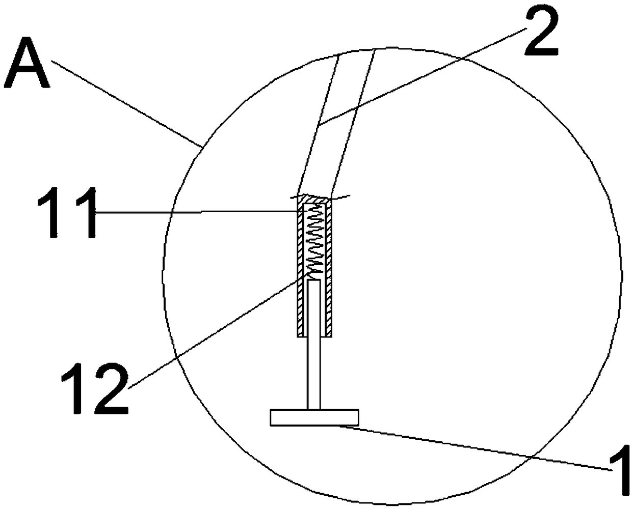
[0028] A UAV surveying and mapping data acquisition device of this embodiment is similar to Embodiment 1, except that the first leg 1 slides in the first straight groove 11 of the second leg 5 and interacts with the spring 12. Cooperate, make the device fall to start the buffering effect, effectively protect the device, prevent the device from being damaged due to rigid contact with the ground, the shape of the first leg 1 is an inverted T shape, so that the contact surface machine increases.

Embodiment 3

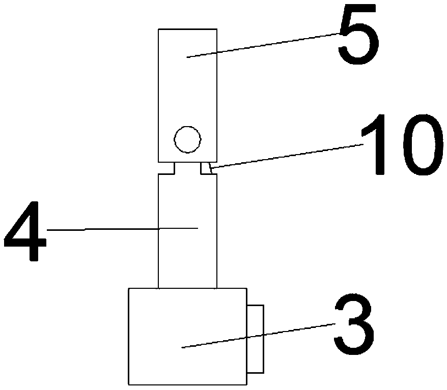
[0030] A kind of unmanned aerial vehicle surveying and mapping data collection device of this embodiment is similar to Embodiment 1, wherein the difference is that the protrusion 17 on the inside of the casing 16 is slidably connected with the annular groove 18 of the first connecting rod 5 to play a role. To protect and limit the role of the first connecting rod.

Embodiment 4

[0032] An unmanned aerial vehicle surveying and mapping data acquisition device in this embodiment is similar to Embodiment 1, except that the model of the telescopic rod 14 is YNT-05.


PUM


Abstract

The invention discloses a surveying and mapping data acquisition device for an unmanned aerial vehicle and belongs to the technical field of a surveying and mapping device. The surveying and mapping data acquisition device comprises an unmanned aerial vehicle, wherein a host of the unmanned aerial vehicle is provided with a processor; two side walls of the unmanned aerial vehicle are respectivelyprovided with a second supporting leg; the bottom of each second supporting leg is provided with a first straight flute; each first straight flute is connected with a spring; the other end of each spring is connected with the top of a first supporting leg; the host of the unmanned aerial vehicle is connected with a motor and fixing rods; a casing pipe is arranged between the fixing rods and is fixedly connected with a lug; the output end of a motor is fixedly connected with a first connecting rod; the outer side wall of the middle end of the first connecting rod is provided with an annular trough; the first connecting rod is provided with a third straight flute; the top of the third straight flute is fixedly provided with an expansion link; the bottom of the expansion link is fixedly connected with a steel rope; the bottom of the first connecting rod is rotatably connected with a second connecting rod; the other end of the steel rope is fixedly connected with the bottom of the second straight flute of the second connecting rod. The surveying and mapping data acquisition device for the unmanned aerial vehicle has the advantages of reasonable design, convenient angle regulation and good buffering performance.

Description

technical field [0001] The invention relates to the technical field of surveying and mapping devices, in particular to an unmanned aerial vehicle surveying and mapping data acquisition device. Background technique [0002] Unmanned aircraft, referred to as "unmanned aerial vehicle", or "UAV" in English, is an unmanned aircraft that is controlled by radio remote control equipment and its own program control device, or is completely or intermittently operated autonomously by an on-board computer. According to the application field, UAV can be divided into military and civilian. UAVs can be used in aerial photography, agriculture, plant protection, micro selfie, express transportation, disaster relief, observing wild animals, monitoring infectious diseases, surveying and mapping, news reports, power inspections, disaster relief, film and television shooting and other fields. [0003] With the rapid development of electronic technology, small drones have made significant breakt...

Claims


Application Information

Patent Timeline
IPC IPC(8): B64C25/62B64D47/08G01C15/00
CPCG01C15/00B64C25/62B64D47/08B64U2101/30B64U10/10B64U2101/00
Inventor 张国玉
Owner RIZHAO POLYTECHNIC
Features
  • R&D
  • Intellectual Property
  • Life Sciences
  • Materials
  • Tech Scout
  • Unparalleled Data Quality
  • Higher Quality Content
  • 60% Fewer Hallucinations
Learn More