High-precision 3D laser scanner site setting and measurement route layout method
A three-dimensional laser, high-precision technology, applied in the field of surveying and mapping engineering, can solve the problems of station setting and surveying route layout, and achieve the effect of reducing the transmission and accumulation of errors
- Summary
- Abstract
- Description
- Claims
- Application Information
AI Technical Summary
Problems solved by technology
Method used
Image
Examples
Embodiment Construction
[0036] Specific embodiments of the present invention are described in conjunction with the accompanying drawings.
[0037] (1) On-site survey, comprehensively investigate the surrounding environment of the dam body, and make relevant records;
[0038] (2) Analyze according to the on-site survey to determine the approximate distance between the scanning site and the object and the accuracy requirements;
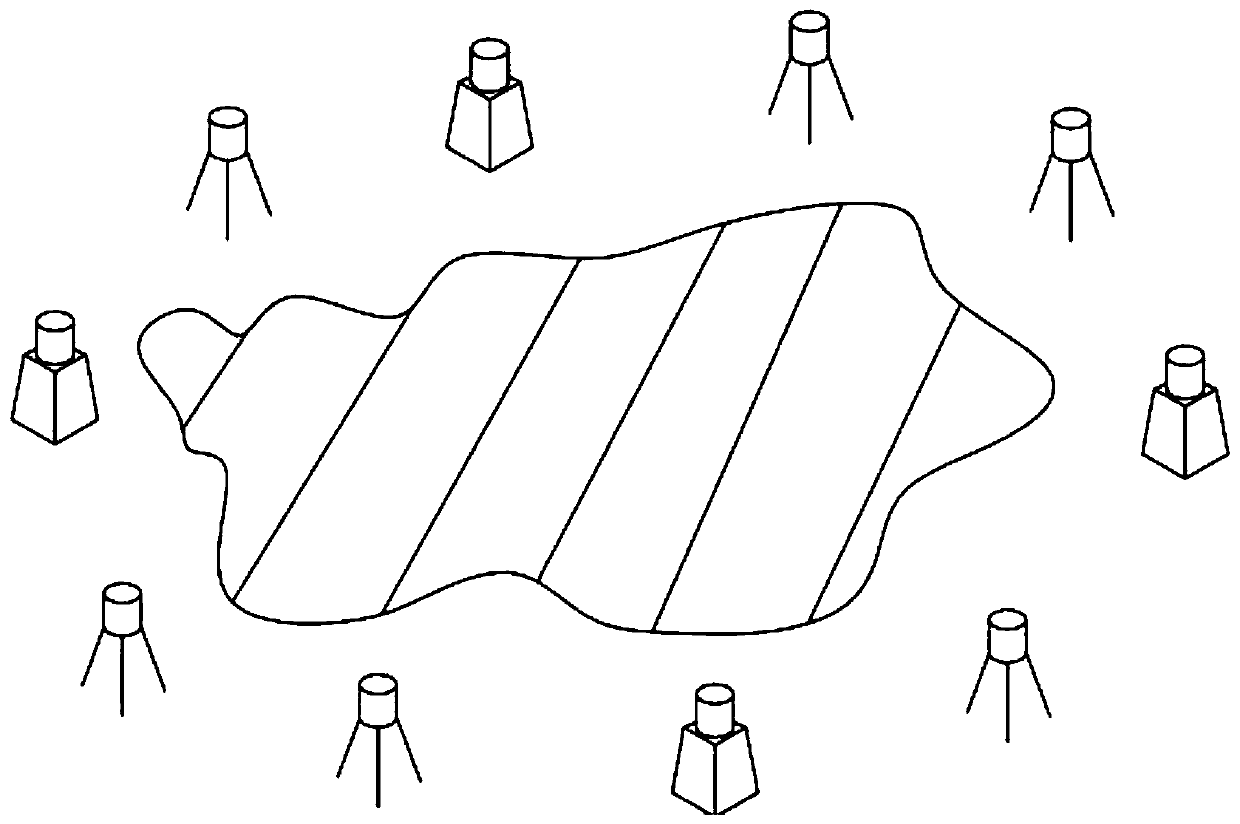
[0039] (3) Design the scanning route and establish the control pier mark. In order to establish a comprehensive and complete 3D scanning model, design the scanning route around the scanned object, and set the scanning route as a closed route. For the specific route of this project, see figure 1 ;
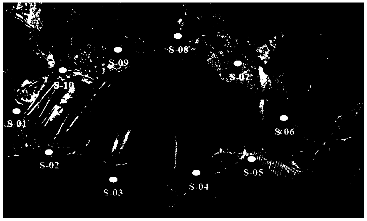
[0040] (4) Determining the number of stations and their locations: ten survey stations are set up in this project, and four high-precision control piers are established, see the attached figure 2 , six common sites. Establish high-precision control piers at S-01, S-04, S-06, an...
PUM
 Abstract
Description
Claims
Application Information
 - R&D
- Intellectual Property
- Life Sciences
- Materials
- Tech Scout
- Unparalleled Data Quality
- Higher Quality Content
- 60% Fewer Hallucinations
Browse by: Latest US Patents, China's latest patents, Technical Efficacy Thesaurus, Application Domain, Technology Topic, Popular Technical Reports.
© 2025 PatSnap. All rights reserved.Legal|Privacy policy|Modern Slavery Act Transparency Statement|Sitemap|About US| Contact US: help@patsnap.com


