

Satellite altimetry gravity data and ship borne gravity data fusion method of combining fractal interpolation and net function interpolation
A technology of gravity data and satellite altimetry, applied in the application of multi-source marine gravity data fusion, in the field of data fusion, it can solve problems such as long operation period, complex statistical method operation and calculation, and no clear standard for the selection of different function models
- Summary
- Abstract
- Description
- Claims
- Application Information
AI Technical Summary
Problems solved by technology
Method used
Image

Examples
Embodiment Construction
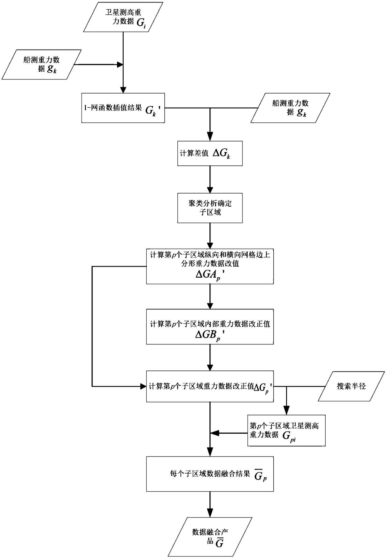
[0052] In order to make the purpose, content and advantages of the present invention clearer, the specific implementation of the present invention will be further described in detail below in conjunction with the accompanying drawings and embodiments:
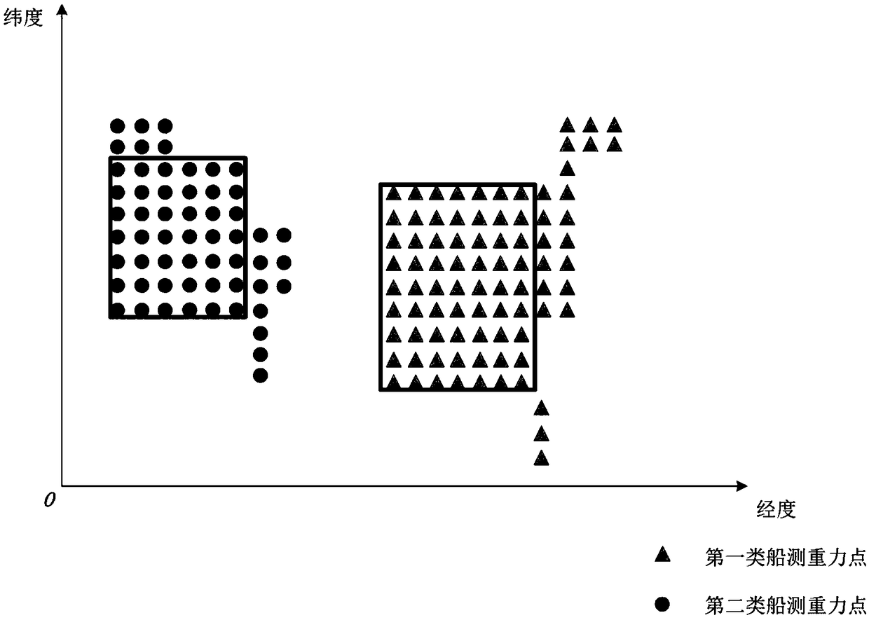
[0053] refer to figure 1 , the implementation steps of the present invention are:
[0054] (1) Determine n ship gravity data g k The satellite altimetry gravity grid where (1≤k≤n) is located, the satellite altimetry gravity data G i (1≤i≤4) interpolation to ship gravity data g k (1≤k≤n), get the satellite altimetry gravity interpolation result G of the ship survey gravity point k '(1≤k≤n), the network function interpolation type is 1-network function interpolation, the formula is:
[0055]
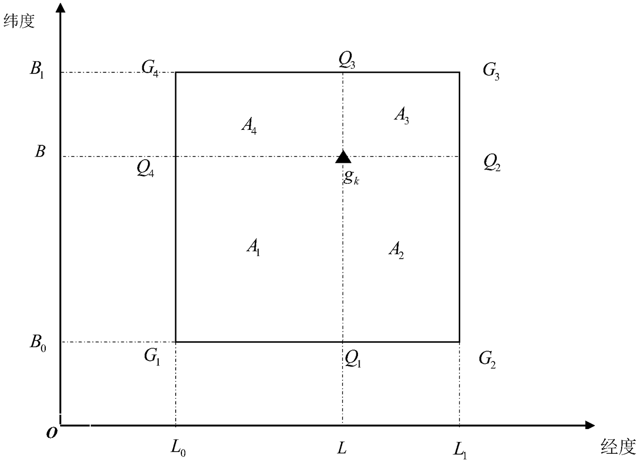
[0056] 1- Net function interpolation such as figure 2 shown, where G 1 (L 0 ,B 0 ), G 2 (L 1 ,B 0 ), G 3 (L 1 ,B 1 ), G 4 (L 0 ,B 1 ) is the ship's gravity point g k (1≤k≤n) The four data points of the satellite altime...
PUM
 Abstract
Description
Claims
Application Information