Satellite formation realizing method for earth ultra-width imaging

A technology of satellite formation and implementation method, applied in non-electric variable control, instrument, attitude control and other directions, can solve the problems of narrow imaging width, small satellite staring range, and inability to continuously image, save fuel, reduce imaging gaps, overcome Effects of wide-format imaging needs

Active Publication Date: 2019-01-18
NANJING UNIV OF AERONAUTICS & ASTRONAUTICS +1
View PDF11 Cites 22 Cited by
  • Summary
  • Abstract
  • Description
  • Claims
  • Application Information

AI Technical Summary

Problems solved by technology

[0005] The purpose of the present invention is to address the deficiencies of the above-mentioned background technology, to provide a satellite formation realization method oriented to super-wide imaging of the ground, to realize the formation design and satellite attitude planning of distribut

Method used


Image

  • Satellite formation realizing method for earth ultra-width imaging
  • Satellite formation realizing method for earth ultra-width imaging
  • Satellite formation realizing method for earth ultra-width imaging

Examples


Embodiment Construction

[0047] The technical solution of the invention will be described in detail below in conjunction with the accompanying drawings.

[0048] The present invention aims at distributed satellite ultra-wide imaging technology, performs variational analysis on the orbital parameters under J2 perturbation and then refines the perturbation model, designs a long-term stable formation formation, and bases on the sub-satellite point coordinates of the reference satellite The attitude planning of the accompanying satellite has been carried out, and long-term stable ultra-wide imaging has been realized.

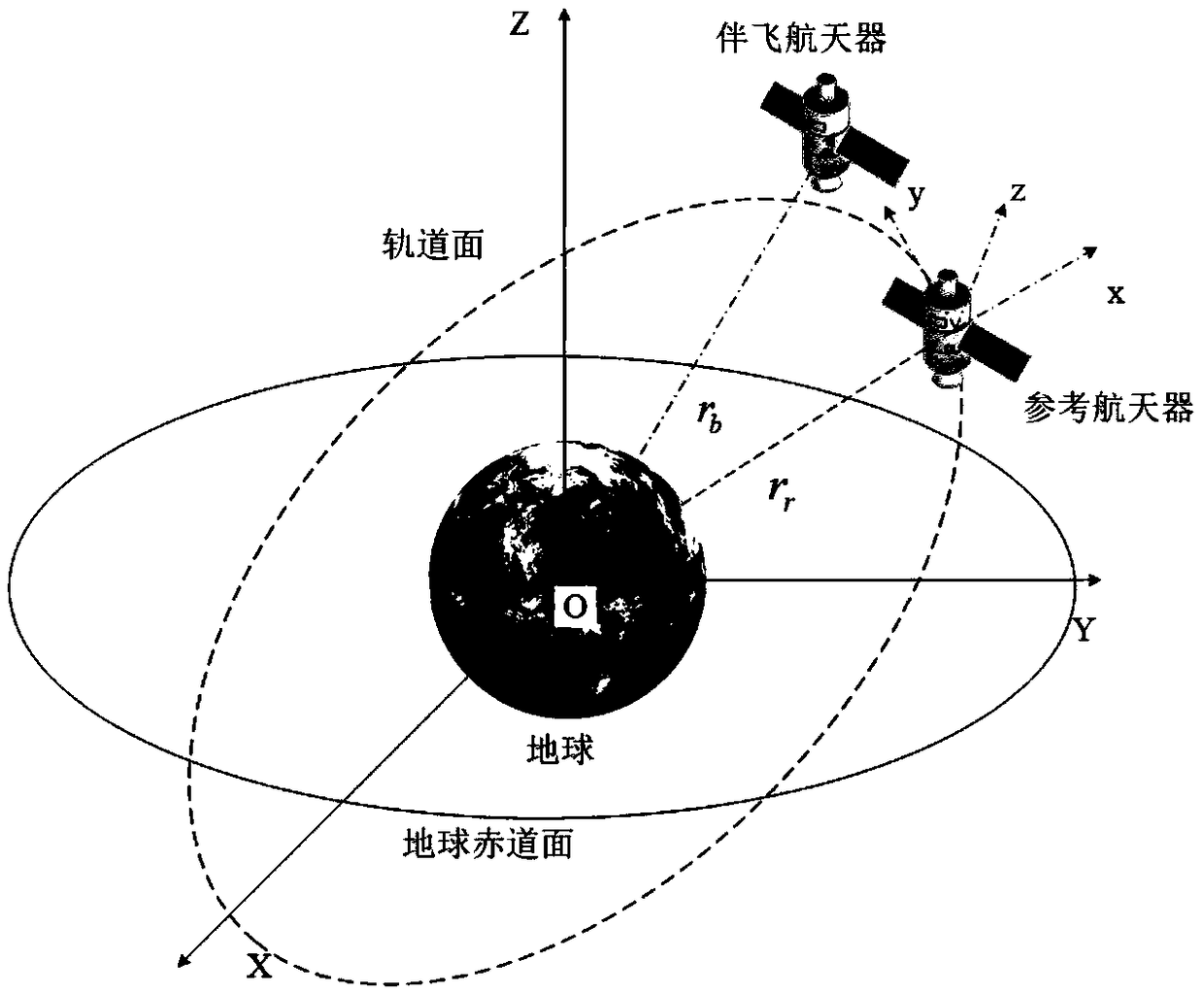
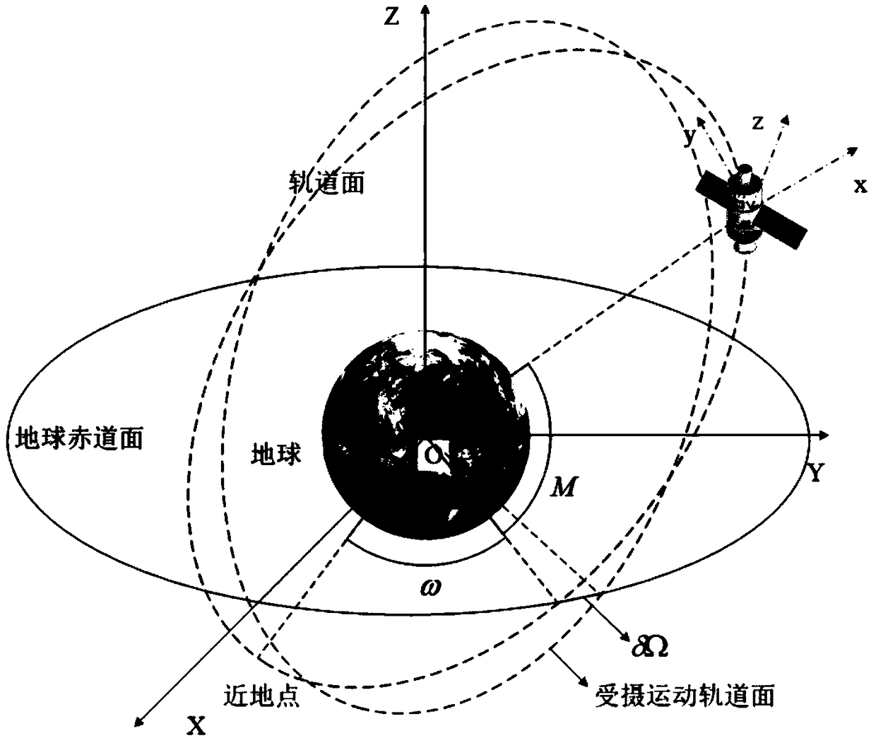
[0049] 1. Relative motion model of spacecraft under J2 perturbation

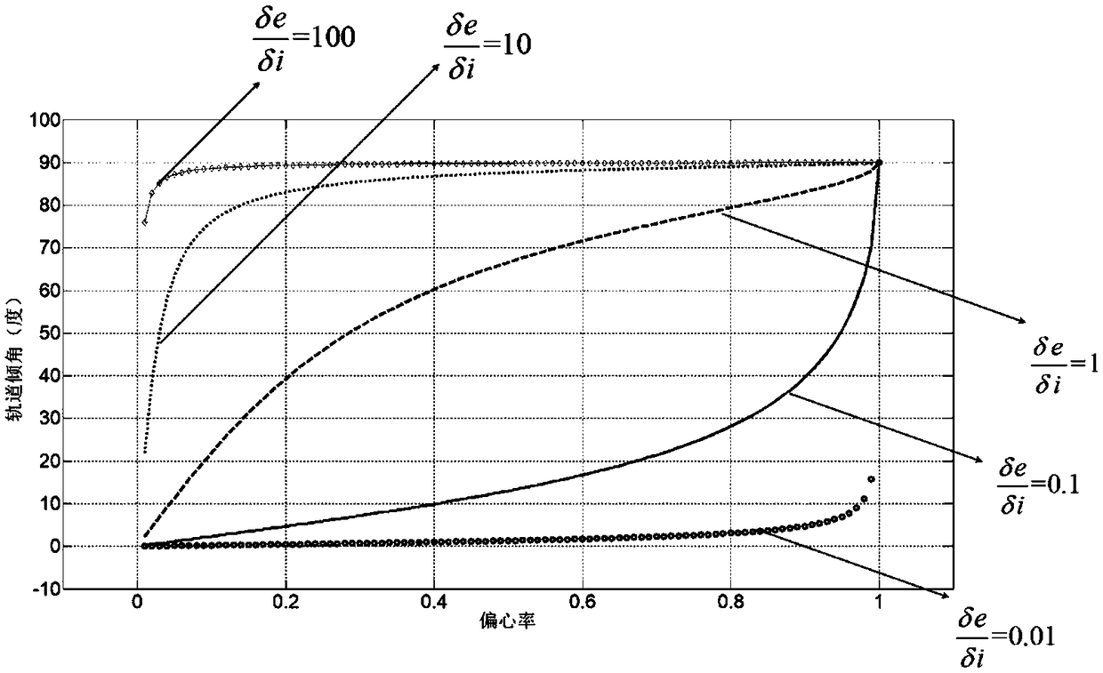
[0050] This part will design the satellite formation required for ultra-wide imaging, mainly based on the imaging requirements of the satellite formation, and design the stability conditions of the satellite formation under the J2 long-term perturbation, and design two different imaging formations.

[0051] 1.1 Spacecra...


PUM


Abstract

The invention discloses a satellite formation realizing method for earth ultra-width imaging, relates to a formation technique of satellite stable imaging, and belongs to the technical field of control and regulation. The method is applied to the problem of distributed ultra-width imaging, which breaks the single-star lower-point imaging mode of traditional satellite imaging and enables the satellite to achieve high-precision ultra-width imaging in the manner of formation imaging by carrying high-precision imaging load and combined with distributed satellite control technology, thereby greatlyenhancing the efficiency of satellite search imaging. The method proposes a distributed satellite formation ultra-width imaging mode based on J2 stability, which solves the problem that the satelliteis unable to achieve continuous imaging on the adjacent areas of the ground caused by small satellite gaze range, narrow imaging width, and the earth rotation.

Description

technical field [0001] The invention discloses a method for realizing a satellite formation oriented to ultra-wide ground imaging, relates to formation technology for satellite stable imaging, and belongs to the technical field of control and adjustment. Background technique [0002] With the rapid development of space technology, satellite remote sensing imaging technology has increasingly highlighted its advantages of speed, convenience, and high precision in agriculture, economy, climate, search and rescue, etc. The distributed micro-nano satellite composed of agile satellites has the characteristics of low cost and flexible configuration. Compared with traditional large satellites, micro-nano satellites have a shorter research and development cycle, relatively lower technical indicators, and lower launch costs due to their lower quality. Small and medium-sized countries and scientific research institutions and universities can all afford their development and launch cost...

Claims


Application Information

Patent Timeline
IPC IPC(8): G05D1/08G05D1/10
CPCG05D1/104
Inventor 华冰刘睿鹏王峰吴云华陈志明
Owner NANJING UNIV OF AERONAUTICS & ASTRONAUTICS
Why Eureka
Try Eureka