
Multi-sensor cooperative radiometric calibration method used for Mapping satellite I

A multi-sensor, radiation calibration technology, applied in the field of remote sensing calibration, can solve the problem that the sensor calibration frequency cannot meet the application needs, etc., and achieve the effect of improving the calibration efficiency, frequency and efficiency.

Active Publication Date: 2019-01-25
HEFEI INSTITUTES OF PHYSICAL SCIENCE - CHINESE ACAD OF SCI +1
View PDF5 Cites 6 Cited by
  • Summary
  • Abstract
  • Description
  • Claims
  • Application Information

AI Technical Summary

Problems solved by technology

[0006] The purpose of the present invention is to solve the defect that the sensor calibration frequency of Tianhui No. 1 satellite cannot meet the application needs in the prior art, and provide a multi-sensor cooperative radiation calibration method for Tianhui No. 1 satellite to solve the above problems

Method used


Image

  • Multi-sensor cooperative radiometric calibration method used for Mapping satellite I
  • Multi-sensor cooperative radiometric calibration method used for Mapping satellite I
  • Multi-sensor cooperative radiometric calibration method used for Mapping satellite I

Examples


Embodiment Construction

[0052] In order to have a further understanding and understanding of the structural features of the present invention and the achieved effects, the preferred embodiments and accompanying drawings are used for a detailed description, as follows:

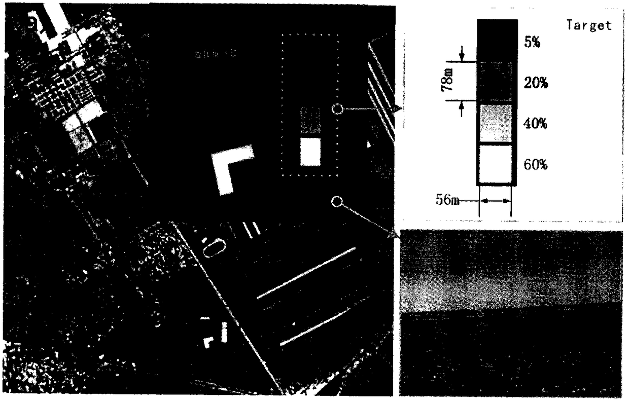
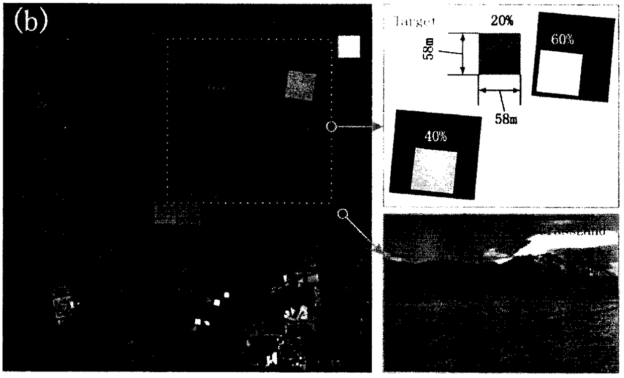
[0053] In the on-orbit absolute radiometric calibration method based on gray-scale targets, the area of ​​the target is related to the spatial resolution of the satellite sensor. When the target area cannot cover 10×10 detectors, the influence of the surrounding background radiation and the extraction error of the target DN value, It will lead to the reduction of sensor radiometric calibration accuracy. For the Tianhui-1 high-resolution camera, both the established fixed calibration field and the moving gray-scale target in use are applicable, and high absolute radiometric calibration accuracy can be obtained. As for the Tianhui-1 multispectral camera, the resolution of 10m makes the area of ​​the fixed target field and the moving gra...


PUM


Abstract

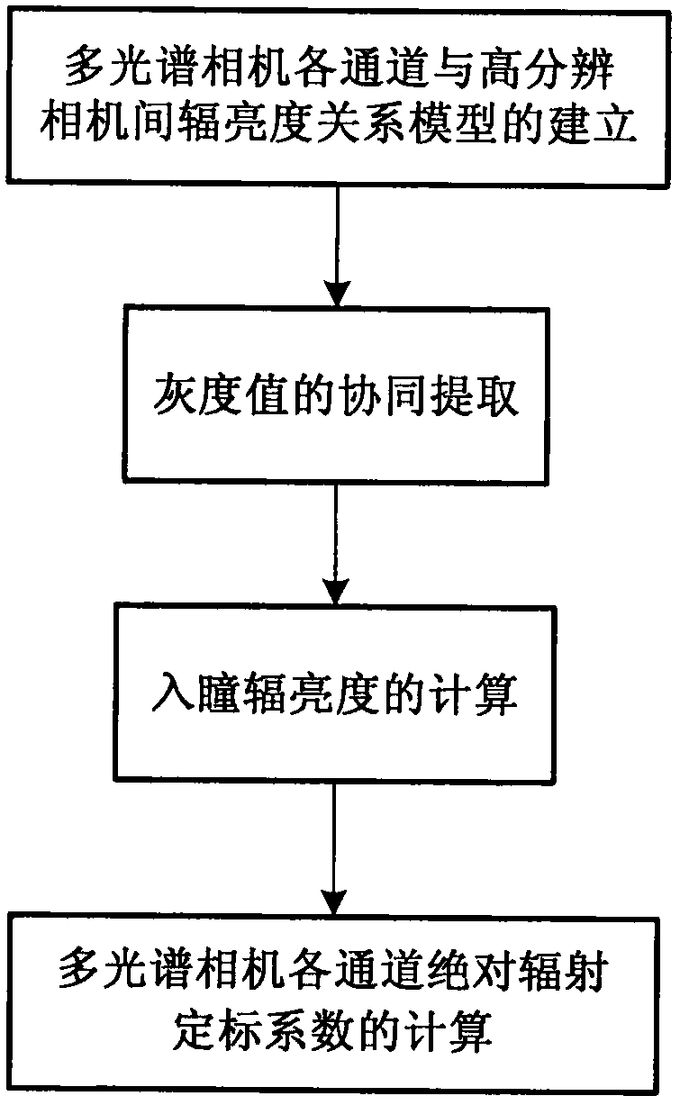
The invention relates to a multi-sensor cooperative radiometric calibration method used for a Mapping satellite I. Compared with the prior art, the defect that the calibration frequency of a sensor ofthe Mapping satellite I cannot satisfy the application requirement is overcome. The method includes following steps: establishment of a radiance relation model between channels of a multiple-spectralcamera and a high-resolution camera; cooperative extraction of grayscale values; calculation of an pupil-entry radiance; and calculation of absolute radiometric calibration coefficients of the channels of the multi-spectral camera. According to the method, calibration of the Mapping satellite I is realized by employing a target of a non-customized dimension, and the frequency and efficiency of in-orbit radiometric calibration of the Mapping satellite I are improved.

Description

technical field [0001] The invention relates to the technical field of remote sensing calibration, in particular to a multi-sensor cooperative radiation calibration method for Tianhui-1 satellite. Background technique [0002] Tianhui-1 is my country's first-generation transmission-type three-dimensional surveying and mapping satellite. At present, 01, 02 and 03 satellites have been successfully launched, and multi-satellite network operation has been realized. Due to the characteristics of fast data acquisition, rich and reliable types, and high uncontrolled positioning accuracy, the satellite data has been widely used in many fields such as map surveying, urban planning, land and resources investigation, precision agriculture, environment and disaster monitoring, etc. Playing an increasingly important role in economic construction and development. [0003] With the gradual deepening of remote sensing applications in various fields, the quantification of remote sensing dat...

Claims


Application Information

Patent Timeline
Patent Type & Authority Applications(China)
IPC IPC(8): G01J3/28G01C25/00
CPCG01C25/00G01J3/2823G01J2003/2826G01J2003/2866
Inventor 杜丽丽易维宁王昱张冬英方薇崔文煜
Owner HEFEI INSTITUTES OF PHYSICAL SCIENCE - CHINESE ACAD OF SCI
Learn More