A panoramic three-dimensional registration system and method for augmented reality assembly
An augmented reality and three-dimensional registration technology, applied in image data processing, instruments, etc., can solve the problems of high algorithm calculation, low positioning accuracy, and small application environment size, and achieve the effect of low algorithm calculation and high positioning accuracy
- Summary
- Abstract
- Description
- Claims
- Application Information
AI Technical Summary
Problems solved by technology
Method used
Image
Examples
Embodiment 1
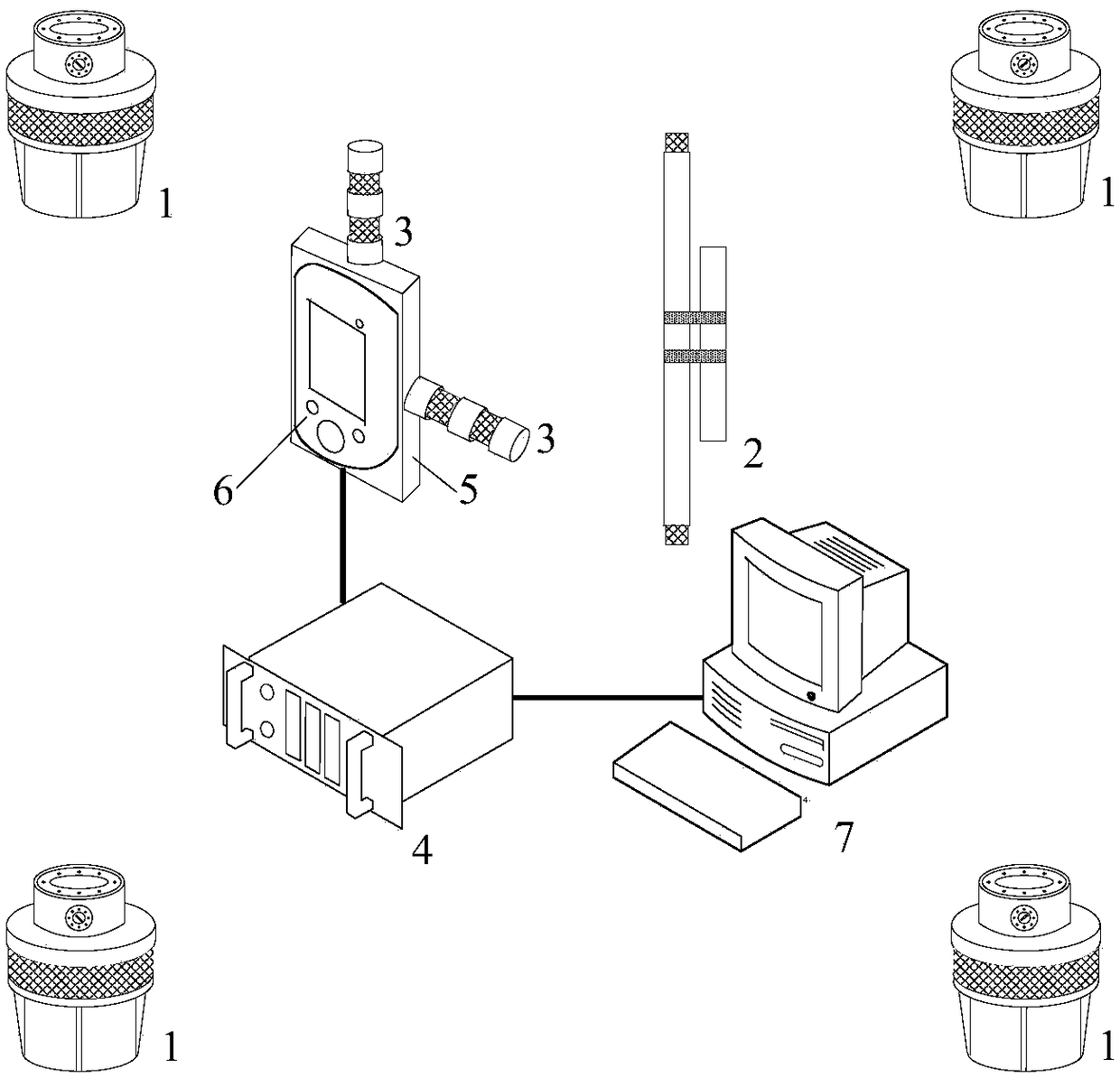
[0059] A specific embodiment of the present invention discloses a panoramic three-dimensional registration system for augmented reality assembly. like figure 1 As shown, it includes: iGPS transmitter (1); iGPS vector sensor (2); iGPS reference ruler (3); iGPS workstation (4); camera terminal (6); calculation and display terminal (7);
[0060] iGPS transmitter, used to emit sector laser;
[0061] iGPS reference ruler, used to calibrate the measurement coordinate system;
[0062] The iGPS vector sensor includes two laser signal receiving points for receiving the laser signal sent by the transmitter and transmitting it to the iGPS workstation;
[0063] The iGPS workstation processes the received laser signal, obtains the coordinates of the above-mentioned laser signal receiving point in the measurement coordinate system, and transmits it to the calculation and display terminal;
[0064] The camera terminal is fixedly connected with the iGPS vector sensor, and is used to acquir...
Embodiment 2
[0076] A panoramic three-dimensional registration method for augmented reality assembly oriented to the application of the system in Embodiment 1 is disclosed, including the following steps:
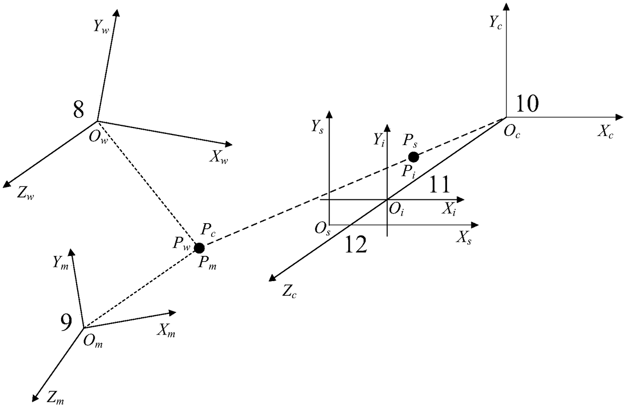
[0077] Step S1, arrange four iGPS transmitters, iGPS reference rulers, two iGPS vector sensors, iGPS workstations, computing and display terminals around the assembly site; use the iGPS reference rulers to calibrate the iGPS measurement network and establish a measurement coordinate system; An iGPS vector sensor is placed at a known position in the design coordinate system, and the coordinates P of the four laser signal receiving points on the two iGPS vector sensors in the design coordinate system are recorded w0_i ; And obtain the measurement coordinate system coordinates P of the four laser signal receiving points on the two iGPS vector sensors m0_i ;i takes 1...4;
[0078] Step S2, the coordinates P of the four laser signal receiving points obtained above w0_i ,P m0_i Substitute i...
PUM
 Abstract
Description
Claims
Application Information
 - R&D
- Intellectual Property
- Life Sciences
- Materials
- Tech Scout
- Unparalleled Data Quality
- Higher Quality Content
- 60% Fewer Hallucinations
Browse by: Latest US Patents, China's latest patents, Technical Efficacy Thesaurus, Application Domain, Technology Topic, Popular Technical Reports.
© 2025 PatSnap. All rights reserved.Legal|Privacy policy|Modern Slavery Act Transparency Statement|Sitemap|About US| Contact US: help@patsnap.com


