

A coandor task mapping method of a remote sensing image processing Docker cluster
A technology of remote sensing image processing and docker container, which is applied in the field of cloud computing to achieve the effect of improving resource utilization
- Summary
- Abstract
- Description
- Claims
- Application Information
AI Technical Summary
Problems solved by technology
Method used
Image

Examples
Embodiment 1
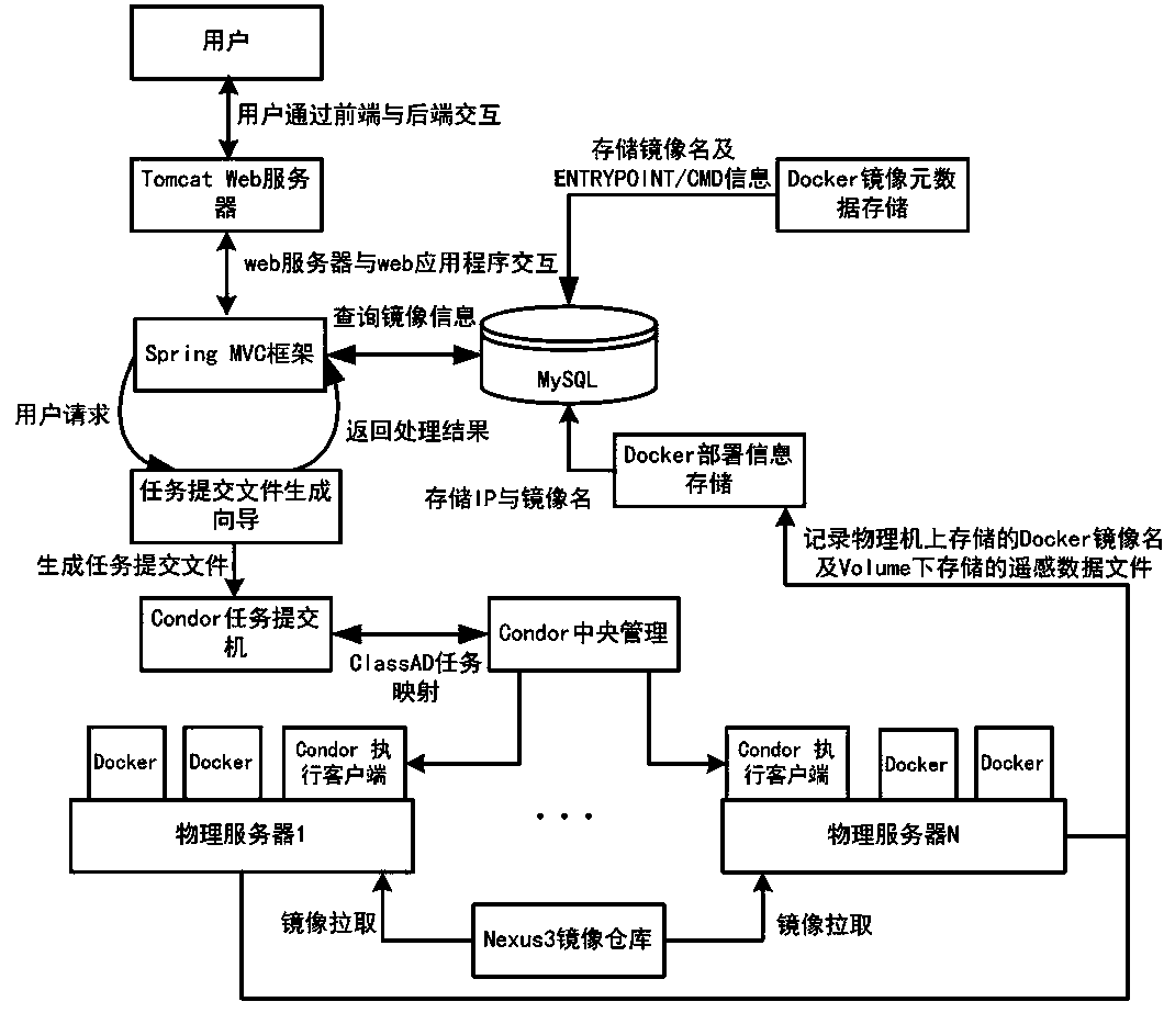
[0040] Such as figure 1 As shown, the present invention provides a condor task mapping method for remote sensing image processing Docker clusters, which consists of four parts: Condor cluster construction, image metadata storage, Docker deployment information storage, and task submission file generation wizard.
[0041] Condor cluster construction is mainly to build a Condor cluster through the conder cluster management system by using the physical machines used to process remote sensing image processing in the same network plane, and then install Docker-engine on each physical machine in the cluster to build a Condor cluster. A Condor cluster environment that can use different Docker containers as a job scheduling, the specific steps are:
[0042] S11: Install the ubuntu system on the central manager, add Condor to install the apt installation source, and then use apt-get to install Condor;
[0043] S12: Install the ubuntu operating system and Condor software on the physical...
PUM
 Abstract
Description
Claims
Application Information