

Cross-country road surface extraction method based on a three-dimensional laser radar
A three-dimensional laser and lidar technology, applied in the field of image recognition, can solve the problems of a large number of manual labeling samples and high labor costs, and achieve the effect of reducing demand and strong adaptability
- Summary
- Abstract
- Description
- Claims
- Application Information
AI Technical Summary
Problems solved by technology
Method used
Image

Examples
Embodiment
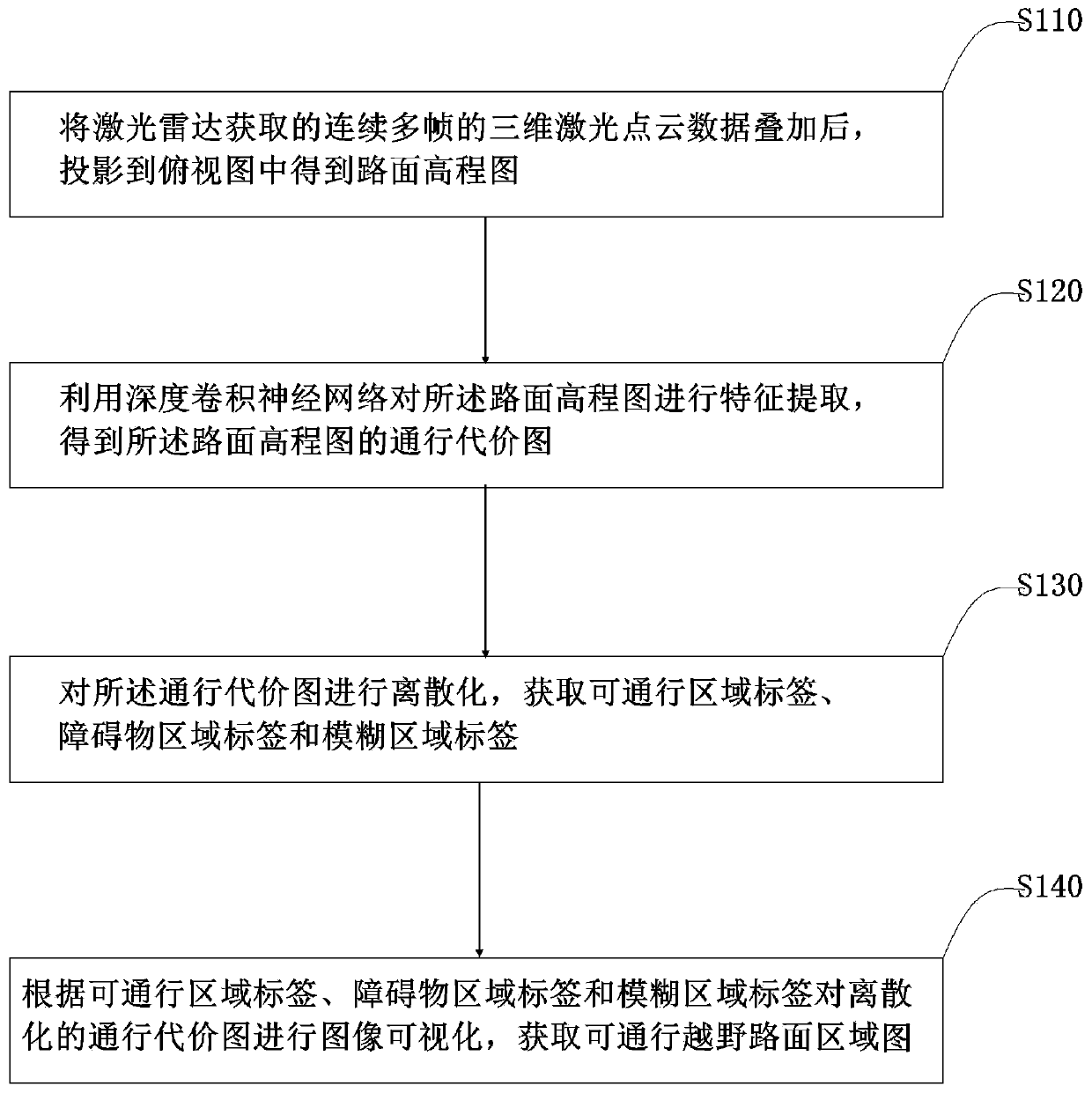
[0041] Such as figure 1 As shown, the embodiment of the present invention provides a method for extracting off-road road surface based on three-dimensional laser radar, the method includes the following process steps:
[0042] Step S110: After superimposing the continuous multi-frame 3D laser point cloud data acquired by the lidar, project it into the top view to obtain the road surface elevation map;
[0043] Step S120: Using a deep convolutional neural network to perform feature extraction on the road elevation map to obtain a traffic cost map of the road elevation map;
[0044] Step S130: discretize the passage cost map, and obtain passable area labels, obstacle area labels, and fuzzy area labels;
[0045] Step S140: Perform image visualization on the discretized pass cost map according to the passable region label, obstacle region label and fuzzy region label, and obtain a passable off-road road area map.
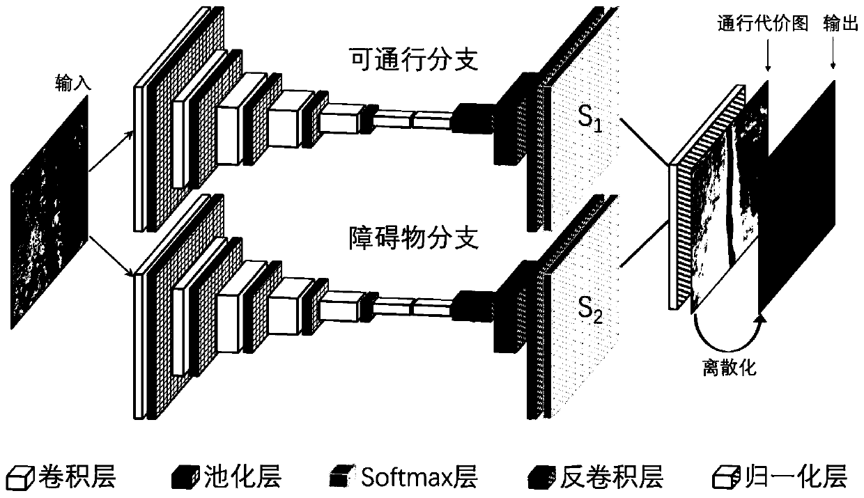
[0046] Such as figure 2As shown, the embodiment of the present...
PUM
 Abstract
Description
Claims
Application Information