Method for delineating geothermal anomalies by using daytime and nighttime thermal infrared remote sensing

A technology of thermal infrared remote sensing and thermal infrared remote sensing, which is applied in the fields of remote sensing geology and thermal infrared remote sensing, can solve the problems of interfering with the determination of geothermal anomalies, difficulty in eliminating relative cold and hot anomalies of temperature, and small spatial resolution, etc., to achieve the elimination of relative cold and heat anomalies Effect

Inactive Publication Date: 2019-06-18
中国人民解放军陆军研究院工程设计研究所严寒冻土设防工程设计站
View PDF6 Cites 3 Cited by
  • Summary
  • Abstract
  • Description
  • Claims
  • Application Information

AI Technical Summary

Problems solved by technology

[0002] Thermal infrared remote sensing is very useful for detecting geothermal anomalies. However, due to the influence of specific heat capacity of different ground features, under the influence of solar radiation, the temperature rise and fall rates of different ground features are different, which leads to the relative hot and cold between different ground features. Anomalies, which interfere with the determination of geothermal anomalies
Eneva and Coolbaugh. (2009) pointed out that the inversion of surface temperature at night is of great significance when performing geothermal detection, but it is still difficult to eliminate the relative cold and hot a...

Method used


Image

  • Method for delineating geothermal anomalies by using daytime and nighttime thermal infrared remote sensing
  • Method for delineating geothermal anomalies by using daytime and nighttime thermal infrared remote sensing
  • Method for delineating geothermal anomalies by using daytime and nighttime thermal infrared remote sensing

Examples


Embodiment Construction

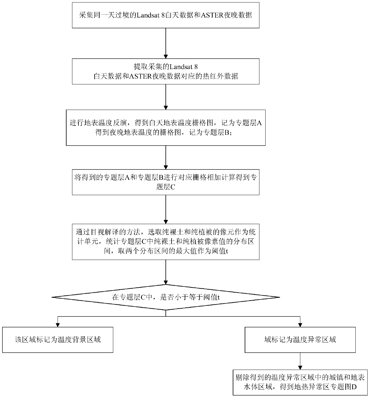
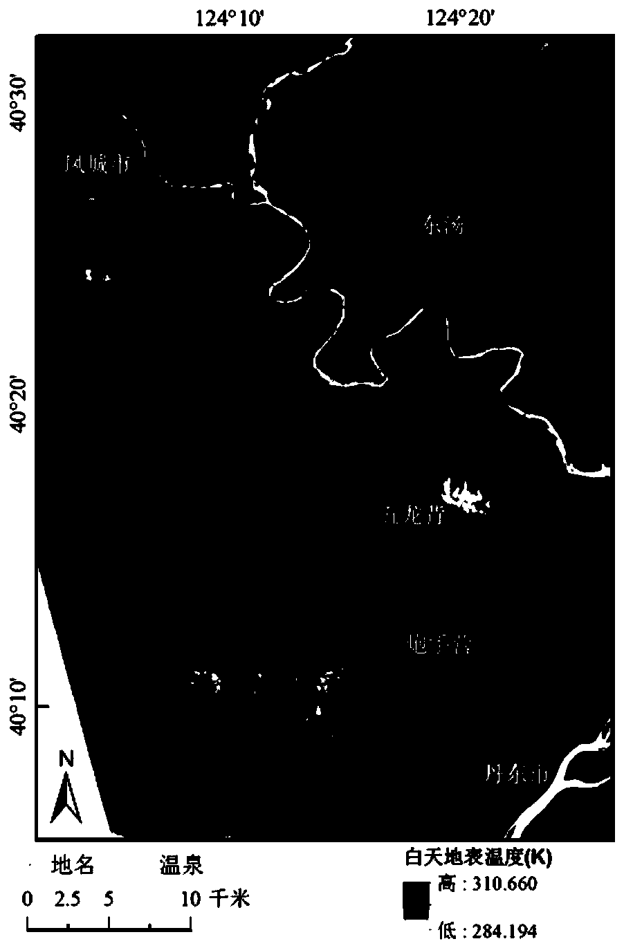
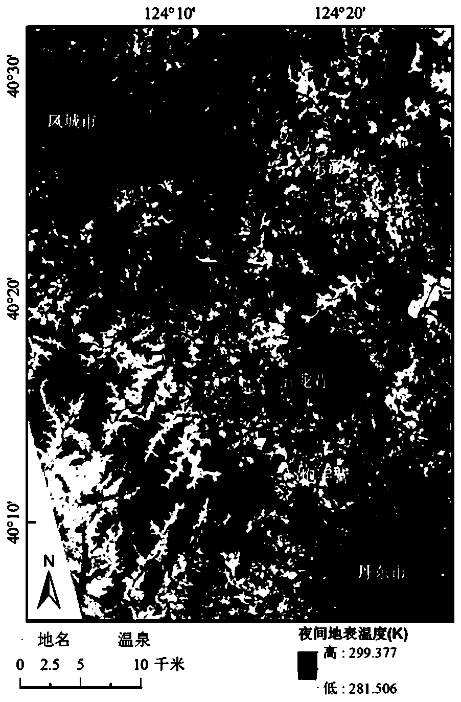
[0020] The invention will be further described below in conjunction with the accompanying drawings and specific implementation examples. The present invention proposes a method for using day and night thermal infrared remote sensing to delineate geothermal anomalies, such as figure 1 As shown, the specific steps are as follows:

[0021] Step 1: Collect Landsat 8 daytime data and ASTER nighttime data that cross the border on the same day, and the cloud coverage of the collected data should be less than 10%;

[0022] In order to eliminate the influence of rainfall on the surface temperature, it is necessary to ensure that there is no rainfall on the day when the satellite transits. If it is difficult to select the satellite data that transits on the same day, the thermal infrared data with similar time, similar temperature and no rainfall in the transit time interval of the two satellites is preferred. In this embodiment, the thermal infrared data of Landsat 8 at 10:22:11 on May...


PUM


Abstract

The invention provides a method for delineating geothermal anomalies by using daytime and nighttime thermal infrared remote sensing. The method includes the following steps that: Landsat 8 daytime data and ASTER nighttime data of the same day are acquired; the data are preprocessed; surface temperature inversion is performed, so that a daytime surface temperature grid map and a nighttime surface temperature grid map are obtained; corresponding grids are added, so that a thematic layer C can be obtained; a threshold t is calculated; in the thematic layer C, regions of which the temperature is lower than or equal to the threshold t are marked as temperature background regions, and regions of which the temperature is higher than the threshold t are marked as temperature anomaly regions; and urban regions and surface water body regions are removed from the temperature anomaly regions, so that a geothermal anomaly area thematic map D is obtained. According to the method of the invention, two kinds of thermal infrared remote sensing products with high spatial resolution are optimally selected so as to be used jointly, and therefore, it can be ensured that surface temperature products canhave high spatial resolution; daytime surface temperature and nighttime surface temperature are added, so that the relative cold and hot anomalies of natural objects at daytime and nighttime are eliminated, and surface high temperature anomalies under the influence of geothermy or human activities are highlighted; and the threshold is calculated according to bare soil and vegetations, so that surface temperature background values can be effectively suppressed, and surface temperature abnormal values are highlighted.

Description

technical field [0001] The invention belongs to the fields of thermal infrared remote sensing and remote sensing geology, and in particular relates to a method for delineating geothermal anomalies by utilizing day and night thermal infrared remote sensing. Background technique [0002] Thermal infrared remote sensing is very useful for detecting geothermal anomalies. However, due to the influence of specific heat capacity of different ground features, under the influence of solar radiation, the temperature rise and fall rates of different ground features are different, which leads to the relative hot and cold between different ground features. Anomalies interfere with the determination of geothermal anomalies. Eneva and Coolbaugh. (2009) pointed out that nighttime surface temperature inversion is of great significance when performing geothermal detection, but it is still difficult to eliminate the relative cold and heat anomalies caused by the difference in specific heat cap...

Claims


Application Information

Patent Timeline
IPC IPC(8): G01V9/00G01J5/00
Inventor 王康于德浩姜琦刚杨彤杨清雷王李贺正清李远华韩天成李兴凯邵云帆李霞徐兴宇董德坤胡畔
Owner 中国人民解放军陆军研究院工程设计研究所严寒冻土设防工程设计站
Why Eureka
Try Eureka