Flood risk dynamic display and analysis system

A technology of dynamic display and flood risk map, applied in special data processing applications, instruments, electrical digital data processing, etc., can solve the problems of long production cycle and lack of timeliness, and achieve the effect of improving timeliness and improving production efficiency

Active Publication Date: 2019-06-25
BEIJING AEROSPACE HONGTU INFORMATION TECH
View PDF8 Cites 8 Cited by
  • Summary
  • Abstract
  • Description
  • Claims
  • Application Information

AI Technical Summary

Problems solved by technology

[0007] In view of this, the purpose of the present invention is to provide a dynamic display and analysis system of flood risk to alleviate the technical problems in the prior art that drawing a flood risk map requires professionals to participate in the production, resulting in long production cycle and lack of timeliness

Method used


Image

  • Flood risk dynamic display and analysis system
  • Flood risk dynamic display and analysis system
  • Flood risk dynamic display and analysis system

Examples


Embodiment 1

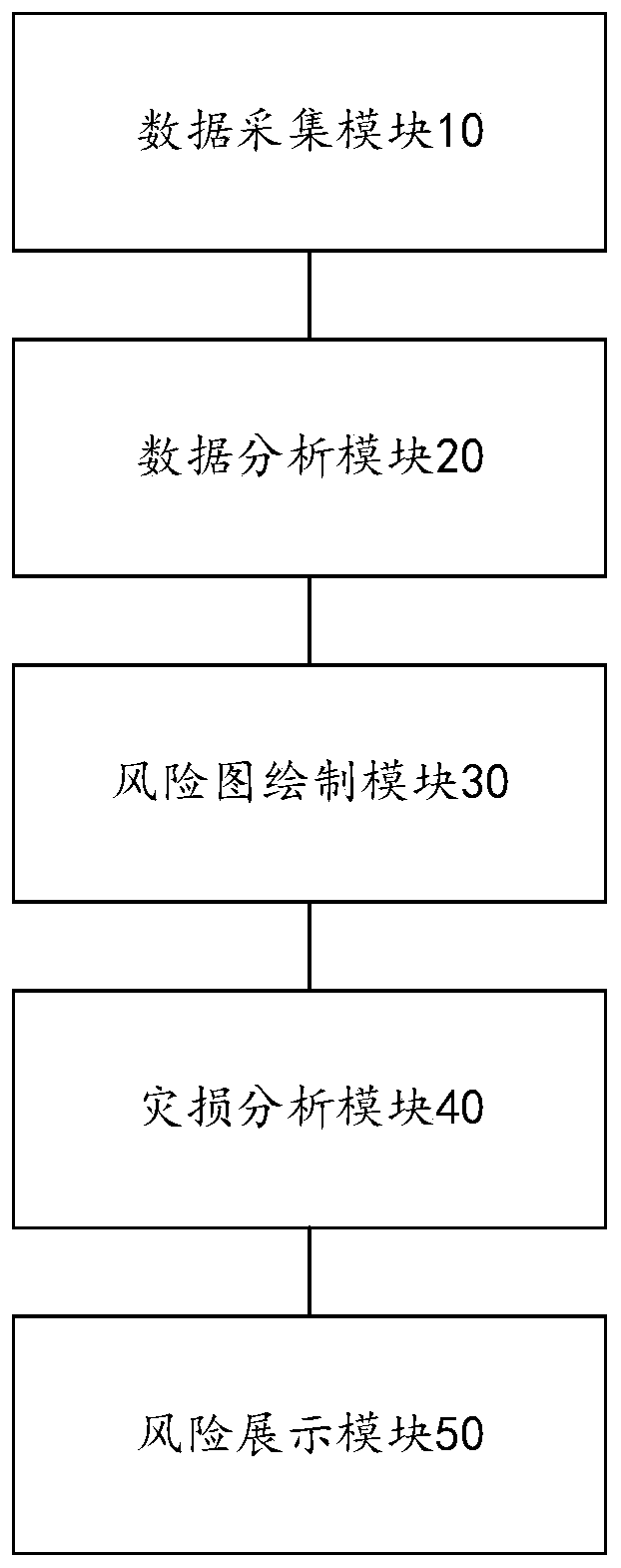
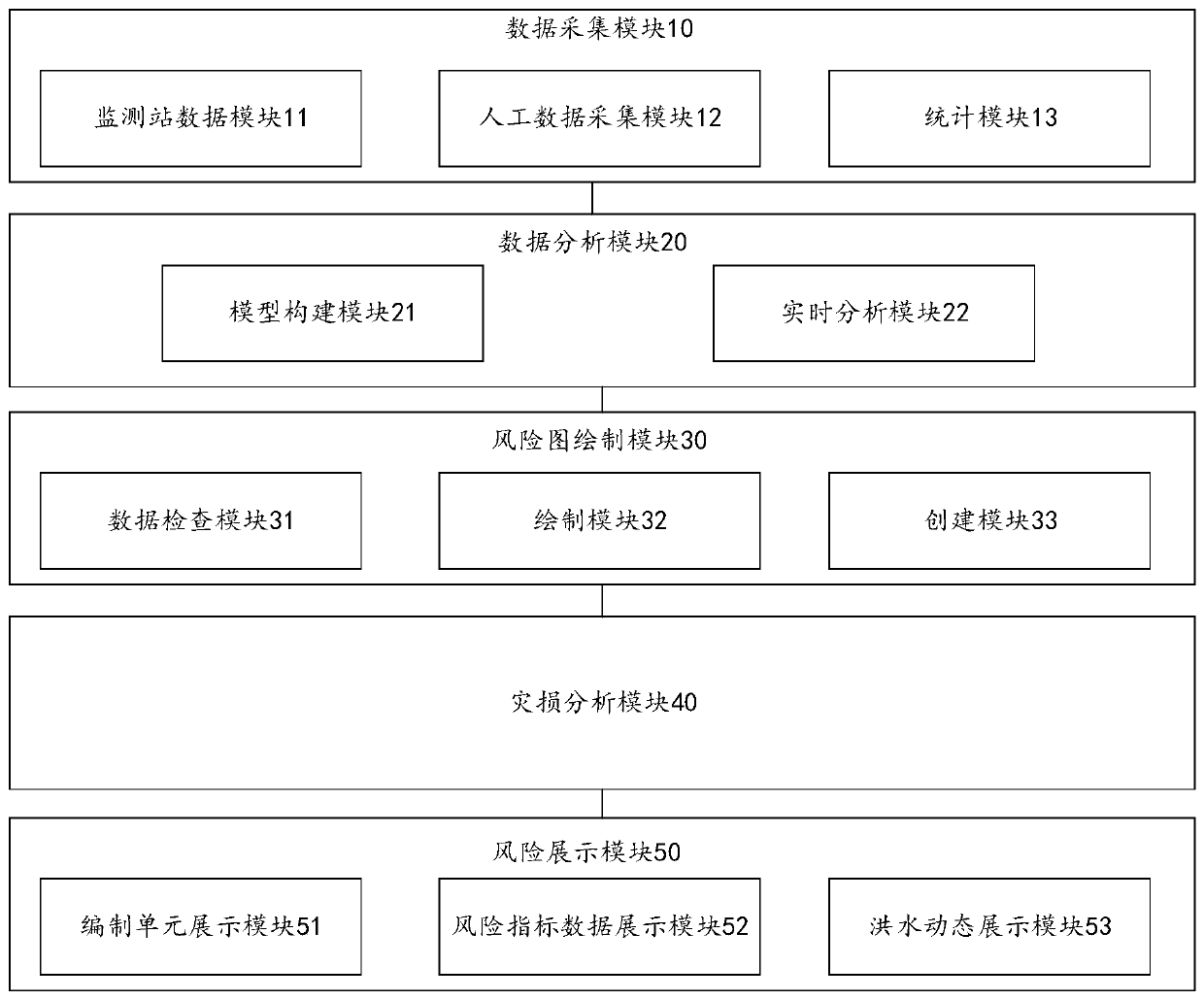
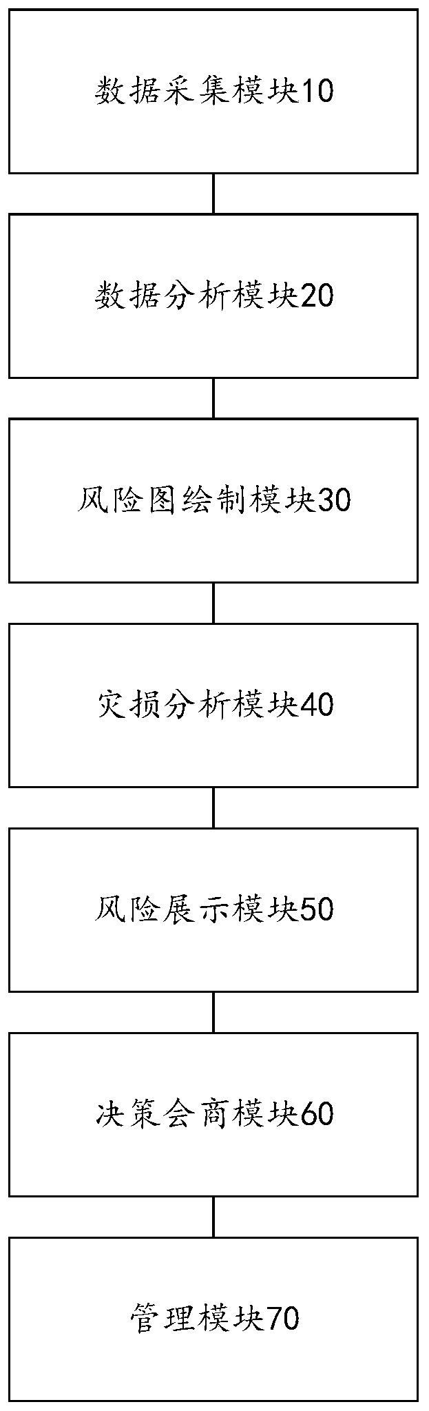
[0029] figure 1 It is a dynamic display and analysis system for flood risk according to an embodiment of the present invention, such as figure 1 As shown, the system includes: a data acquisition module 10, a data analysis module 20, a risk map drawing module 30, a disaster analysis module 40 and a risk presentation module 50, wherein,

[0030] The data collection module 10 is used to collect water and rain data in the area to be monitored, and count the accumulated water and rain data in the area to be monitored within a preset time;

[0031]The data analysis module 20 is used to input the boundary conditions set by the user and the accumulated water and rain data into the real-time analysis model to obtain the data in the area to be monitored when the accumulated water and rain data is greater than a preset threshold. The flood advance evolution process, wherein the boundary conditions include at least one of the following: the river flow level in the area to be monitored, a...


PUM


Abstract

The invention provides a flood risk dynamic display and analysis system, which relates to the technical field of disaster monitoring, and comprises a data acquisition module for acquiring water and rain condition data of a to-be-monitored area and counting accumulated water and rain condition data of the to-be-monitored area within a preset time; a data analysis module used for inputting the boundary condition set by the user and the accumulated water and rainfall condition data into a real-time analysis model under the condition that the accumulated water and rainfall condition data is greater than a preset threshold value to obtain a flood propulsion evolution process in the to-be-monitored area; a risk map drawing module used for drawing a flood propulsion evolution process and risk index data on a water conservancy base map based on a geographic information system to obtain a flood risk map; and a disaster damage analysis module used for generating a disaster analysis report basedon the flood risk map, the inundation area economic information and the flood influence analysis index, and solving the technical problems that in the prior art, professional personnel are needed to participate in drawing the flood risk map and analyzing the flood risk, so that the manufacturing period is long, and timeliness is lacked.

Description

technical field [0001] The invention relates to the technical field of disaster monitoring, in particular to a dynamic display and analysis system for flood risk. Background technique [0002] The flood risk map is mainly based on the topographic elements and water conservancy engineering element data of a specific year, the flood inundation process is calculated through the model, and the spatial distribution map of the fixed frequency and typical flood inundation is drawn by GIS software. Through the statistical analysis of a picture, the flood prevention and risk avoidance decision can be made for possible floods. [0003] The dynamic flood risk map can accurately predict and analyze the inundation situation of the current flood by inputting the latest information such as real-time rainfall, water regime, project scheduling, and underlying surface, and can solve the problem of poor timeliness of the flood risk map. The basic data required include: underlying surface info...

Claims


Application Information

Patent Timeline
Patent Type & Authority Applications(China)
IPC IPC(8): G06F16/29G06F16/248
Inventor 廖通逵邹天远张景润王九龙戴守政王哲庞志平陈宇雄戴然褚晓王博文
Owner BEIJING AEROSPACE HONGTU INFORMATION TECH
Why Eureka
Try Eureka