Unmanned aerial vehicle three-dimensional route planning method based RFID inventory verification

A path planning and unmanned aerial vehicle technology, applied in the direction of three-dimensional position/channel control, etc., can solve the problems of no path planning, no planning of three-dimensional flight paths involving information collection, and lack of flexibility

Inactive Publication Date: 2019-06-28
ZHEJIANG UNIV OF TECH
View PDF8 Cites 9 Cited by
  • Summary
  • Abstract
  • Description
  • Claims
  • Application Information

AI Technical Summary

Problems solved by technology

[0006] At this stage, there is no path planning problem specifically for UAV+RFID. Most of the path planning problems for unmanned fighter jets are two-dimensional, lacking sufficient flexibility, and there is no planning for three-dimensional flight paths involving information collection.

Method used


Image

  • Unmanned aerial vehicle three-dimensional route planning method based RFID inventory verification
  • Unmanned aerial vehicle three-dimensional route planning method based RFID inventory verification
  • Unmanned aerial vehicle three-dimensional route planning method based RFID inventory verification

Examples


Embodiment Construction

[0069] The technical solution of the present invention will be further described below in conjunction with the accompanying drawings.

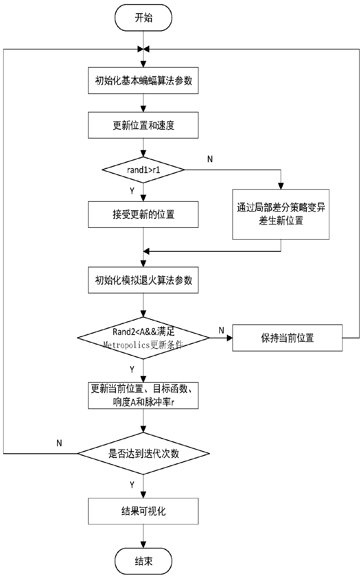
[0070] In this example, the Quantum Behavioral Particle Swarm Algorithm (QPSO) studied by Zhang Hang et al. and the hybrid bat algorithm based on quadratic differential evolution are used as comparison algorithms to verify the effectiveness of the method proposed by the present invention.

[0071] Describe the present invention below in conjunction with specific embodiment:

[0072] In this example, the UAV 3D path planning method based on RFID inventory inventory adopts the following steps:

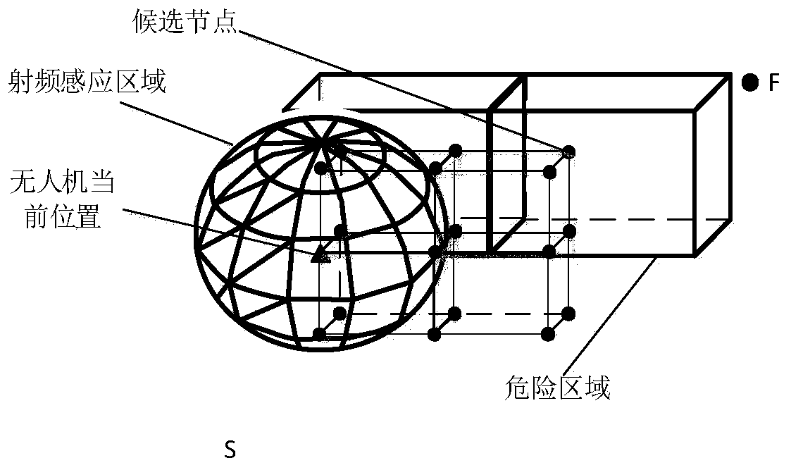
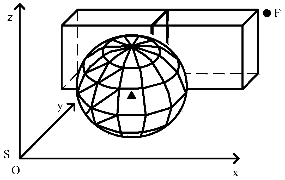
[0073] Step 1: Use Mathlab7.11.0 as the simulation platform to collect the location and size of obstacles and information collection points in the production workshop (this paper uses cuboids to replace obstacles and information collection points) data information, and establish a corresponding production workshop model;

[0074] Step 2: Use the Quantum...


PUM


Abstract

The invention relates to an unmanned aerial vehicle (UAV) three-dimensional route planning method based RFID inventory verification. The method comprises the following steps: building a flight networkmodel in a three-dimensional space and establishing a corresponding coordinate system; building a target function by building a dangerous counterguard adaptability degree function, an RFID reader identification applicability degree function and a route minimal adaptability degree function and ensuring that the UAV can acquire the minimum value of the target function on the premise of acquiring goods inventory information of each warehouse; solving the target function by a hybrid bat algorithm based on quadratic difference evolution and simulated annealing to acquire the global optimal flightroute. The method is high in global search capability and high in robustness. The counting efficiency of carrying the RFID reader by the UAV is improved, the invalid inventory flight of the UAV is avoided and the inventory flight route is reduced.

Description

technical field [0001] The invention relates to a three-dimensional path planning method for an unmanned aerial vehicle used for inventory counting. Background technique [0002] With the rapid development of Internet of Things technology, Radio Frequency Identification (RFID), because it can realize real-time wireless data collection, is widely used in logistics, asset tracking, equipment monitoring and other fields. [0003] RFID is mainly used in the field of logistics for transportation, storage, distribution, and warehousing and other links. Due to the characteristics of small size, light weight, and flexible turning, UAV can solve the problem of data information collection in some special environments (such as high temperature, dust-proof and other production environments). Therefore, warehouse cargo information based on UAV and RFID technology Management systems have already begun to be adopted. [0004] In UAV+RFID technology, UAV path planning is a key technology....

Claims


Application Information

Patent Timeline
IPC IPC(8): G05D1/10
Inventor 鲁建厦翟文倩赵林斌闫青汤洪涛詹燕
Owner ZHEJIANG UNIV OF TECH
Why Eureka
Try Eureka