Landslide detection method based on unmanned aerial vehicle point cloud

A detection method and unmanned aerial vehicle technology, applied in image data processing, instruments, calculations, etc., can solve the problems of not being able to obtain fine-scale terrain structures, unsatisfactory, and low measurement coverage

CN110232683AInactive Publication Date: 2019-09-13BEIJING UNIV OF TECH
7 Cites 11 Cited by

Patent Information

Authority / Receiving Office
CN · China
Current Assignee / Owner
Publication Date
2019-09-13
Estimated Expiration
Not applicable · inactive patent

Smart Images

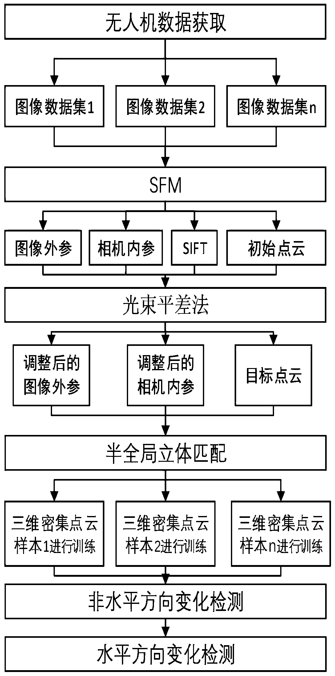
  • Figure 1
    Figure 1
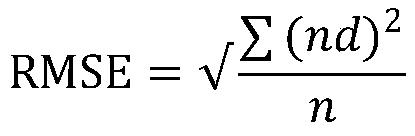
  • Figure 2
    Figure 2
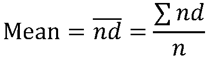
  • Figure 3
    Figure 3
Patent Text Reader

Abstract

The invention discloses a landslide detection method based on unmanned aerial vehicle point cloud. The landslide detection method comprises the following steps: capturing a high-resolution geographicmark image of a landslide through unmanned aerial vehicle equipment; refining parameters estimated in the SFM process through an SFM program and a beam adjusting method; generating dense three-dimensional point clouds for each observation epoch by using an image captured only in the specific area through a semi-global dense matching process; calculating the normal distance between the two point clouds obtained at any different time periods, and detecting the volume surface change by adopting a point-to-point three-dimensional corresponding relation; and finally, through comparison of the pointcloud landslide steep slopes obtained at different time periods, calculating the displacement rate in the horizontal direction, and detecting the point cloud based on low-altitude, unmanned, aviationand vehicle images. According to the landslide detection method, a large amount of images from different data sources can be easily processed without a large amount of ground control point information or further processing. The research result has a certain reference value for landslide research.
Need to check novelty before this filing date? Find Prior Art

Description

technical field

[0001] The invention relates to the technical field of geological disaster monitoring, in particular to a method for analyzing landslide debris flow based on an unmanned aerial vehicle. Background technique

[0002] Changes and displacements are basic indicators of the movement of masses on the Earth's surface, such as landslides, soil creep, and rockslides, whether caused by human activities or natural processes. Detecting surface changes is of great significance for natural disaster reduction and dynamic monitoring in environmental management. Landslides are considered to be a natural hazard of great significance that occurs widely in almost every country in the world. Traditional site survey methods, such as the use of total stations, GPS and geological compasses, etc., cannot meet the required cost, time efficiency and safety parameters, and these traditional surveying methods for detecting landslides and steep slopes have low measurement coverage and ca...

Examples

Embodiment Construction

[0024] The present invention will be described in detail below in conjunction with the accompanying drawings and embodiments.

[0025] like figure 1 As shown, when S1 is collecting UAV image data, it first uses the indoor camera calibration test field to calibrate the GoPro camera and test the stability of internal characteristics, and refines the camera calibration on site. The Simultaneous Multiframe Analysis Correction (SMAC) distortion model is used for correction. Camera calibration parameters include focal length (c), principal point offset (xp, yp), radial (K1, K2, and K3) and decentering (P1, and P2) lens distortion; then sets the course of the multicopter over the target area and flight altitude, so that the UAV is equipped with a camera to fly horizontally in automatic mode, and the camera collects landslide images, and the GPS receiver records the GPS measurement value of the exposure time of each image.

[0026] After the S2 camera collects the image, use the SFM...