

GIS-based three-dimensional management platform construction method, system and device and medium
A technology of management platform and construction method, applied in the field of digital management, can solve the problems of single data source, single function of business management platform, poor construction effect, etc., and achieve the effect of improving management efficiency, strong function expansion and strong linkage
- Summary
- Abstract
- Description
- Claims
- Application Information
AI Technical Summary
Problems solved by technology
Method used
Image

Examples
Embodiment 1
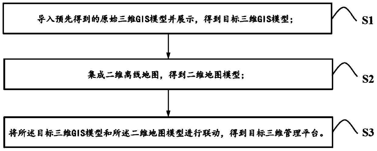
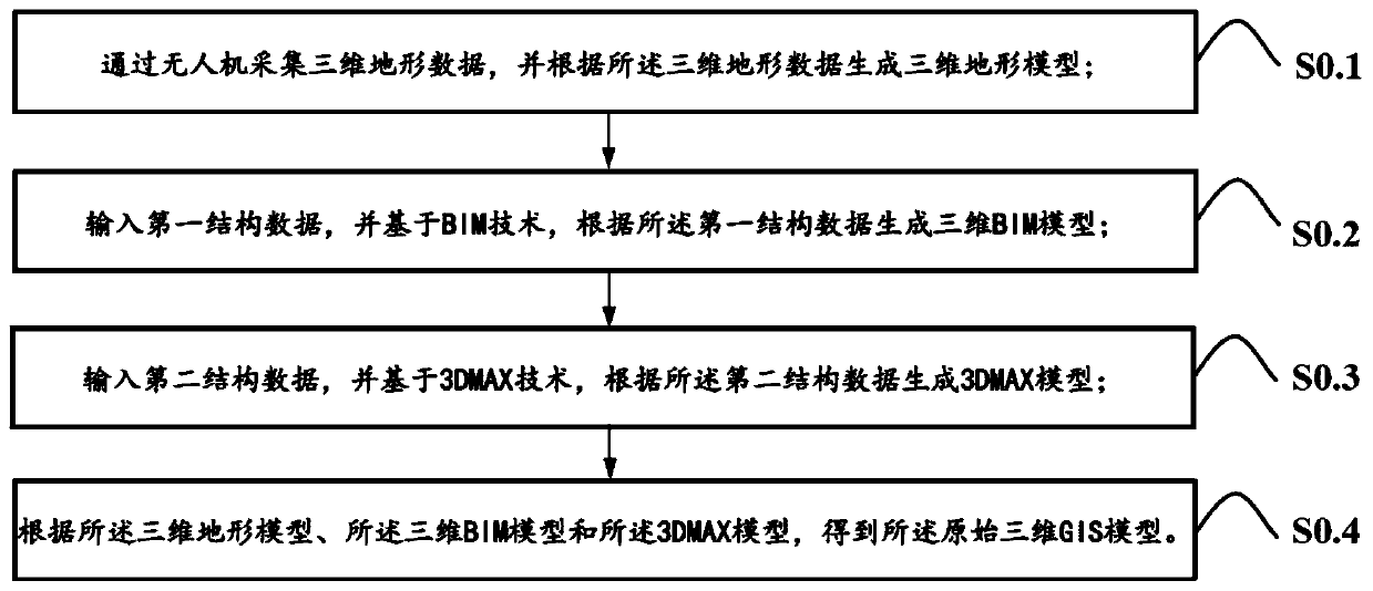
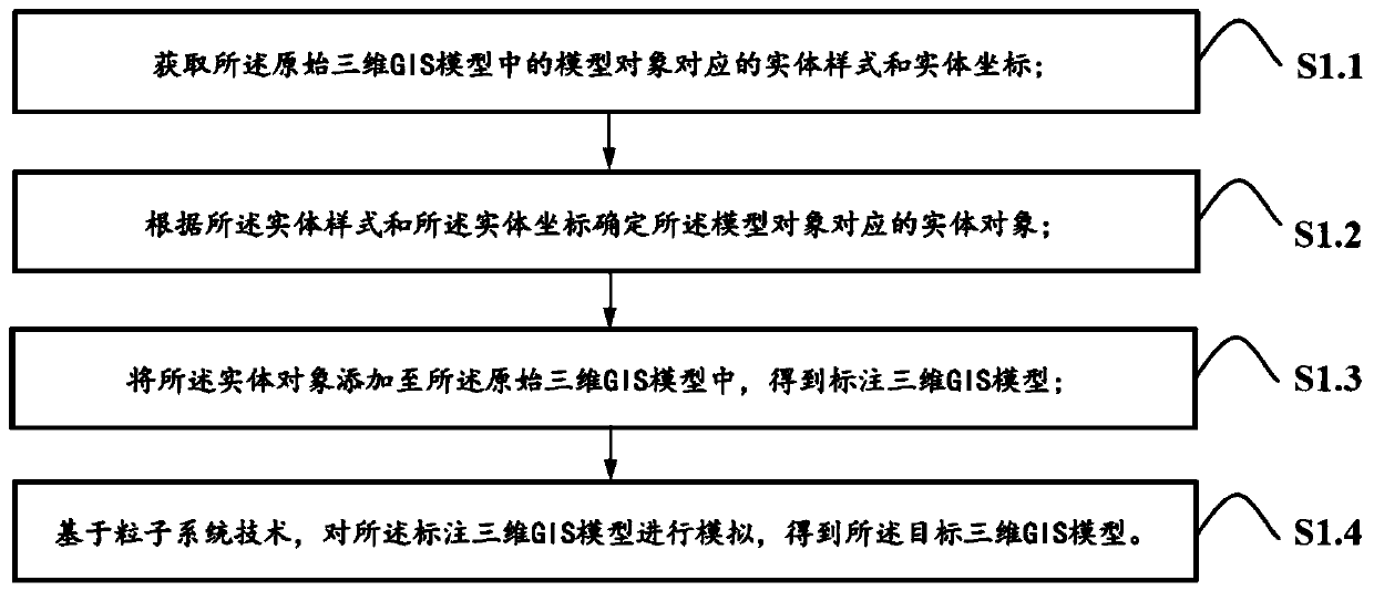
[0071] Embodiment one, as figure 1 As shown, a method for constructing a GIS-based three-dimensional management platform includes the following steps:
[0072] S1: Import and display the pre-obtained original 3D GIS model to obtain the target 3D GIS model;
[0073] S2: Integrate the two-dimensional offline map to obtain the two-dimensional map model;
[0074] S3: Link the target 3D GIS model with the 2D map model to obtain a target 3D management platform.
[0075] By importing the pre-obtained original 3D GIS model, it can support the original 3D GIS model generated by a variety of 3D GIS data sources. It has strong versatility. After importing the original 3D GIS model, it can be displayed, and various entities such as equipment and buildings can be realized in three dimensions. The display is more convenient and intuitive; the integrated 2D offline map can support multiple map sources, facilitate the acquisition of 2D map models, and facilitate the subsequent linkage betwe...
Embodiment 2
[0127] Embodiment two, such as Figure 7 As shown, a GIS-based three-dimensional management platform construction system includes an import module, a display module, an integration module and a linkage module;
[0128] The import module is used to import the pre-obtained original three-dimensional GIS model;
[0129] The display module is used to display the original 3D GIS model to obtain the target 3D GIS model;
[0130] The integration module is used to integrate a two-dimensional offline map to obtain a two-dimensional map model;
[0131] The linkage module is used to link the target 3D GIS model and the 2D map model to obtain a target 3D management platform.
[0132] The pre-obtained original 3D GIS model can be imported through the import module, which can support the original 3D GIS model generated by a variety of 3D GIS data sources. Three-dimensional display of various entities is more convenient and intuitive; the integration of two-dimensional offline maps throug...
Embodiment 3
[0139] Embodiment 3. Based on Embodiment 1 and Embodiment 2, this embodiment also discloses a device for building a GIS-based three-dimensional management platform, including a display, a processor, and a memory;
[0140] The display is used to display the target three-dimensional GIS model, the two-dimensional map model and the target three-dimensional management platform;
[0141] The memory is used to store computer programs;
[0142] The processor is configured to run the computer program, and when the computer program runs, the figure 1 The specific steps from S1 to S3 are shown.
[0143] Through the computer program stored in the memory, and running on the processor, combined with the display function of the display, the construction of the three-dimensional management platform based on GIS of the present invention is realized, and the target three-dimensional management platform constructed can combine abstract data with equipment and buildings. And other entities are...
PUM
 Abstract
Description
Claims
Application Information