Land quality geochemical survey and acquisition system

A geochemical and acquisition system technology, applied in structured data retrieval, geographic information databases, resources, etc., can solve the problems of lack of real-time upload of collection information, failure to grasp the status of collection work in time, and inability to understand the progress of sample collection work, etc. Achieve the effect of seamless connection, unified management, and fast input and export

Pending Publication Date: 2019-09-27
湖北省地质科学研究院
View PDF4 Cites 5 Cited by
  • Summary
  • Abstract
  • Description
  • Claims
  • Application Information

AI Technical Summary

Problems solved by technology

[0008] The traditional working method lacks instant uploading of collection information, and various departments and leaders cannot grasp the status of collection work in time, and cannot understand the progress of sample collection work

Method used


Image

  • Land quality geochemical survey and acquisition system
  • Land quality geochemical survey and acquisition system
  • Land quality geochemical survey and acquisition system

Examples


Embodiment Construction

[0045] In order to make the object, technical solution and advantages of the present invention clearer, the present invention will be further described in detail below in conjunction with the accompanying drawings. It should be understood that the specific embodiments described here are only used to explain the present invention, not to limit the present invention.

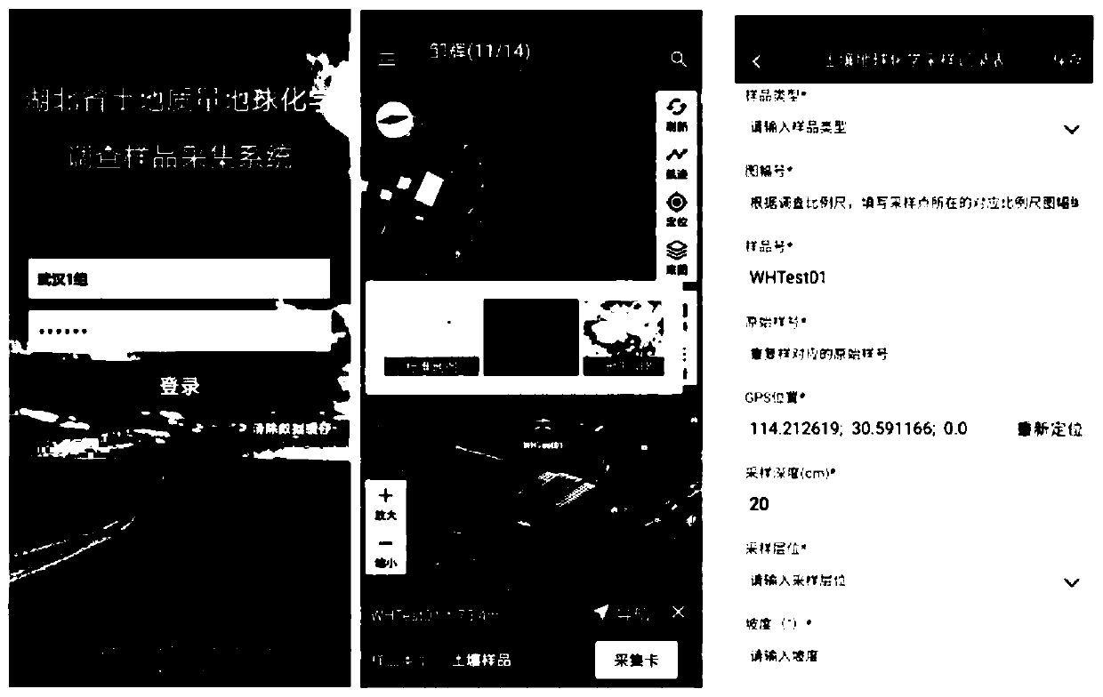
[0046] A land quality geochemical survey collection system, comprising:

[0047] Digital mobile field survey system: use the wireless communication module to call the server data to download and distribute point information, use GIS technology and third-party map service providers to view and navigate the point position, use the GPS module to read latitude and longitude and record track, use The wireless communication module uploads data to the cloud platform server database;

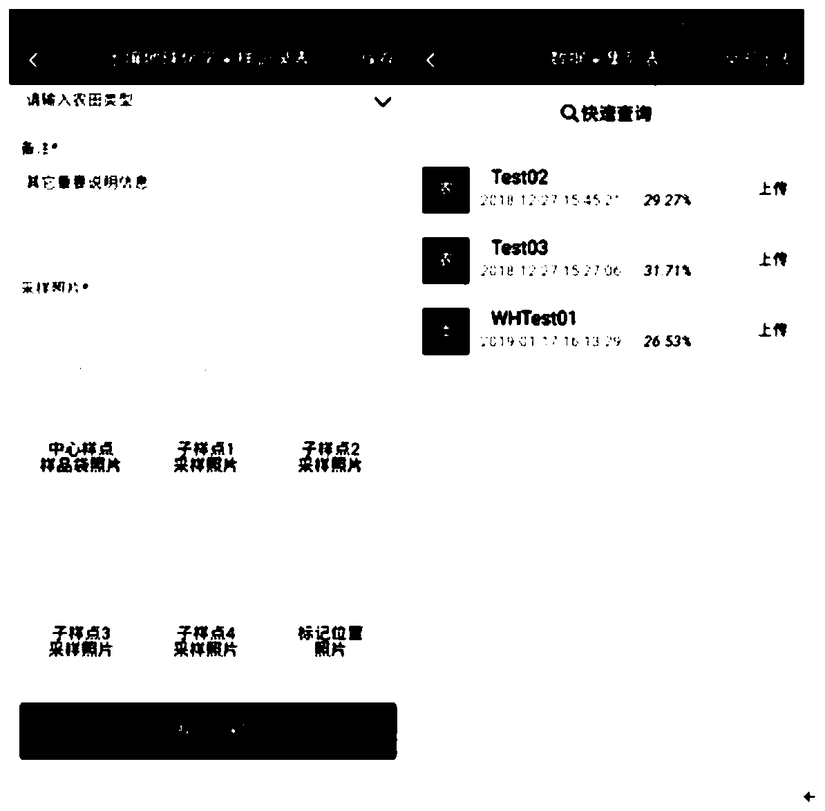
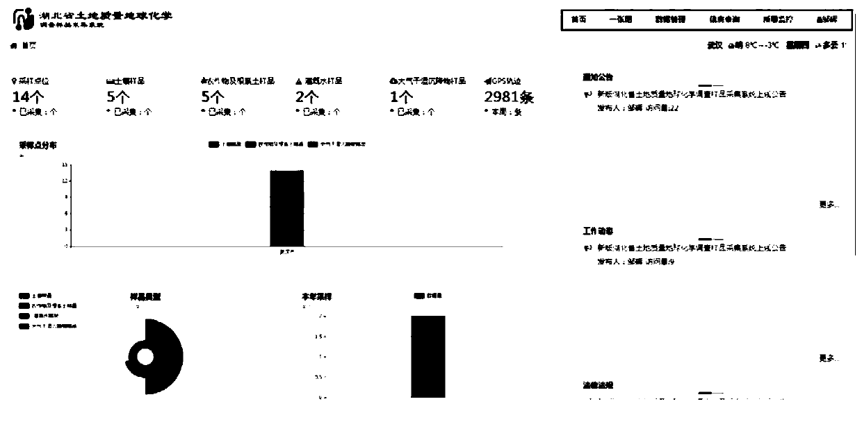
[0048] Collection information management system: use the communication module to call the server data to view the uploaded point informat...


PUM


Abstract

The invention provides a land quality geochemical survey and acquisition system. The system comprises a digital mobile field investigation system, a wireless communication module is utilized to call server data to download and distribute point location information, a GIS technology and a third-party map service provider are utilized to check and navigate point location positions, a GPS module is utilized to read latitude and longitude and record tracks, and the wireless communication module is utilized to upload data to a cloud platform server database. Simultaneous collection and checking of information are achieved. Paperless operation is achieved, data is uploaded to a server through one key, and dynamic tracking and transparent supervision of sampling work are achieved. Seamless connection and unified management of data between different systems are realized. And the data is integrated in a unified system for management, so that the functions of rapid input and output, rapid query, quality monitoring and the like of information are realized.

Description

technical field [0001] The invention relates to the field of land survey, in particular to a land quality geochemical investigation and acquisition system. Background technique [0002] In the current land quality survey process, traditional methods are generally used for sample data collection and information management. That is, manually carry tools such as camera tools, handheld GPS, paper record forms, topographic maps, etc. to collect and record sample information in paper, and manage sample data by integrating sample information record forms. Compared with the information means, the manual method mainly highlights the following deficiencies: [0003] The survey sampling method is outdated, and the record keeping of sample information is inconvenient [0004] The sample collection method of the land quality and geochemical survey in our province mainly relies on manually carrying camera tools, hand-held GPS, paper record forms and topographic maps to find sampling poi...

Claims


Application Information

Patent Timeline
Patent Type & Authority Applications(China)
IPC IPC(8): G06Q10/06G06F16/29G06Q50/26
CPCG06Q10/06395G06F16/29G06Q50/26
Inventor 邹辉戴光忠项剑桥杨军黄彬闫加力段碧辉李春诚赵敏徐春燕袁知洋夏伟王天一潘飞
Owner 湖北省地质科学研究院
Why Eureka
Try Eureka