Typhoon storm surge risk assessment method and system based on ArcGIS platform

A risk assessment and storm surge technology, applied in the field of typhoon storm surge risk assessment and planning in coastal areas, can solve problems such as tidal water protection in coastal areas, and achieve the effect of improving completeness and reliability

Pending Publication Date: 2019-10-25
中国地质大学深圳研究院
View PDF2 Cites 11 Cited by
  • Summary
  • Abstract
  • Description
  • Claims
  • Application Information

AI Technical Summary

Problems solved by technology

Storm surges are often accompanied by strong winds and huge waves. If they are superimposed with astr

Method used


Image

  • Typhoon storm surge risk assessment method and system based on ArcGIS platform
  • Typhoon storm surge risk assessment method and system based on ArcGIS platform
  • Typhoon storm surge risk assessment method and system based on ArcGIS platform

Examples


Embodiment 1

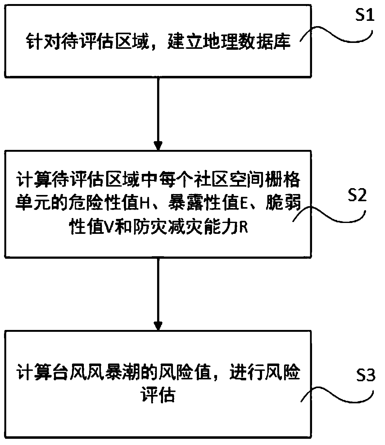
[0048] Please refer to figure 1 , which is an implementation flowchart of the typhoon storm surge risk assessment method disclosed in the present invention, a kind of typhoon storm surge risk assessment method based on the ArcGIS platform disclosed in the present invention comprises the following steps:

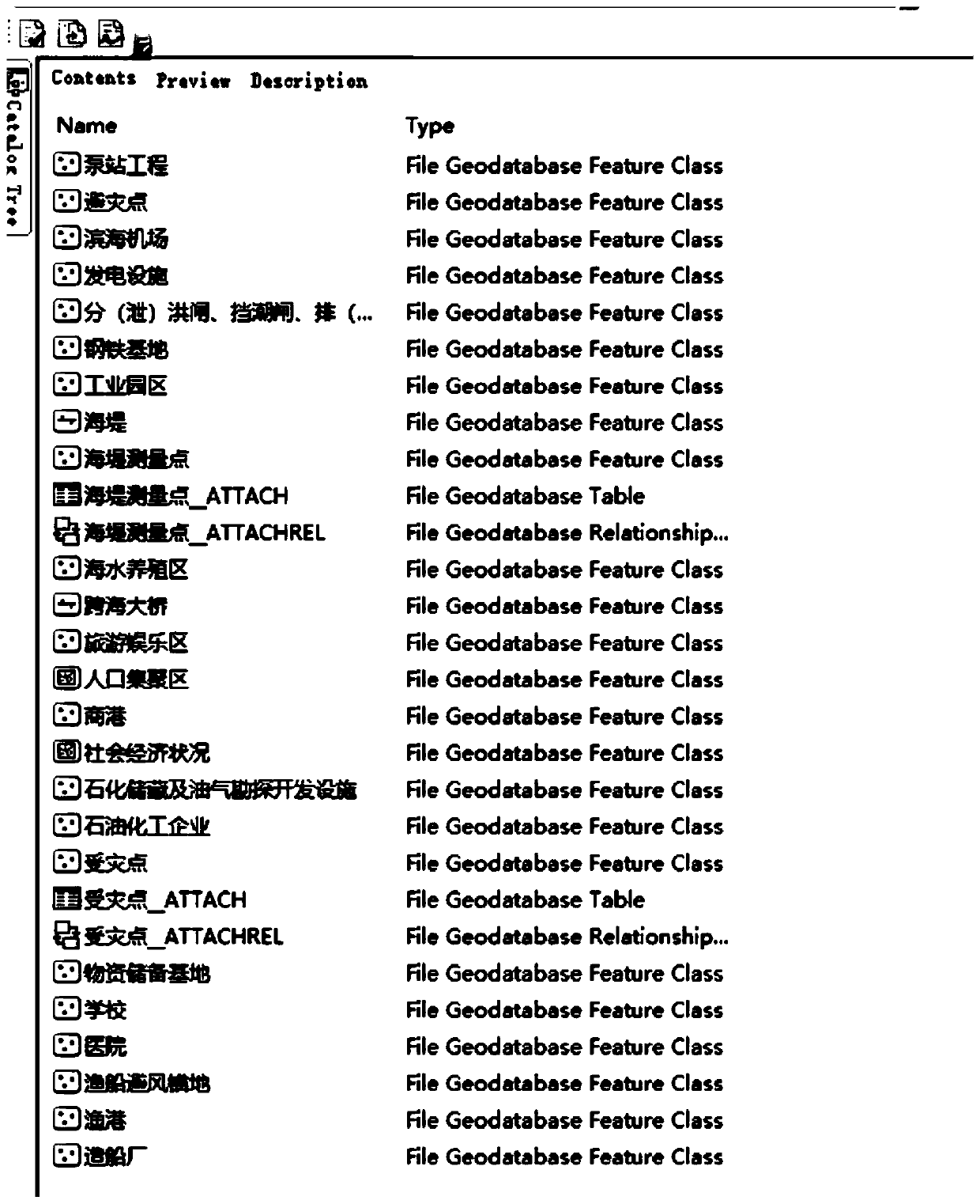
[0049] S1. For the area to be evaluated, establish a geographic database-Geodatabase; wherein, the geographic database includes administrative division vector data, tide station observation data, DEM data, DLG data, DOM data, coastline data, and the position of important carriers , quantity, distribution data; in the present embodiment, what set up is Huizhou city disaster prevention and mitigation risk zoning database Geodatabase; Wherein, the display figure of database is as image 3 shown.

[0050] S2. According to the geographic information data obtained from the geographic database, calculate the final risk value factors affecting each area to be assessed, specifically ...

Embodiment 2

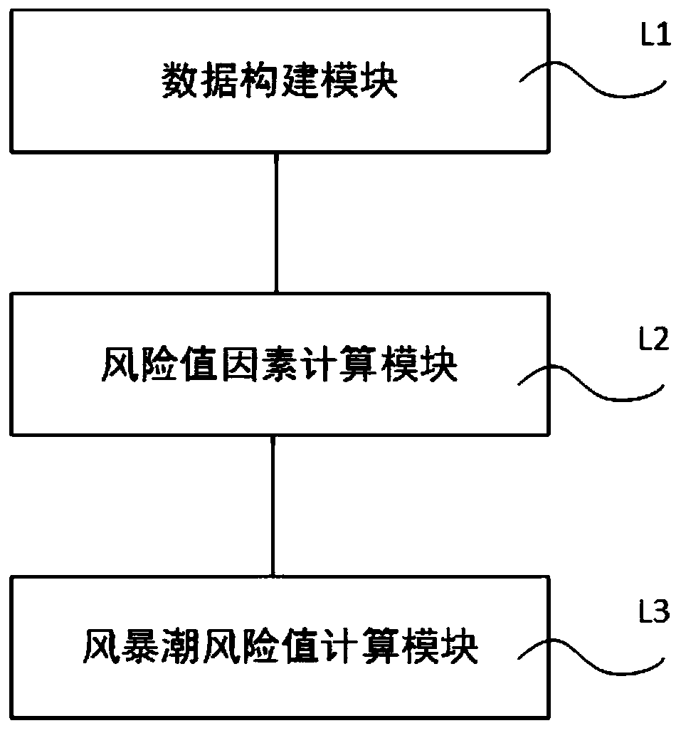
[0088] Please refer to figure 2 , which is a schematic structural diagram of the typhoon storm surge risk assessment system disclosed in the present invention. The typhoon storm surge risk assessment system disclosed in the present invention specifically includes a data construction module L1, a risk value factor calculation module L2 and a storm surge risk value calculation module L3, in:

[0089] The data construction module L1 is used to establish a geographic database-Geodatabase for the area to be evaluated; wherein, the geographic database includes administrative division vector data, tide station observation data, DEM data, DLG data, DOM data, coastline data, and important The location, quantity and distribution data of the carrier;

[0090] Risk value factor calculation module L2 is used to calculate the hazard value H, exposure value E, vulnerability value V and Disaster prevention and mitigation capability R;

[0091] The storm surge risk value calculation module...


PUM


Abstract

The invention discloses a typhoon storm surge risk assessment method and a system based on an ArcGIS platform. The method has the advantages that compared with a traditional storm surge risk zoning strategy, the risk quantitative evaluation strategy is provided, and quantitative calculation is conducted on each factor (H, E, V and R) influencing the final risk value of the area to be evaluated. Therefore, the final risk value can be measured from two perspectives, one is a traditional risk level form, the other is an innovative quantitative mode, and a specific risk value can be obtained. Andthe method has important significance for disaster prevention, disaster reduction and disaster relief deployment. Meanwhile, only three parameters are considered at most in traditional risk division,an algorithm is provided for detailed calculation of each parameter, meanwhile, the disaster prevention and reduction capacity is considered, and therefore the completeness and reliability of an evaluation result are further improved.

Description

technical field [0001] The invention relates to the fields of disaster prevention and mitigation and disaster assessment, and mainly refers to the risk assessment and planning of typhoon storm surges in coastal areas based on the ArcGIS platform. Background technique [0002] A storm surge is a rise and fall of sea water due to severe atmospheric disturbances, such as strong winds and sudden changes in wind pressure (usually referring to disastrous weather systems such as typhoons and extratropical cyclones), causing the affected sea area to greatly exceed the normal ultramicro Phenomenon. Storm surges are often accompanied by strong winds and huge waves. If they are superimposed with astronomical tides, they will often result in tidal protection in coastal areas and lead to huge disasters. China is located on the west coast of the Pacific Ocean, with a continental coastline of more than 18,000 km. It is one of the few countries in the world most severely affected by storm ...

Claims


Application Information

Patent Timeline
IPC IPC(8): G06F16/29G06Q10/06G06Q50/26
CPCG06F16/29G06Q10/0635G06Q50/26
Inventor 牟林刘大榕王道胜
Owner 中国地质大学深圳研究院
Why Eureka
Try Eureka