Cloud rendering three-dimensional visualization implementation method and system
An implementation method and three-dimensional technology, applied in the field of three-dimensional visualization, can solve problems such as high cost, browser crash, and difficult enterprise client hardware, and achieve the effect of reducing performance requirements and enhancing processing capacity.
- Summary
- Abstract
- Description
- Claims
- Application Information
AI Technical Summary
Problems solved by technology
Method used
Image
Examples
Embodiment 1
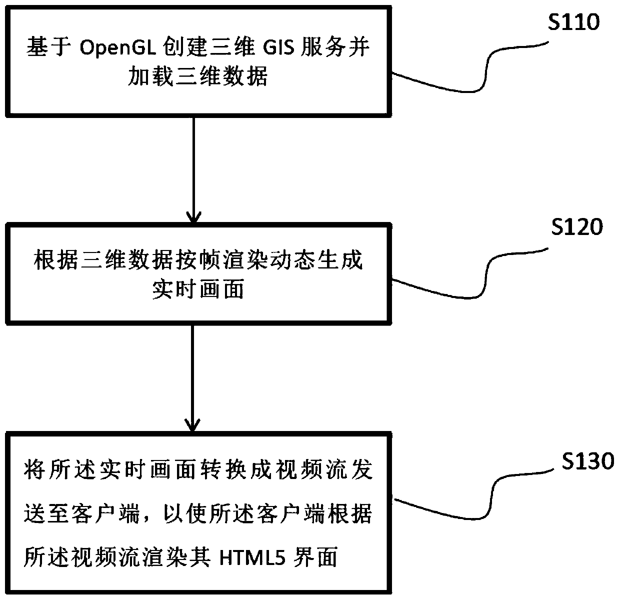
[0031] Embodiment 1 provides a cloud-rendered 3D visualization implementation method, which aims to perform cloud rendering on a 3D GIS written based on OpenGL, and complete the client-side 3D visualization in the form of a video stream.
[0032] The 3D GIS written by WebGL is embedded in the browser, so it does not need to load any components, and only needs to use the GPU for graphics hardware acceleration, but the demand for the GPU of the client device is high; on the basis of this 3D GIS, the 3D GIS Graphics rendering and other processes are completed through the cloud, and the client only needs to render simple functions such as bubbles and menus, which can reduce the performance requirements of the client device by more than 50%.
[0033] According to the above principles, 3D GIS services are written based on OpenGL. Compared with WebGL, OpenGL does not require a browser to support WebGL functions, and only needs to meet the requirements of HTML5.
[0034] Please refer ...
Embodiment 2
[0048] Embodiment 2 is an improvement made on the basis of Embodiment 1, which mainly explains and illustrates the realization process of user operation information in the cloud.
[0049] A user operation instruction is received, and spatial conversion is performed on the three-dimensional data according to the user operation instruction, so as to update the three-dimensional data.
[0050] The user operation instruction is the user's operation instruction on the HTML5 interface monitored by the client.
[0051] Specifically, the client listens to the user's operation actions on the HTML5 interface through the mouse, and simulates the operation actions to form the user operation instructions; the user operation instructions include mouse actions and instruction sets, and the instruction sets do not need to be simulated, and the instructions are from The client directly sends the video stream address to the cloud, and renders the HTML5 interface according to the feedback from t...
Embodiment 3
[0055] Embodiment 3 of the present invention also provides a cloud rendering 3D visualization realization system, which includes a server and a client, wherein:
[0056] The server end is used to create a three-dimensional GIS service based on OpenGL and load three-dimensional data, and dynamically generate a real-time picture according to the frame rendering of the three-dimensional data; and convert the real-time picture into a video stream and send it to the client;
[0057] The client is used to receive the video stream and render its HTML5 interface according to the video stream.
[0058] The client is a web client.
[0059] Preferably, the cloud rendering 3D visualization implementation method further includes:
[0060] A user operation instruction is received, and spatial conversion is performed on the three-dimensional data according to the user operation instruction, so as to update the three-dimensional data.
[0061] The user operation instruction is the user's op...
PUM
 Abstract
Description
Claims
Application Information
 - R&D
- Intellectual Property
- Life Sciences
- Materials
- Tech Scout
- Unparalleled Data Quality
- Higher Quality Content
- 60% Fewer Hallucinations
Browse by: Latest US Patents, China's latest patents, Technical Efficacy Thesaurus, Application Domain, Technology Topic, Popular Technical Reports.
© 2025 PatSnap. All rights reserved.Legal|Privacy policy|Modern Slavery Act Transparency Statement|Sitemap|About US| Contact US: help@patsnap.com

