
Unmanned aerial vehicle data docking method and system, electronic equipment and storage medium

A UAV and data technology, applied in the field of data transmission, can solve the problem of UAV lost contact and other problems

Inactive Publication Date: 2019-11-15
VISIONVERA INFORMATION TECH CO LTD
View PDF13 Cites 5 Cited by
  • Summary
  • Abstract
  • Description
  • Claims
  • Application Information

AI Technical Summary

Problems solved by technology

[0003] When a natural disaster occurs, the UAV can be controlled under the emergency command situation of the networked GIS Sky Eye dispatching application system service, which can provide the command center with the command situation on the front line, but it may be due to harsh natural conditions. The man-machine lost contact while exploring the site

Method used


Image

  • Unmanned aerial vehicle data docking method and system, electronic equipment and storage medium
  • Unmanned aerial vehicle data docking method and system, electronic equipment and storage medium
  • Unmanned aerial vehicle data docking method and system, electronic equipment and storage medium

Examples


Embodiment Construction

[0041] In order to make the above objects, features and advantages of the present invention more comprehensible, the present invention will be further described in detail below in conjunction with the accompanying drawings and specific embodiments.

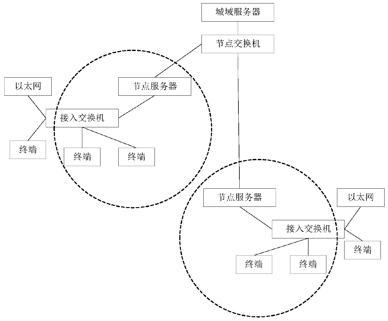
[0042] The Internet of Vision is an important milestone in the development of the network. It is a real-time network that can realize real-time transmission of high-definition video, and push many Internet applications to high-definition video, high-definition face-to-face.

[0043] The Internet of View adopts real-time high-definition video exchange technology, which can provide required services on one network platform, such as high-definition video conferencing, video surveillance, intelligent monitoring and analysis, emergency command, digital broadcast TV, time-lapse TV, online teaching, live broadcast , VOD on demand, TV mail, personalized recording (PVR), intranet (self-managed) channel, intelligent video broadcast control, ...


PUM


Abstract

The invention discloses a method for docking flight data of an unmanned aerial vehicle by a GIS sky-eye system, and relates to the technical field of data transmission. The method comprises the following steps that an articulated naturality web client acquires an unmanned aerial vehicle ID and flight data from the unmanned aerial vehicle and encapsulates the unmanned aerial vehicle ID and the flight data into a first data packet, uploads the first data packet to a streaming media server; the streaming media server transmits the first data packet to a message forwarding server, the message forwarding server analyzes and packages the first data packet into a second data packet and then transmits the second data packet to a GIS client, and the GIS client analyzes the second data packet and displays the parameter data and the flight path of the unmanned aerial vehicle on a page. The invention further discloses a system for docking the GIS sky-eye system with the flight data of the unmannedaerial vehicle, electronic equipment and a readable storage medium. By adopting the method provided by the invention, the flight data of the unmanned aerial vehicle can be quickly acquired, so that the corresponding parameter data and flight path of the unmanned aerial vehicle are displayed on the front-end page of the GIS client, and the flight condition of the unmanned aerial vehicle is monitored in real time.

Description

technical field [0001] The present invention relates to the technical field of data transmission, in particular to a data docking method, system, electronic equipment and storage medium of an unmanned aerial vehicle. Background technique [0002] The GIS Sky Eye scheduling application system seamlessly integrates heterogeneous networks based on the Internet of Vision technology, and realizes the networking application of terminal equipment in different business systems. The system organically combines networked devices with geographic locations. Users can quickly locate and query target devices directly on the map, and can also conduct unified management, unified application, and unified scheduling of networked systems through partitioned browsing navigation and spatial indexing. When it happens, it can efficiently command and dispatch emergency rescue and disaster relief work. [0003] When a natural disaster occurs, the UAV can be controlled under the emergency command si...

Claims


Application Information

Patent Timeline
Patent Type & Authority Applications(China)
IPC IPC(8): H04B7/185H04L29/08H04L29/06H04L12/46H04N7/18G06F16/29
CPCH04B7/18506H04L69/162H04L69/08H04L12/4633H04L69/22H04N7/18G06F16/29H04L67/565
Inventor 张洋庾少华袁占涛王艳辉
Owner VISIONVERA INFORMATION TECH CO LTD
Learn More