

Landslide early warning system and landslide early warning method
A technology for early warning systems and landslide risks, applied in radio wave measurement systems, satellite radio beacon positioning systems, alarms, etc., can solve problems such as difficult modeling, insufficient image accuracy, and many blind spots
- Summary
- Abstract
- Description
- Claims
- Application Information
AI Technical Summary
Problems solved by technology
Method used
Image

Examples
Embodiment Construction
[0033] The technical solutions in the present invention will be clearly and completely described below in conjunction with the accompanying drawings in the present invention.
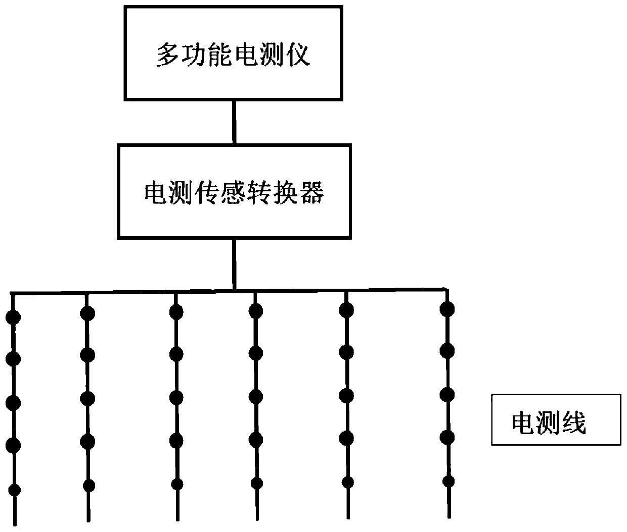
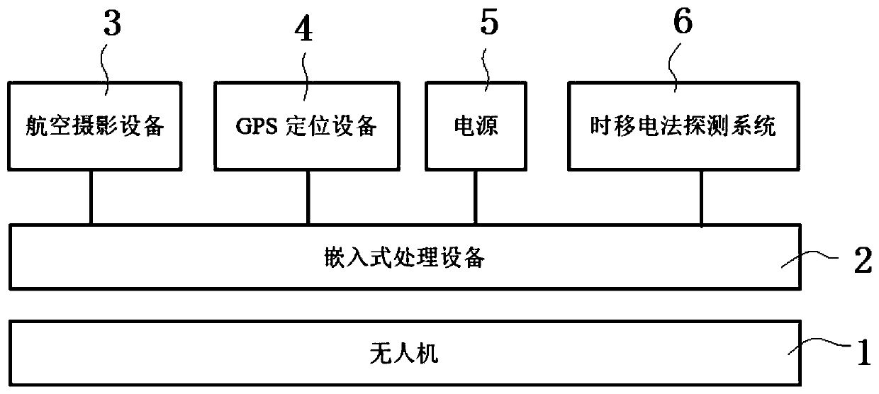
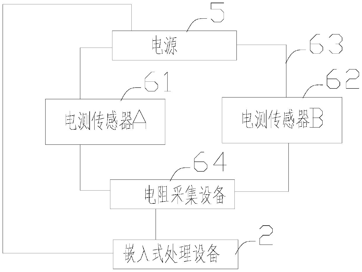
[0034] Such as figure 2 As shown, the embodiment of the present invention provides a landslide early warning system, including a UAV 1 and a landslide early warning platform installed on the UAV 1, and the landslide early warning platform includes an embedded processing device 2 and an embedded processing device 2 Connected aerial photography equipment 3, GPS positioning equipment 4, power supply 5, time-shift electrical detection system 6. The UAV 1 takes pictures and videotapes the working area through the aerial photography equipment 3, and obtains photos and videos of the working area; 1. Deploy two electrical sensors (61, 62) at the set detection points and measure the resistivity of the working area. According to the photos and videos obtained by the aerial photography equipment 3 and the electr...
PUM
 Abstract
Description
Claims
Application Information