

Plane track planning method of unmanned underwater vehicle (UUV) formation
A technology for unmanned aerial vehicle and track planning, which is applied to instruments, two-dimensional position/channel control, control/regulation systems, etc., and can solve problems such as poor optimization.
- Summary
- Abstract
- Description
- Claims
- Application Information
AI Technical Summary
Problems solved by technology
Method used
Image

Examples
Embodiment Construction
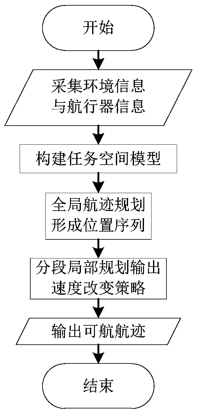
[0091] The present invention will be further described in detail below in conjunction with the accompanying drawings and specific embodiments.
[0092] A method for planning a plane track of an underwater unmanned aerial vehicle formation, specifically comprising the following steps:
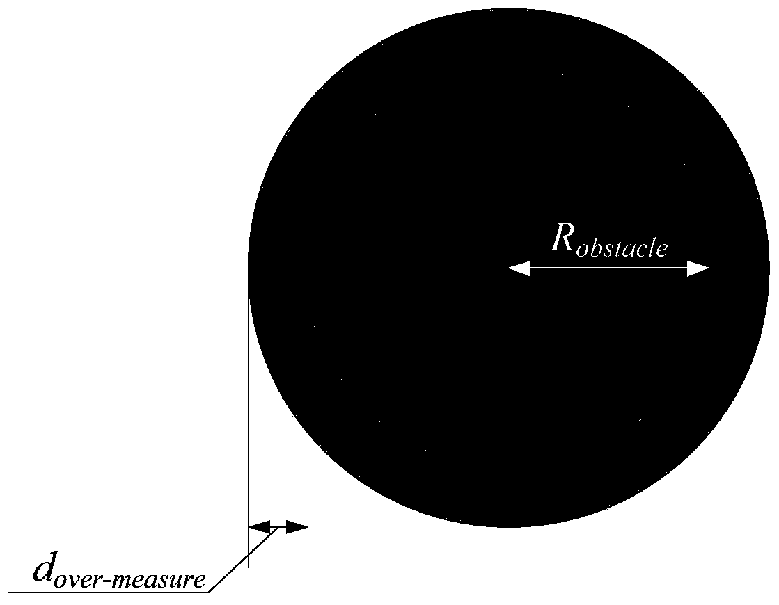
[0093] Step 1: According to the environmental information database or the environmental information detected by the sensor, construct the mission space model. Since the trajectory planning process is carried out in two-dimensional space, the mission space is described as: Ω={(x,y)|x min ≤x≤x max ,y min ≤y≤y max ,z≡C}, where the center of the basic unit circle of the obstacle zone is (x obstacle ,y obstacle ), the radius is R obstacle , the puffing distance is d over-measure , its model is attached as figure 2 shown;
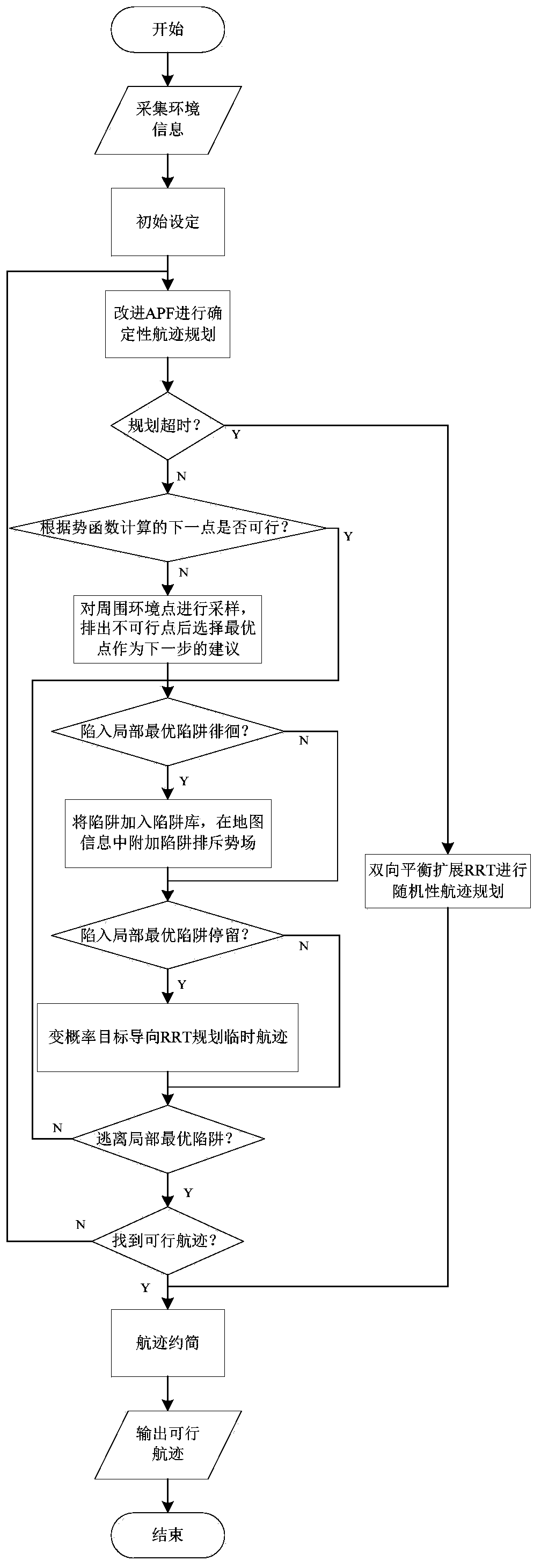
[0094] Step 2: Based on the static environment information, the artificial potential field method (APF) and the improved and fusion algorithm of the rapid expansion random...
PUM
 Abstract
Description
Claims
Application Information