A Method for Generating Remote Sensing Image Samples of Construction Waste
A remote sensing image and construction waste technology, which is applied in 2D image generation, image analysis, image enhancement, etc., can solve the problem of few remote sensing construction waste image samples, and achieve the effect of suppressing noise and increasing contrast
- Summary
- Abstract
- Description
- Claims
- Application Information
AI Technical Summary
Problems solved by technology
Method used
Image
Examples
Embodiment Construction
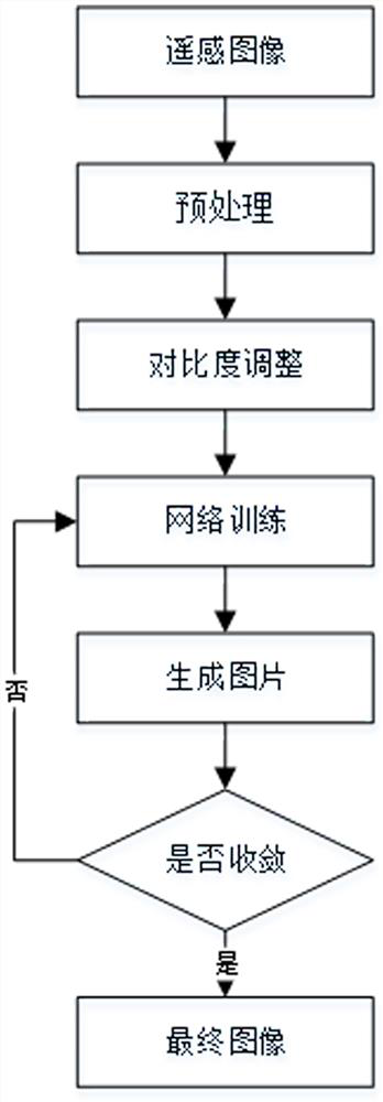
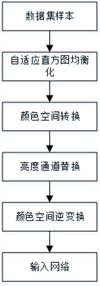
[0053] Such as figure 1 As shown, a method for generating remote sensing image samples of construction waste, the overall process is as follows: preprocess the downloaded remote sensing images to obtain two sample data sets, and when the sample sets enter the program, the system will adjust the contrast of the sample sets , and then input it into the generative confrontation network to generate samples. If the sample accuracy reaches the standard and the network reaches convergence, it will be completed.
[0054] Specifically include:
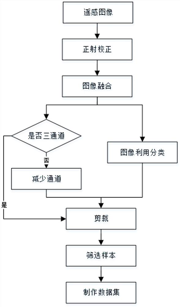
[0055] S1. Remote sensing image preprocessing to create sample data sets
[0056] Such as figure 2 As shown, the sample data set production process is as follows:
[0057] S1.1. Orthorectification
[0058] For orthorectification, select multi-spectral data for input data, and select DEM data with a global resolution of 900 meters for DEM data, and the output pixel size is 4 meters. The resampling method is triple convolution method, and th...
PUM
 Abstract
Description
Claims
Application Information
 - R&D
- Intellectual Property
- Life Sciences
- Materials
- Tech Scout
- Unparalleled Data Quality
- Higher Quality Content
- 60% Fewer Hallucinations
Browse by: Latest US Patents, China's latest patents, Technical Efficacy Thesaurus, Application Domain, Technology Topic, Popular Technical Reports.
© 2025 PatSnap. All rights reserved.Legal|Privacy policy|Modern Slavery Act Transparency Statement|Sitemap|About US| Contact US: help@patsnap.com


