Vehicle-mounted integrated navigation system and positioning method
An integrated navigation system and integrated navigation technology, applied in surveying and mapping, road network navigator, radio wave measurement system, etc., can solve the problem of reduced availability of satellite navigation and achieve the effect of improving the accuracy of calculation
- Summary
- Abstract
- Description
- Claims
- Application Information
AI Technical Summary
Problems solved by technology
Method used
Image
Examples
Embodiment Construction
[0049] The present invention will be further described below in conjunction with specific embodiments. It should be understood that the following examples are only used to illustrate the present invention but not to limit the scope of the present invention.
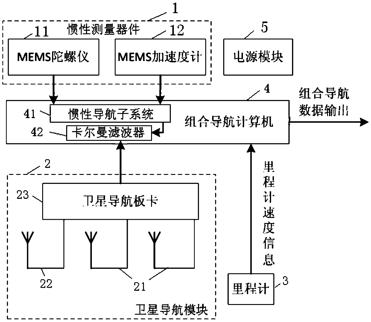
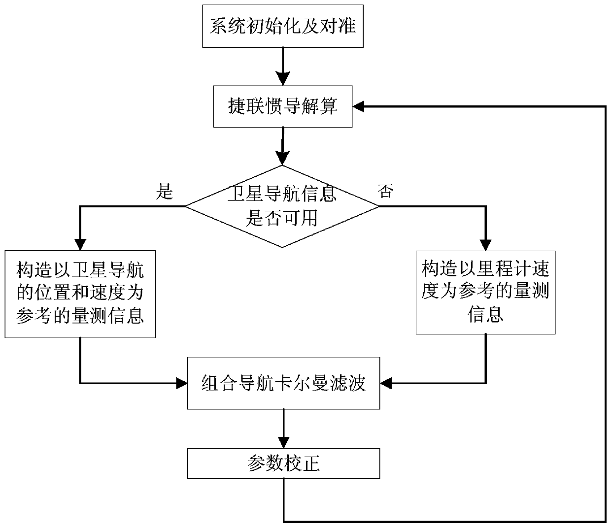
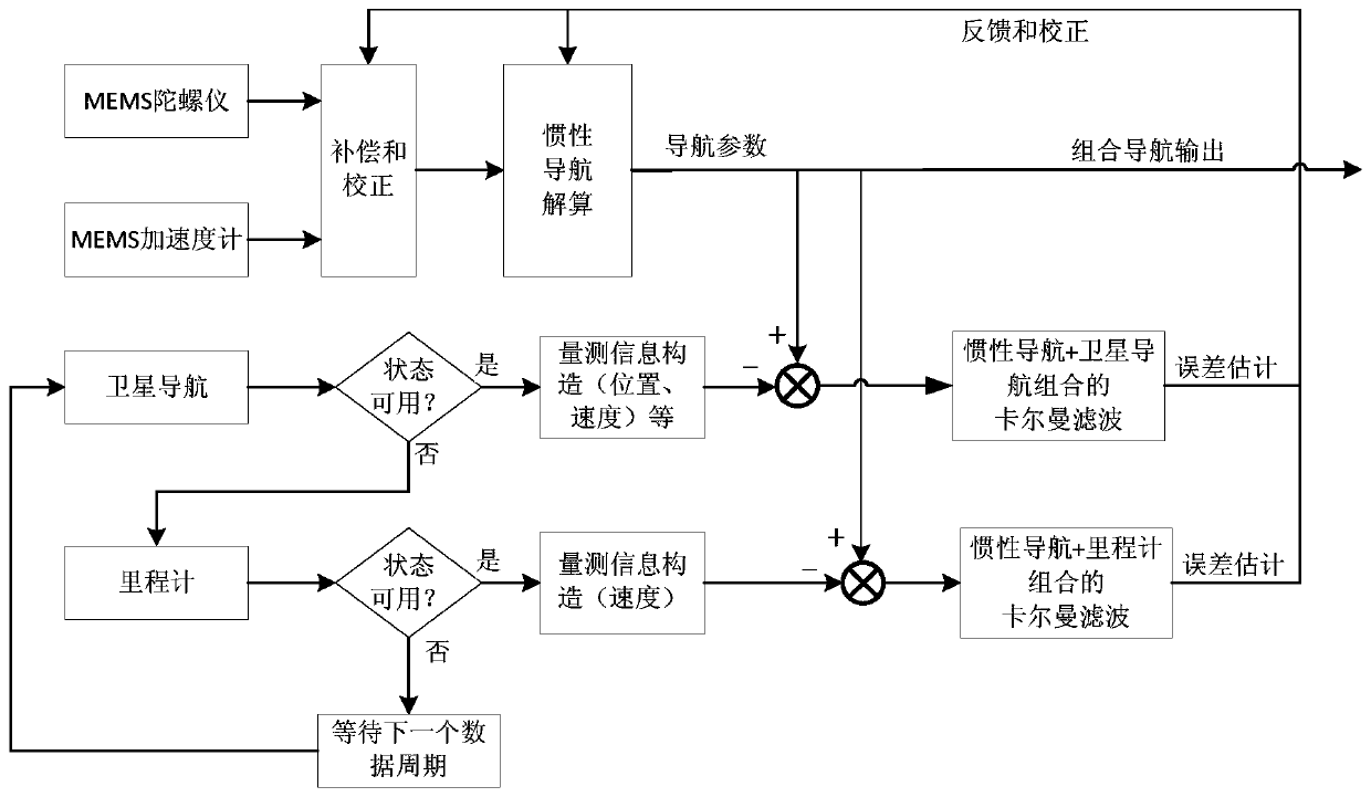
[0050] like figure 1 Shown is a vehicle-mounted integrated navigation system according to an embodiment of the present invention, which is installed on a carrier (usually a vehicle), and realizes the high-precision of a train or a car through the combination of satellite navigation, strapdown inertial navigation and odometer Acquisition of position information, including inertial measurement device 1, satellite navigation module 2:
[0051] Inertial measurement device 1 is used for measuring inertial navigation signal, comprises gyroscope 11 and accelerometer 12; Wherein, gyroscope 11 is MEMS gyroscope, is used for measuring the angular velocity (turning or rolling) of carrier, and accelerometer 12 is MEMS accelerometer,...
PUM
 Abstract
Description
Claims
Application Information
 - R&D
- Intellectual Property
- Life Sciences
- Materials
- Tech Scout
- Unparalleled Data Quality
- Higher Quality Content
- 60% Fewer Hallucinations
Browse by: Latest US Patents, China's latest patents, Technical Efficacy Thesaurus, Application Domain, Technology Topic, Popular Technical Reports.
© 2025 PatSnap. All rights reserved.Legal|Privacy policy|Modern Slavery Act Transparency Statement|Sitemap|About US| Contact US: help@patsnap.com


