

Road three-dimensional sight distance checking calculation method
A technology of driving simulator and driving simulation, which is applied in the field of three-dimensional line-of-sight checking and calculation of roads based on BIM and driving simulators, can solve problems such as low efficiency and high testing costs, and achieve the goal of ensuring authenticity, intuitive testing, and improving testing accuracy Effect
- Summary
- Abstract
- Description
- Claims
- Application Information
AI Technical Summary
Problems solved by technology
Method used
Image


Examples
Embodiment 1
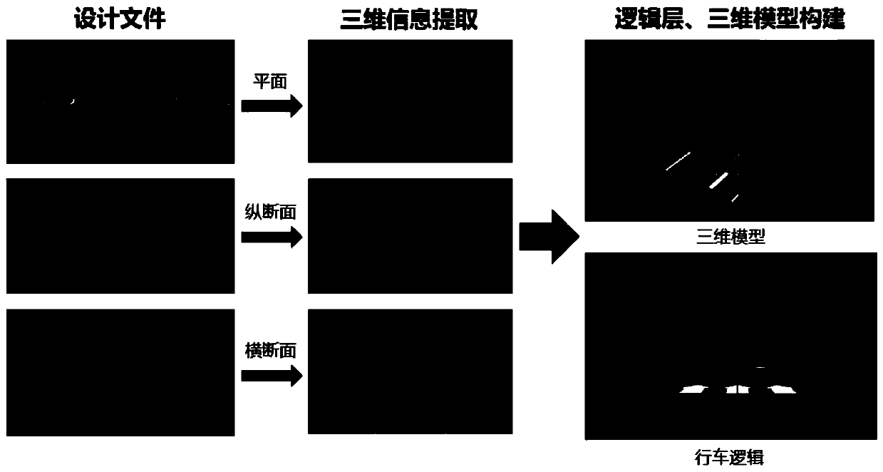
[0045] A road three-dimensional line-of-sight checking method based on BIM and driving simulator; the steps are as follows:
[0046] Step 1: Establish road BIM based on road horizontal, vertical and horizontal design data and terrain and object information, forming a static scene for driving simulation;
[0047] Step 2: Based on the horizontal and vertical design data of the road, use SCANeR TM The Studio driving simulation software establishes the driving logic layer, laying the foundation for the dynamic scene construction of the driving simulator;
[0048] Step 3: Add the driving vehicle and the vehicle in front in the simulation scene, and calculate the parking sight distance S in real time based on the running speed V of the driving vehicle T , and in the driving simulator according to the parking sight distance S T updating the position of the vehicle in front in real time to form a dynamic scene for driving simulation;
[0049] Step 4: Execute SCANeRTM The Simulati...
Embodiment 2
[0067] Sight distance inspection of North Cross Passage (East Section) in Shanghai. The project is the first east-west ultra-long underground expressway in Shanghai. It runs from 200m east of Tibet North Road to Haining Road and Zhoujiazui Road, and ends 100m west of Shuangyang Road. The total length is 6.9km. Set up 3 pairs of underground ramps to serve key areas along the line, 3 wind towers, and 1 management center.
[0068] Such as figure 1 As shown, step 1, establish road BIM based on road level, vertical and horizontal design data and terrain and surface object information, and provide static scenes for driving simulation;
[0069] Step 2. Based on the horizontal and vertical design data of the road, the driving simulation software is used to establish the driving logic layer, laying the foundation for the dynamic scene construction of the driving simulator;
[0070] Such as figure 2 and image 3 As shown, in step 3, add the driving vehicle and the vehicle in front ...
PUM
 Abstract
Description
Claims
Application Information