A spaceborne SAR imaging processing method
An imaging processing and space-borne technology, which is applied in the direction of instruments, measuring devices, and utilization of re-radiation, etc., can solve the problems of no longer meeting the requirements of fast and high-precision image focusing, limiting space-borne SAR application scenarios, and increasing the amount of processed data. Achieve the effects of promoting the application of earth observation, solving the problem of velocity and space variation, and saving resources and time
- Summary
- Abstract
- Description
- Claims
- Application Information
AI Technical Summary
Problems solved by technology
Method used
Image


Examples
Embodiment Construction
[0040] In order to make the object, technical solution and advantages of the present invention clearer, the present invention will be described in further detail below in conjunction with specific embodiments and with reference to the accompanying drawings.
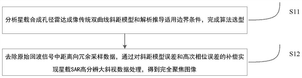
[0041] like figure 1 as shown, figure 1 The flow chart of the spaceborne synthetic aperture radar imaging processing method provided by the embodiment of the present invention, the method includes:
[0042] Analyze the traditional hyperbolic slant range model of spaceborne synthetic aperture radar imaging and analytically derive the applicable boundary conditions to complete the algorithm selection;
[0043] The redundant sampling data in the range direction of the original echo signal is removed, and the spaceborne SAR high-resolution high-squint data processing is realized by compensating the slant range model error and high-order phase error, and a fully focused image is obtained.
[0044] Step 1: Analyze the traditi...
PUM
 Abstract
Description
Claims
Application Information