
Mass geological data two-dimensional and three-dimensional integrated management method

A technology of geological data and management methods, applied in geographic information databases, structured data retrieval, etc., can solve problems such as inconvenient storage forms and failure to realize integrated management, so as to improve filtering and access efficiency, facilitate query, and facilitate switching Effect

Active Publication Date: 2020-06-02
星际空间(天津)科技发展有限公司
View PDF9 Cites 2 Cited by
  • Summary
  • Abstract
  • Description
  • Claims
  • Application Information

AI Technical Summary

Problems solved by technology

At present, most geological reports compiled by geological survey units exist in the form of traditional cardboard, which is inconvenient in the use of reports
First of all, the biggest inconvenience is information query. When searching for a drill hole data or a certain laboratory data, it is necessary to browse through a large number of documents according to the report catalogue. The problem is more prominent when looking up maps. A large number of auxiliary documents are needed to accurately interpret the maps; Secondly, in terms of report release, although some geological reports have been electronicized, integrated management of 2D data and 3D data has not been realized.

Method used


Image

  • Mass geological data two-dimensional and three-dimensional integrated management method
  • Mass geological data two-dimensional and three-dimensional integrated management method
  • Mass geological data two-dimensional and three-dimensional integrated management method

Examples


Embodiment 1

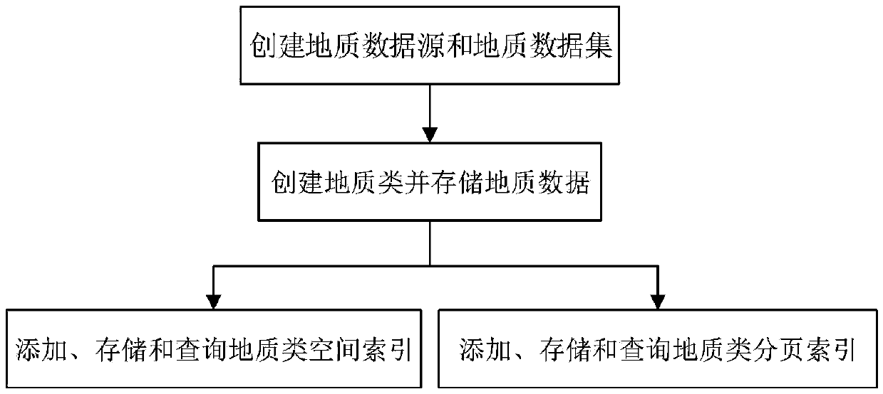
[0055] figure 1 It is a 2D and 3D integrated management method for massive geological data, such as figure 1 As shown, the method includes the following steps:

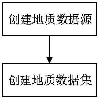
[0056] Create geological data sources and geological data sets: create geological data sources according to geological standards, and organize the information in geological data sources; create geological data sets according to map sheets or project index numbers, and initialize the geological texture library;

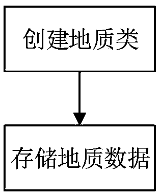
[0057] Create geological classes and store geological data: create geological classes consisting of drilling feature classes, original stratum classes, standard stratum classes, drilling test classes, and survey result attachment classes, and add database indexes to the geological classes; organize geological data Get the geological elements and store the geological elements in the geological class;

[0058] Add, store and query geological spatial index: determine the starting point and grid value of the geo...


PUM


Abstract

A mass geological data two-dimensional and three-dimensional integrated management method relates to the field of data processing management, and comprises the following steps: creating a geological data source and a geological data set; creating a geological class and storing geological data; adding, storing and querying geological class space indexes; and adding, storing and querying the geological paging index. The method has the advantages that the technical problems of two-dimensional and three-dimensional integrated management, spatial data organization, retrieval and analysis and the like based on massive geological data in geographic information can be effectively solved.

Description

technical field [0001] The invention relates to the management field of data processing, in particular to a technical problem that can effectively solve the two-dimensional and three-dimensional integrated management of massive geological data based on geographic information, spatial data organization, retrieval and analysis. Through the organized processing of boreholes and strata in geological data, the query and rendering of geological elements is facilitated, the access efficiency of geological information in 3D scenes is improved, and the unified display and management of aboveground boreholes and underground stratum layers is improved. 2D and 3D integrated management methods for massive geological data at the level of analysis and analysis. Background technique [0002] The traditional geological exploration data management mode restricts the convenience of data application and the scope of data sharing. With the development of computing technology, the integration of ...

Claims


Application Information

Patent Timeline
Patent Type & Authority Applications(China)
IPC IPC(8): G06F16/29
Inventor 沈美岑高健沈迎志周培龙蔡红王方正鲍佳欢
Owner 星际空间(天津)科技发展有限公司
Learn More