Offshore haze remote sensing identification method and system under clear sky condition
A remote sensing recognition and haze technology, applied in scene recognition, neural learning methods, character and pattern recognition, etc., can solve the problems of high difficulty of haze monitoring, time-consuming and laborious, and limited observation space.
- Summary
- Abstract
- Description
- Claims
- Application Information
AI Technical Summary
Problems solved by technology
Method used
Image
Examples
Embodiment 1
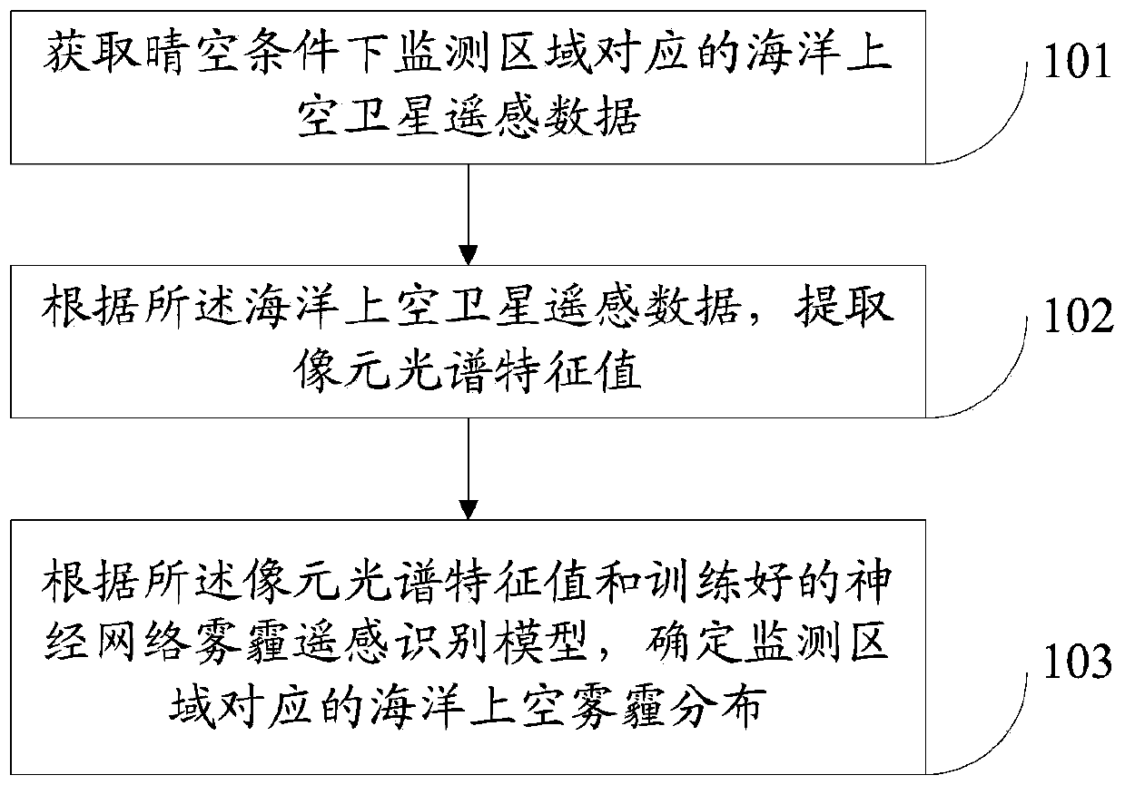
[0043] Such as figure 1 As shown, this embodiment provides a remote sensing identification method for sea haze under clear sky conditions, including the following steps.
[0044] Step 101: Obtain satellite remote sensing data over the ocean corresponding to the monitoring area under clear sky conditions.
[0045] Among them, the satellite remote sensing data over the ocean used in this embodiment comes from MODIS L1A data on the ocean color data website (https: / / oceancolor.gsfc.nasa.gov / ).
[0046] Step 102: Extract the spectral feature value of the pixel according to the satellite remote sensing data over the ocean.
[0047] In this embodiment, the spectral characteristic value of the pixel is the remote sensing reflectance R after de-Rayleigh correction rc , Referred to as Rayleigh remote sensing reflectivity R rc .
[0048] Due to the serious situation of cloud masks on satellite remote sensing data over the ocean, the remote sensing reflectivity of MODIS L1A data is R rs There are m...
Embodiment 2
[0073] In order to achieve the above objective, this embodiment also provides a remote sensing recognition system for sea haze under clear sky conditions, such as Figure 8 Shown, including:
[0074] The satellite remote sensing data acquisition module 201 over the ocean is used to acquire satellite remote sensing data over the ocean corresponding to the monitoring area under clear sky conditions.
[0075] The pixel spectral feature value extraction module 202 is configured to extract the pixel spectral feature value according to the satellite remote sensing data over the ocean.
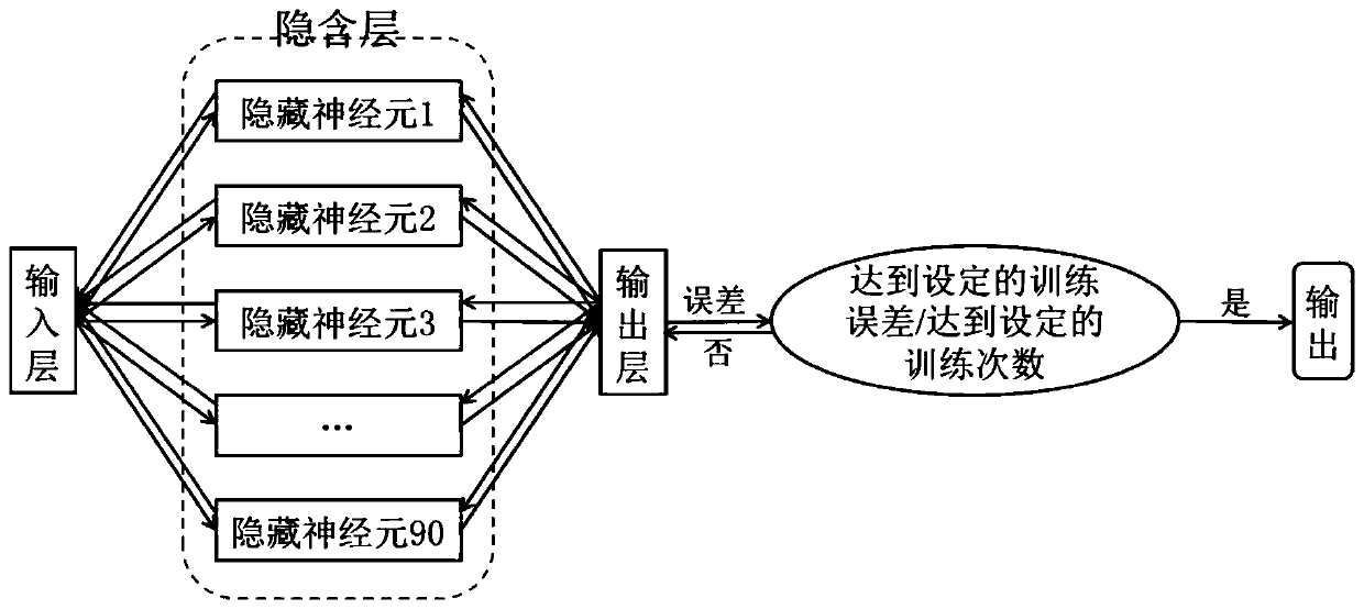
[0076] The haze distribution determination module 203 over the ocean is used to determine the haze distribution over the ocean corresponding to the monitored area according to the spectral feature values of the pixels and the trained neural network haze remote sensing recognition model; wherein the trained neural network The network haze remote sensing recognition model is obtained by training the MLP neu...
PUM
 Abstract
Description
Claims
Application Information
 - R&D
- Intellectual Property
- Life Sciences
- Materials
- Tech Scout
- Unparalleled Data Quality
- Higher Quality Content
- 60% Fewer Hallucinations
Browse by: Latest US Patents, China's latest patents, Technical Efficacy Thesaurus, Application Domain, Technology Topic, Popular Technical Reports.
© 2025 PatSnap. All rights reserved.Legal|Privacy policy|Modern Slavery Act Transparency Statement|Sitemap|About US| Contact US: help@patsnap.com


