High-resolution remote sensing image city function partitioning method based on multi-feature fusion

A multi-feature fusion, urban function technology, applied in the field of high-resolution remote sensing image urban function zoning, can solve the problems of the same spectrum of foreign objects, reduced classification accuracy, and different spectrum of the same object

Active Publication Date: 2020-08-25
NINGBO UNIV
View PDF7 Cites 4 Cited by
  • Summary
  • Abstract
  • Description
  • Claims
  • Application Information

AI Technical Summary

Problems solved by technology

Moreover, when only remote sensing images are used for urban functional zoning, there will be situations of "same object with different spectrum" and "same spectrum with different

Method used


Image

  • High-resolution remote sensing image city function partitioning method based on multi-feature fusion
  • High-resolution remote sensing image city function partitioning method based on multi-feature fusion
  • High-resolution remote sensing image city function partitioning method based on multi-feature fusion

Examples


Embodiment Construction

[0066] The present invention will be further described below in conjunction with the examples. The description of the following examples is provided only to aid the understanding of the present invention. It should be pointed out that for those skilled in the art, some modifications can be made to the present invention without departing from the principles of the present invention, and these improvements and modifications also fall within the protection scope of the claims of the present invention.

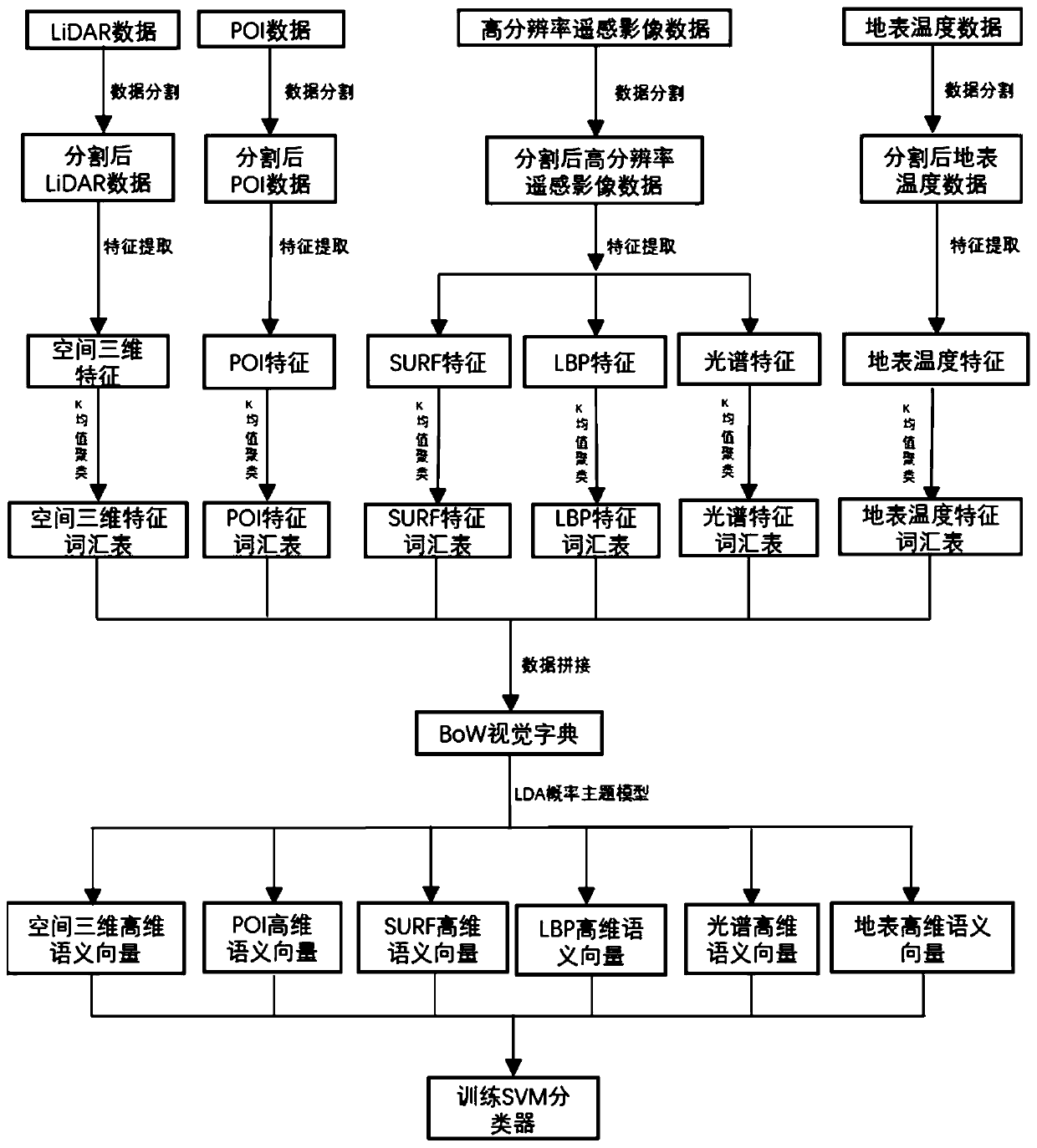
[0067] A multi-feature fusion-based urban functional partitioning method for high-resolution remote sensing images, the technical flow chart is as follows figure 1 As shown, it specifically includes the following steps:

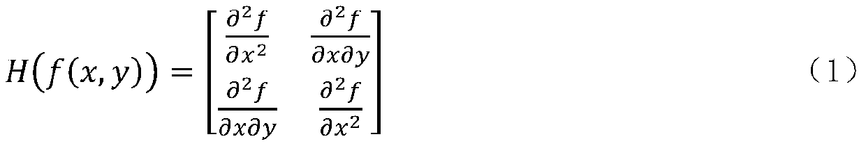
[0068] Step 1, image preprocessing, and use a suitable grid to divide the image, select a training set and a test set; calculate the proportion of the number of POI types falling into each grid, and obtain POI features; extract the local features, Spectral feat...


PUM


Abstract

The invention relates to a high-resolution remote sensing image city function partitioning method based on multi-feature fusion. The method comprises the steps of 1, image preprocessing; step 2, distributing the feature values in each image to the visual word most similar to the feature value, and counting the corresponding word frequency of each visual word to form a visual word feature; constructing a multi-feature BoW visual dictionary; 3, constructing an LDA probability topic model, and mining a high-dimensional semantic vector of the image by utilizing the LDA probability topic model; 4,training an SVM classifier according to the high-dimensional semantic vector obtained in the step 3; and step 5, carrying out urban function partitioning on the test set by using an SVM classifier. The method has the beneficial effects that the POI data is introduced, so that the wrong score of the remote sensing data caused by metamerism and foreign matters in the same spectrum is reduced; multiple features of the image, which comprises local features, spectral features, texture features, surface temperature features, spatial three-dimensional features and POI features, are comprehensively utilized, and higher classification precision can be obtained under the condition that the single feature of the image is not obvious.

Description

technical field [0001] The present invention relates to the field of remote sensing image classification, especially including a multi-feature fusion-based high-resolution remote sensing image city function partition method, which uses semantic models and probabilistic theme models in combination with POI data to bridge the gap between low-level visual features and high-level semantics of remote sensing images to improve the accuracy of urban functional zoning. Background technique [0002] With the development of remote sensing technology, the temporal and spatial resolution of remote sensing images has been continuously improved, and the data volume of remote sensing images has increased dramatically. In the face of massive remote sensing data, it takes a lot of time and manpower to interpret remote sensing images using manual visual interpretation. Therefore, how to use computers to automatically interpret remote sensing images has become a hot research issue in the fiel...

Claims


Application Information

Patent Timeline
IPC IPC(8): G06K9/00G06K9/32G06K9/34G06K9/46G06K9/62
CPCG06V20/13G06V10/267G06V10/25G06V10/462G06F18/28G06F18/24155G06F18/2411
Inventor 孙伟伟高子为杨刚
Owner NINGBO UNIV
Why Eureka
Try Eureka