Multi-rotor unmanned aerial vehicle route planning and aerial photography method suitable for strip-shaped measuring area

A multi-rotor UAV, UAV technology, applied in three-dimensional position/channel control, vehicle position/route/altitude control, instruments and other directions, can solve problems such as many flight sorties, UAV power consumption, etc. Economic benefits, increased airline efficiency, and reduced airline redundancy coverage

Active Publication Date: 2020-09-11
自然资源部第二地理信息制图院
View PDF19 Cites 6 Cited by
  • Summary
  • Abstract
  • Description
  • Claims
  • Application Information

AI Technical Summary

Problems solved by technology

[0009] The purpose of the present invention is to propose a multi-rotor suitable for strip-shaped areas in view of the problems of excessive flight sorties and serious power loss of drones when using drones for surveying and mapping in strip-shaped areas in the prior art. UAV route planning and aerial photography method

Method used


Image

  • Multi-rotor unmanned aerial vehicle route planning and aerial photography method suitable for strip-shaped measuring area
  • Multi-rotor unmanned aerial vehicle route planning and aerial photography method suitable for strip-shaped measuring area
  • Multi-rotor unmanned aerial vehicle route planning and aerial photography method suitable for strip-shaped measuring area

Examples


specific Embodiment approach 1

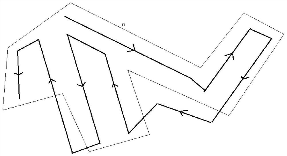
[0033] Specific implementation mode one: refer to Figure 7 and Figure 8 This embodiment is described in detail. A method for route planning and aerial photography of a multi-rotor UAV suitable for a belt-shaped survey area described in this embodiment includes the following steps:

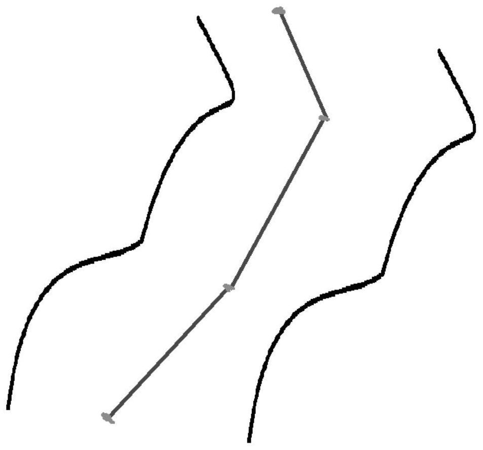
[0034] Step 1. Collect the centerline of the strip-shaped area: collect the centerline according to the direction of the area in the strip-shaped operation area, such as the centerline of the road, collect points according to the direction of the road, and generate a polyline segment, such as figure 2 shown;

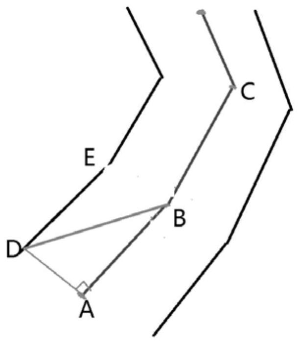
[0035] Step 2. Generate stitched rectangular area: set the route width d according to the width of the road, and translate the center line to both sides by a distance d to generate an aerial survey area. Knowing the coordinates of A, B, and C, you can calculate the upper edge of the survey area The coordinates of two points D and E.

[0036] First, the coordinates of A and B are known, ...


PUM


Abstract

The invention discloses a multi-rotor unmanned aerial vehicle route planning and aerial photography method suitable for a strip-shaped measuring area, and relates to the technical field of unmanned aerial vehicle autonomous control. In order to solve the problem that in the prior art, when an unmanned aerial vehicle is used for surveying and mapping a strip-shaped area, excessive flight sortie exists, the electric quantity loss of the unmanned aerial vehicle is serious, by adopting the method, the line segment route planning problem of the multi-rotor unmanned aerial vehicle in the irregular strip-shaped measuring area can be solved; the flight sortie can be reduced on the premise of ensuring the availability of flight results; take-off and landing time of an airplane is shortened, invalidloss of an airplane battery is reduced, the working efficiency of field flight personnel is improved, the redundancy coverage rate of the airline is reduced, the effective rate of the airline is increased, and the ortho-image mapping precision is improved in a parallel airline mode, so that the flight cost of a project is reduced, and the economic benefit of the project is improved.

Description

technical field [0001] The invention relates to the technical field of autonomous control of unmanned aerial vehicles, in particular to a multi-rotor unmanned aerial vehicle route planning and aerial photographing method suitable for strip survey areas. Background technique [0002] A multi-rotor UAV is an aircraft driven by aerodynamic or electric power. It has a simple structure, flexible handling, and low cost. People can control its flight on the ground through radio remote control or pre-programmed programs. The ground monitoring and control system of the UAV is the monitoring center and command control center of the UAV. flight data and control it. [0003] In the surveying and mapping industry, some surveying and mapping projects have small areas, large scales, and special surveying and mapping areas. For example, strip-shaped work areas in road surveys require fewer personnel. Using multi-rotor UAV operations can reduce economic costs and reduce personnel. Engage a...

Claims


Application Information

Patent Timeline
Patent Type & Authority Applications(China)
IPC IPC(8): G05D1/10
CPCG05D1/101
Inventor 王军武海英马旭林占云杨继文
Owner 自然资源部第二地理信息制图院
Why Eureka
Try Eureka