Vehicle integrated positioning method for advanced automatic driving V2X and laser point cloud registration

An autonomous driving, laser point cloud technology, applied in advanced technology, vehicle components, vehicle wireless communication services, etc., can solve problems such as poor GNSS signal, the impact of vehicle positioning in the road network, and reduce vehicle and pedestrian safety.

Active Publication Date: 2020-11-17
BEIHANG UNIV
View PDF10 Cites 22 Cited by
  • Summary
  • Abstract
  • Description
  • Claims
  • Application Information

AI Technical Summary

Problems solved by technology

[0006] Under normal circumstances, the intelligent vehicle networking system can determine the real position of vehicles in the road network through GNSS satellite signals, but in mountainous areas or high-rise buildings, the GNSS signals will be blocked, resulting in poor GNSS signals in this area, which is very important for the road network. The positioning of the vehicle

Method used


Image

  • Vehicle integrated positioning method for advanced automatic driving V2X and laser point cloud registration
  • Vehicle integrated positioning method for advanced automatic driving V2X and laser point cloud registration
  • Vehicle integrated positioning method for advanced automatic driving V2X and laser point cloud registration

Examples


Embodiment Construction

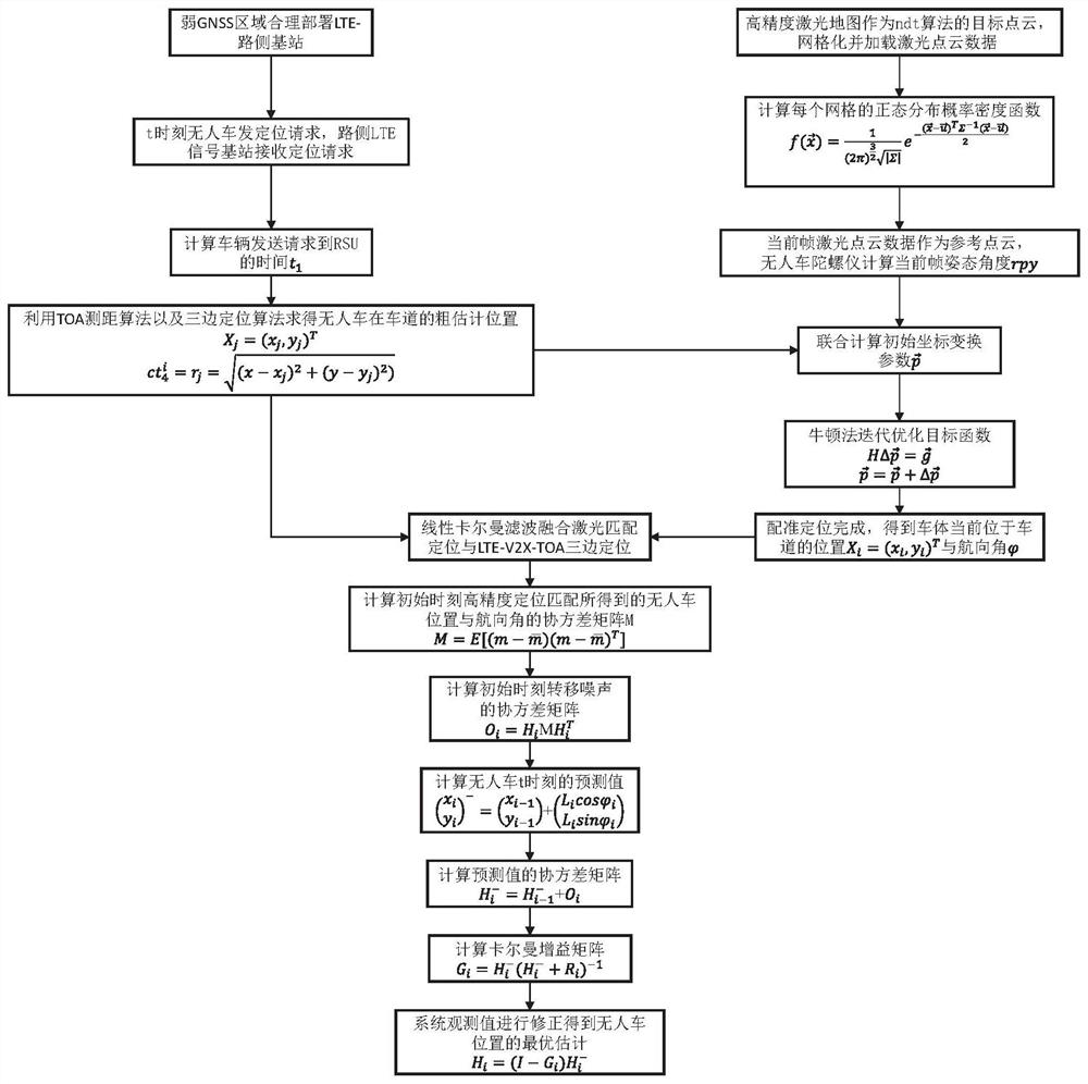
[0076] The present invention will be further described below in conjunction with the accompanying drawings.

[0077] Step 1. Use the vehicle-road coordination LTE-V2X positioning technology to realize the preliminary positioning of the unmanned vehicle;

[0078] E. First, reasonably deploy the number and location of roadside LTE signal base stations in weak GNSS signal areas, so that the vehicle is always within the good communication range of at least three roadside LTE signal base stations during operation. The unmanned vehicle drives on the road as a mobile node, and the roadside LTE signal base station serves as a fixed positioning base station.

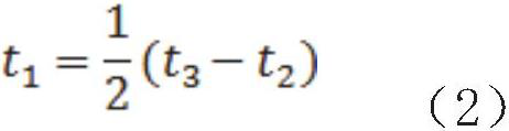
[0079] F. The unmanned vehicle sends a positioning request request and marks the sending time. Then, after receiving the positioning request from the unmanned vehicle, the roadside LTE signal base station marks the arrival time of the request. Then calculate the time difference t between sending and arriving 1 , and the reques...


PUM


Abstract

The invention discloses a vehicle integrated positioning method for advanced automatic driving V2X and single vehicle laser radar point cloud feature matching and integration. The method comprises thesteps: enabling an unmanned vehicle to obtain the surrounding environment information in real time through a laser radar, and carrying out feature matching with an existing high-precision map, thereby achieving the local positioning of the vehicle on a lane; positioning the vehicle between the vehicle and a roadside LTE signal base station through an LTEV2X vehicle networking technology and a wireless positioning technology; by fully fusing the two positioning modes, achieving more accurate vehicle-road cooperative positioning. The technical characteristics of laser radar high-precision map feature matching and positioning in single-vehicle intelligence and the advantages of vehicle-road wireless communication positioning are fully utilized, the positioning problem of the unmanned vehiclein a weak satellite signal coverage area can be effectively solved, and the purpose of advanced automatic driving is achieved.

Description

technical field [0001] The patent of the present invention relates to an unmanned vehicle positioning system and a fusion positioning method in the field of vehicle-road wireless communication technology, which is used to solve the problem of local relative positioning of vehicles in weak signal areas, and to promote the development of advanced automatic driving. Background technique [0002] Unmanned driving technology is an important frontier field in the development of intelligent transportation in recent years, which includes perception positioning, path planning, decision-making control and other components. Unmanned vehicles need to provide accurate positioning information to achieve safe and correct driving. The driverless positioning technology mainly obtains the centimeter-level position information of the vehicle by integrating GNSS, IMU, on-board camera, ultrasonic radar, laser radar and other sensors. The current mainstream unmanned driving positioning technolog...

Claims


Application Information

Patent Timeline
IPC IPC(8): G06F17/18G01C21/16H04W4/44H04W64/00
CPCG06F17/18G01C21/165H04W4/44H04W64/00Y02D30/70
Inventor 段续庭姜航田大新周建山赵元昊林椿眄郑坤贤
Owner BEIHANG UNIV
Why Eureka
Try Eureka