Method and system for converting large-range live-action three-dimensional projection coordinate into spherical coordinate system

A three-dimensional projection and coordinate system technology, applied in the field of measurement, can solve problems such as failure to meet accuracy requirements and errors, and achieve the effect of reducing accuracy errors

Active Publication Date: 2020-12-15
广西壮族自治区自然资源遥感院
View PDF2 Cites 3 Cited by
  • Summary
  • Abstract
  • Description
  • Claims
  • Application Information

AI Technical Summary

Problems solved by technology

[0004] The loading method of the traditional 3D spherical system platform to the real-scene 3D model data is only to perform coordinate conversion on the coordinate origin of the model (the rigidity change of the plane data is placed on the earth), because the edge of the model data has the influence of projection transformation error and curvature , the error is not large in a small range (usually a few kilometers), but there will be a large error in the large-scale or city-level real-scene 3D model data loaded on the ball (the plane error is usually in the meter level), which is far from the number Accuracy requirements for cities, 3D real estate, urban and rural planning and other industries

Method used


Image

  • Method and system for converting large-range live-action three-dimensional projection coordinate into spherical coordinate system
  • Method and system for converting large-range live-action three-dimensional projection coordinate into spherical coordinate system
  • Method and system for converting large-range live-action three-dimensional projection coordinate into spherical coordinate system

Examples


Embodiment 1

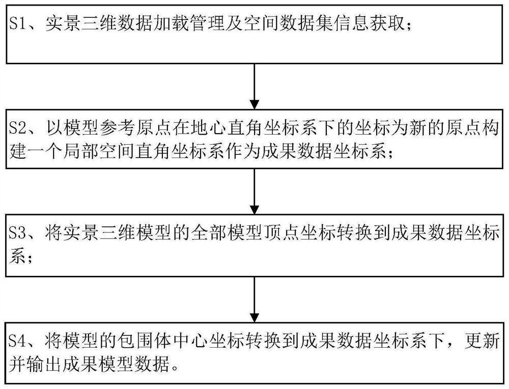
[0044] Such as figure 1 As shown, the large-scale real scene three-dimensional projected coordinates of the present embodiment converts the spherical coordinate system into a method, including the following:

[0045] Step S1, real-scene 3D data loading management and spatial dataset information acquisition. The specific content is as follows:

[0046] S11. Loading the 3D data adopts the BVH tree of the bounding volume level to realize the management of the scene graph;

[0047] S12. Acquiring model space dataset information.

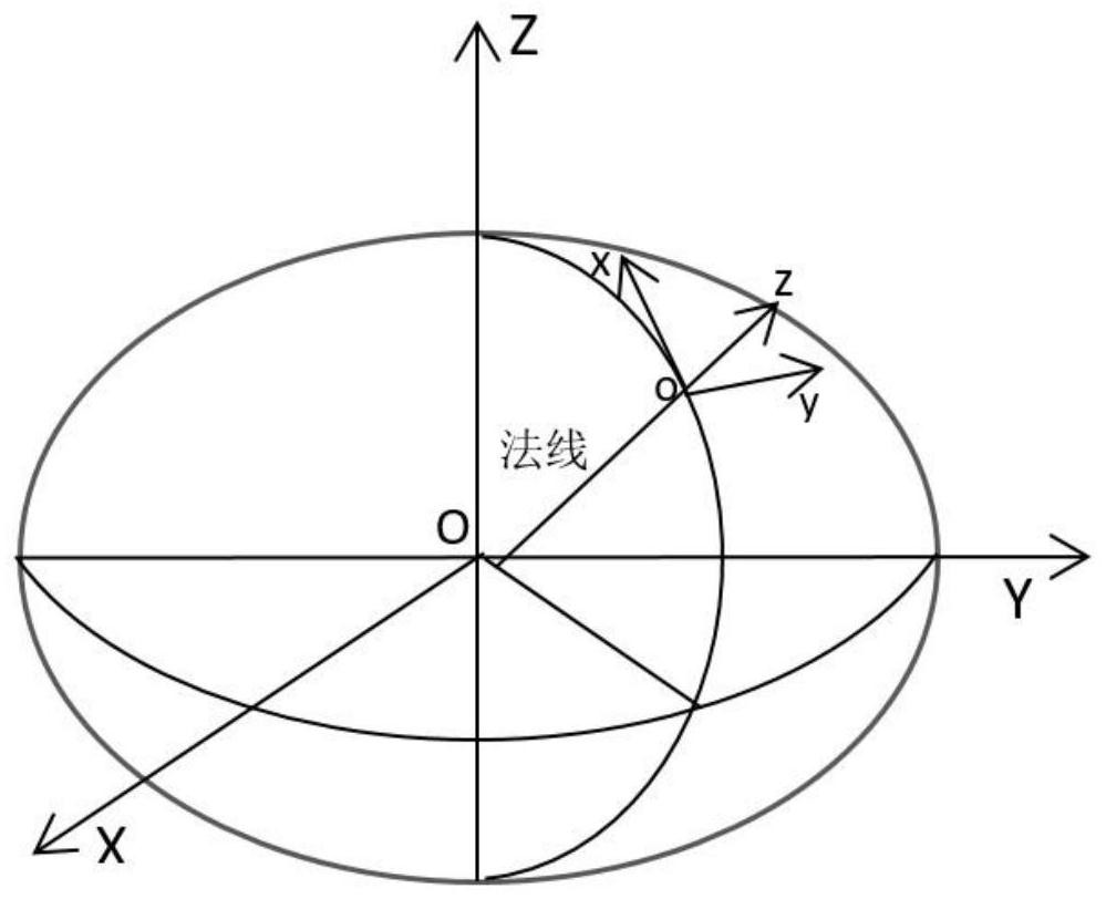
[0048] Use the BVH tree to organize and manage the data spatially, and obtain the model space data set information mainly including the model reference origin in the projected coordinate system, the model vertex coordinates, and the center point coordinates of the model enclosure in the BVH tree structure. Obtain the model space dataset information DataSet, mainly including the model reference origin O in the Gaussian projection coordinate system (xy...

Embodiment 2

[0072] On the basis of the aforementioned conversion method, the system based on the conversion method will be described below. For details, please refer to the aforementioned example of the scheduling method.

[0073] Such as Figure 6 As shown, the large-scale real-scene three-dimensional projected coordinates of the present embodiment to the spherical coordinate system transformation system includes the following contents:

[0074] Loading management module: used for real-scene 3D data loading management and spatial dataset information acquisition; wherein, the model spatial dataset information DataSet includes the model reference origin O under the Gaussian projection coordinate system (xyz) , model vertex coordinates Vertex (xyz) and the center point coordinate information of the model bounding volume in the BVH tree structure;

[0075] Build the coordinate system module: used to refer to the origin O with the model (xyz) The coordinates in the geocentric Cartesian coo...


PUM


Abstract

The invention discloses a method for converting a large-range live-action three-dimensional projection coordinate system into a spherical coordinate system, which particularly belongs to data processing of a geographic information system and comprises the following steps: S1, performing loading management of live-action three-dimensional data and acquiring spatial data set information; S2, constructing a local space rectangular coordinate system as a result data coordinate system by taking the coordinate of the model reference origin O (xyz) under the geocentric rectangular coordinate system as a new origin; S3, converting all model vertex coordinates Vertex (xyz) of the live-action three-dimensional model into a result data coordinate system; and S4, converting a bounding volume center coordinate of the model into an achievement data coordinate system, and updating and outputting achievement model data. According to the invention, the data coordinates of the live-action three-dimensional model are converted from a central zeroing local coordinate system under a projection coordinate system to a central zeroing local coordinate system under a geocentric coordinate system, so that large-range live-action three-dimensional model data can be accurately loaded to a spherical coordinate system platform.

Description

technical field [0001] The invention relates to the field of surveying technology, in particular to geographic information system data processing, in particular to a conversion method from large-scale real-scene three-dimensional projection coordinates to a spherical coordinate system. Background technique [0002] Oblique photogrammetry technology is a high-tech developed in recent years. It overturns the limitation that the previous orthophoto can only be taken from a vertical angle. One vertical and four oblique) to conduct aerial photogrammetry on the ground at the same time, and obtain higher-resolution multi-angle image data, and automatically generate a real 3D model (that is, a real 3D model). [0003] Oblique photogrammetry technology plays a key role in the construction of digital China and digital cities. The real-scene 3D model data produced by oblique photogrammetry technology has reached the city level and is a projected coordinate system. Therefore, the real-s...

Claims


Application Information

Patent Timeline
Patent Type & Authority Applications(China)
IPC IPC(8): G06T3/60G06T3/00
CPCG06T3/606G06T3/005
Inventor 刘润东陈瑞波陈家兴罗义谈曲瑞超陶衡王国忠李伟鹏
Owner 广西壮族自治区自然资源遥感院
Why Eureka
Try Eureka