
Illegal construction land development automatic detection method based on multi-source optical remote sensing image

An optical remote sensing image and construction land technology, applied in the field of remote sensing image processing, can solve the problems of low efficiency and high cost, achieve the effects of high execution efficiency, reduce monitoring cost, and improve monitoring efficiency and timeliness

Active Publication Date: 2021-01-26
SUN YAT SEN UNIV
View PDF7 Cites 5 Cited by
  • Summary
  • Abstract
  • Description
  • Claims
  • Application Information

AI Technical Summary

Problems solved by technology

[0005] In order to overcome the defects of high cost and low efficiency of the land cover change detection method based on optical remote sensing images described in the above prior art, the present invention provides an automatic detection method for illegal construction land development based on multi-source optical remote sensing images

Method used


Image

  • Illegal construction land development automatic detection method based on multi-source optical remote sensing image
  • Illegal construction land development automatic detection method based on multi-source optical remote sensing image
  • Illegal construction land development automatic detection method based on multi-source optical remote sensing image

Examples


Embodiment 1

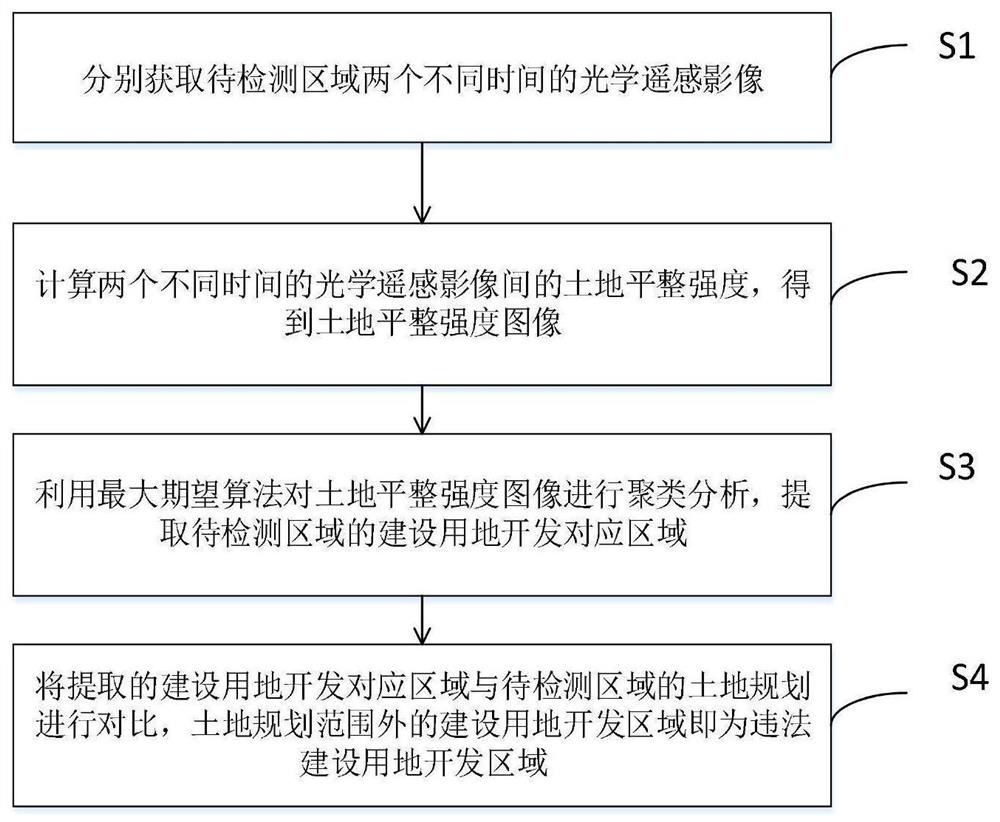
[0032] Such as figure 2 As shown, in order to realize timely and automatic monitoring of illegal construction development, the present invention proposes an automatic detection method for illegal construction land development based on multi-source optical remote sensing images, including the following steps:

[0033] S1: Obtain optical remote sensing images of the area to be detected at two different times;

[0034] It should be noted that two optical remote sensing images corresponding to different times can be acquired by the same satellite or by different satellites.

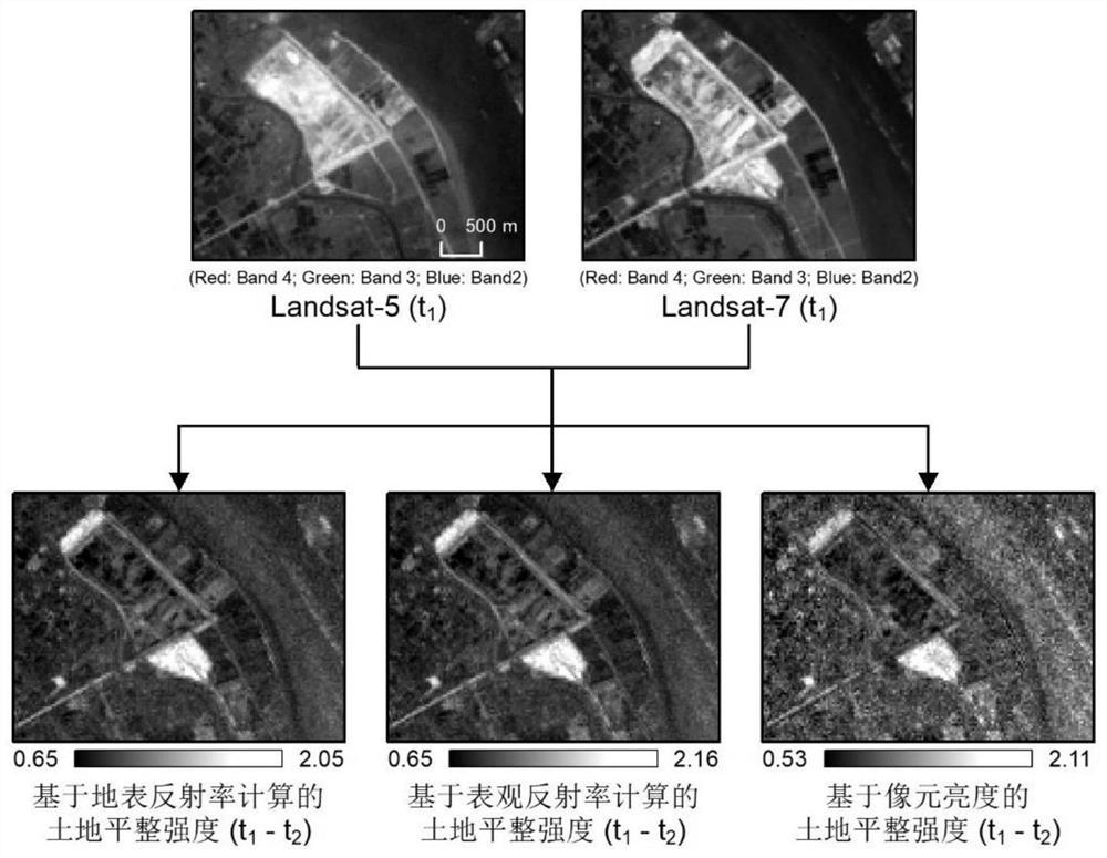
[0035] S2: Calculate the land leveling intensity between two optical remote sensing images at different times to obtain a land leveling intensity image;

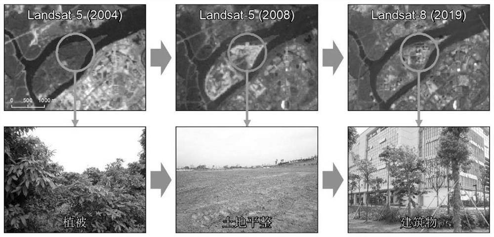
[0036]It should be noted that the development of construction land generally begins with the leveling of the land. The main purpose of leveling is to remove existing vegetation, buildings and other obstacles on the land to be developed, so as to facilitat...


PUM


Abstract

The invention discloses an illegal construction land development automatic detection method based on multi-source optical remote sensing images. The method comprises the steps of acquiring optical remote sensing images of a to-be-detected area at two different times; calculating the land leveling intensity between the two optical remote sensing images at different time to obtain a land leveling intensity image; performing clustering analysis on the land leveling intensity image by using a maximum expectation algorithm, and extracting a construction land development corresponding region of theto-be-detected area; and comparing the extracted construction land development corresponding area with the land planning of the to-be-detected area, wherein the construction land development in the land planning strict development area is illegal construction land development. According to the invention, short-period and full-automatic monitoring can be carried out on illegal construction land development, the calculation is simple, the understanding is easy, the execution efficiency is high, no training sample is needed, various social and environmental problems caused by illegal constructionland can be discovered and prevented in time, the monitoring cost is significantly reduced, and the monitoring efficiency is improved.

Description

technical field [0001] The invention relates to the technical field of remote sensing image processing, and more specifically, to an automatic detection method for illegal construction land development based on multi-source optical remote sensing images. Background technique [0002] Illegal construction land has become one of the main problems faced by land use in my country's social and economic transition period, and poses a severe challenge to new urbanization and ecological civilization construction. According to the China Land and Resources Bulletin, from 2012 to 2016, a total of 390,000 illegal land use activities were discovered across the country, involving a land area of ​​175,500 hectares. Illegal land use for construction has exacerbated the disorderly expansion of the city, not only undermining the overall coordination and comprehensive development of the city, but also encroaching on a large amount of high-quality farmland, resulting in the continuous shrinking...

Claims


Application Information

Patent Timeline
IPC IPC(8): G06K9/00G06K9/32G06K9/62
CPCG06V20/188G06V20/13G06V10/25G06V2201/07G06F18/23
Inventor 齐志新
Owner SUN YAT SEN UNIV
Learn More