A remote sensing image adaptive feature selection segmentation method and system
A feature selection and remote sensing image technology, applied in the field of satellite remote sensing image processing, to achieve the effects of high precision, reduced computational complexity, and easy implementation
- Summary
- Abstract
- Description
- Claims
- Application Information
AI Technical Summary
Problems solved by technology
Method used
Image
Examples
Embodiment Construction
[0041] The technical solutions of the present invention will be described in detail below with reference to the accompanying drawings and embodiments.
[0042] The technical solution of the present invention can be applied to a plurality of traditional models, and the current popular deep learning frameworks can be used to train the models, including Pytorch, TensorFlow, and the like.
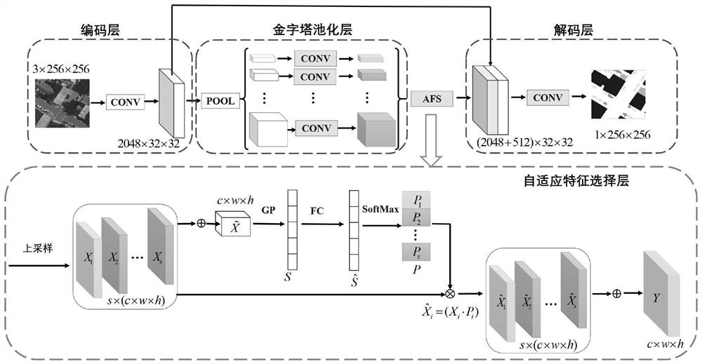
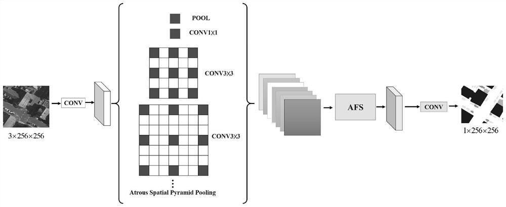
[0043] The embodiment of the present invention provides a remote sensing image adaptive feature selection and segmentation method, and takes the application of an adaptive feature selection module (which may be called an AFS module) in U-Net, PSPNet and DeepLabV3 as an example to illustrate the technical solution of the present invention .
[0044] A remote sensing image adaptive feature selection and segmentation method provided by an embodiment of the present invention includes the following steps:
[0045]Step 1, data preparation, including cropping and data preprocessing of high-resolution...
PUM
 Abstract
Description
Claims
Application Information
 - R&D
- Intellectual Property
- Life Sciences
- Materials
- Tech Scout
- Unparalleled Data Quality
- Higher Quality Content
- 60% Fewer Hallucinations
Browse by: Latest US Patents, China's latest patents, Technical Efficacy Thesaurus, Application Domain, Technology Topic, Popular Technical Reports.
© 2025 PatSnap. All rights reserved.Legal|Privacy policy|Modern Slavery Act Transparency Statement|Sitemap|About US| Contact US: help@patsnap.com


