

Method and device for quickly modeling mesh road by utilizing height control construction curved surface in Civil3D
A road and mesh technology, applied in the field of rapid modeling of mesh roads, can solve the problem of forgetting to adjust the height, and achieve the effect of improving work efficiency, solving the uniformity of the elevation of the intersection, and realizing the program control.
- Summary
- Abstract
- Description
- Claims
- Application Information
AI Technical Summary
Problems solved by technology
Method used
Image

Examples
Embodiment 1
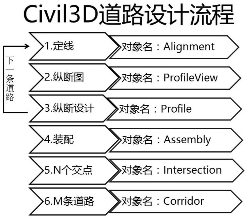
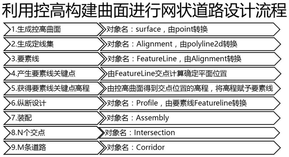
[0037] Provides a method for rapid modeling of network roads in Civil3D by using height-controlled surface construction, as shown in the attached figure 2 As shown, the steps are as follows:
[0038] Step 1. Generate a height-controlling surface, specifically: build a height-controlling surface (surface) in Civil3D by controlling height (expressed by the object of aeccpoint), and place it in an empty site.
[0039] Step 2. Generate the alignment set of networked roads, specifically: convert the alignments expressed using polyline2d into uniformly named Civil3D alignment objects (alignment), and obtain the alignment set of networked roads . In this step, the method described in 201810882559.X to automatically name networked roads according to sorting rules in civil3d can be used to generate a set of alignments, or the polylines can be individually aligned for each road.
[0040] Step 3. Generating feature lines, specifically: converting the alignment set of networked roads i...
Embodiment 2
[0052] The present invention also provides a device for quickly modeling networked roads in Civil3D using height-controlled construction surfaces, including:
[0053] The height-controlling surface generation module is used to construct a height-controlling surface (surface) in Civil3D by controlling height (expressed by the object of aeccpoint), and place it in an empty site (site).
[0054] The alignment set generation module of the networked road is used to batch convert the alignment expressed by polyline2d into a uniformly named Civil3D alignment object (alignment), and obtain the alignment set of the networked road. Among them, the method described in 201810882559.X to automatically name the meshed roads according to the sorting rules in civil3d can be used to generate the alignment set, or the polylines can be individually aligned for each road.
[0055] The feature line generation module is used to convert the alignment set of networked roads into a feature line (featu...
PUM
 Abstract
Description
Claims
Application Information