Regional rubber forest remote sensing identification method
A remote sensing recognition and rubber technology, which is applied in character and pattern recognition, instruments, calculations, etc., can solve the problems of insufficient consideration of regional differences in the physiological and phenological characteristics of rubber forests, heavy workload, large errors, mixed pixels, etc.
- Summary
- Abstract
- Description
- Claims
- Application Information
AI Technical Summary
Problems solved by technology
Method used
Image
Examples
Embodiment Construction
[0024] In order to make the object, technical solution and advantages of the present invention clearer, the present invention will be further described in detail below with reference to the accompanying drawings and examples.
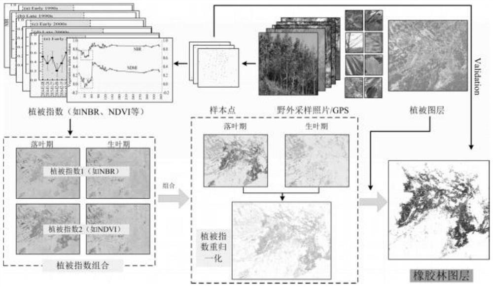
[0025] like figure 1 As shown, a remote sensing identification method for regional rubber forests, including:
[0026] 1. Based on the field landscape positioning photos and GE high-definition images, roughly determine the densely planted rubber forest areas, and then screen the points of interest / sample points (POIs) and interest areas / Sample areas (ROIs), using MODIS-NDVI vegetation index product data, reveal the inter-annual / intra-annual dynamic changes of rubber forests and other land types (natural forests), and thus determine the differences between rubber forests and other land types.
[0027] 2. According to the NDVI time-series dynamic curve of the rubber forest, use wavelet analysis and other methods to automatically detect the mutation thre...
PUM
 Abstract
Description
Claims
Application Information
 - R&D
- Intellectual Property
- Life Sciences
- Materials
- Tech Scout
- Unparalleled Data Quality
- Higher Quality Content
- 60% Fewer Hallucinations
Browse by: Latest US Patents, China's latest patents, Technical Efficacy Thesaurus, Application Domain, Technology Topic, Popular Technical Reports.
© 2025 PatSnap. All rights reserved.Legal|Privacy policy|Modern Slavery Act Transparency Statement|Sitemap|About US| Contact US: help@patsnap.com

