A method for fully automatic extreme point depth estimation of potential field in undulating terrain
An extreme point, fully automatic technology, applied in the field of geophysical exploration, to achieve the effect of improving efficiency and accuracy, wide application prospects, and stable and reliable calculation results
- Summary
- Abstract
- Description
- Claims
- Application Information
AI Technical Summary
Problems solved by technology
Method used
Image
Examples
Embodiment Construction
[0061] The present invention is described in further detail below in conjunction with the accompanying drawings and specific embodiments:
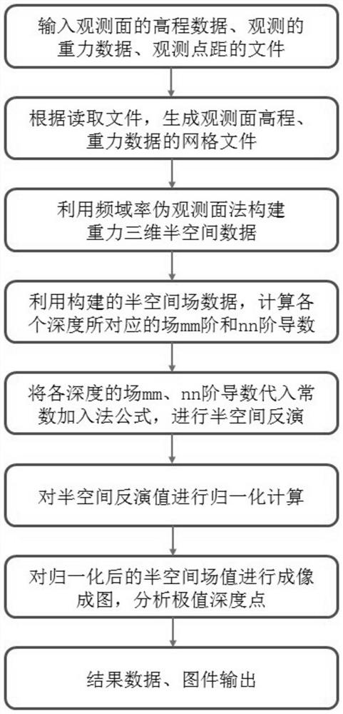
[0062] The invention proposes a fully automatic extreme point depth estimation method of potential field under undulating terrain. figure 1 It is a flow chart of a fully automatic extreme point depth estimation method of potential field under undulating terrain of the present invention, which specifically includes the following steps:
[0063] Step 1: Input the elevation data, gravity observation value and observation point distance of the observation surface to generate the elevation grid file and gravity grid file of the observation surface.
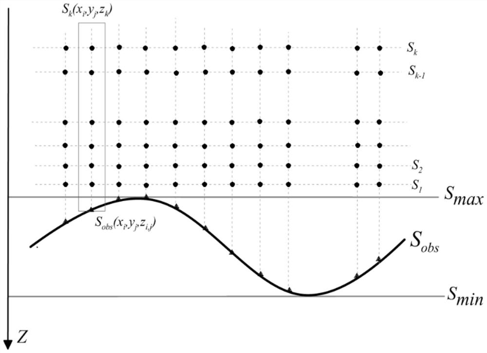
[0064] Step 2, using the frequency domain rate pseudo-observation surface method to construct a three-dimensional half-space field of gravity, which specifically includes the following steps:
[0065] Step 2.1, according to the elevation grid file and gravity grid file of the observation surface, ...
PUM
 Abstract
Description
Claims
Application Information
 - R&D
- Intellectual Property
- Life Sciences
- Materials
- Tech Scout
- Unparalleled Data Quality
- Higher Quality Content
- 60% Fewer Hallucinations
Browse by: Latest US Patents, China's latest patents, Technical Efficacy Thesaurus, Application Domain, Technology Topic, Popular Technical Reports.
© 2025 PatSnap. All rights reserved.Legal|Privacy policy|Modern Slavery Act Transparency Statement|Sitemap|About US| Contact US: help@patsnap.com


