Potential field full-automatic extreme point depth estimation method under rugged topography

An extreme point, fully automatic technique for geophysical exploration

Active Publication Date: 2021-04-13
中国地质科学院地球物理地球化学勘查研究所
View PDF4 Cites 1 Cited by
  • Summary
  • Abstract
  • Description
  • Claims
  • Application Information

AI Technical Summary

Problems solved by technology

[0006] Aiming at the above-mentioned technical problems in the prior art, the present invention proposes a fully automatic extreme point depth estimation method for potential field under undulating terrain, which solves the problems of singular points and trapezoidal lines in the solution process of conventional extreme point depth estimation methods. problem, improving the accuracy of extreme point depth estimation under undulating terrain conditions

Method used


Image

  • Potential field full-automatic extreme point depth estimation method under rugged topography
  • Potential field full-automatic extreme point depth estimation method under rugged topography
  • Potential field full-automatic extreme point depth estimation method under rugged topography

Examples


Embodiment Construction

[0061] Below in conjunction with accompanying drawing and specific embodiment the present invention is described in further detail:

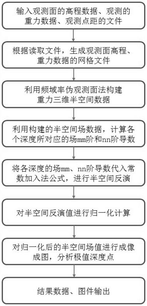
[0062] The present invention proposes a method for fully automatic extreme point depth estimation of potential field under undulating terrain. figure 1 It is a flow chart of the method for fully automatic extreme point depth estimation of the potential field under undulating terrain of the present invention, which specifically includes the following steps:

[0063] Step 1. Input the elevation data, gravity observation value and observation point distance of the observation surface, and generate the elevation grid file and gravity grid file of the observation surface.

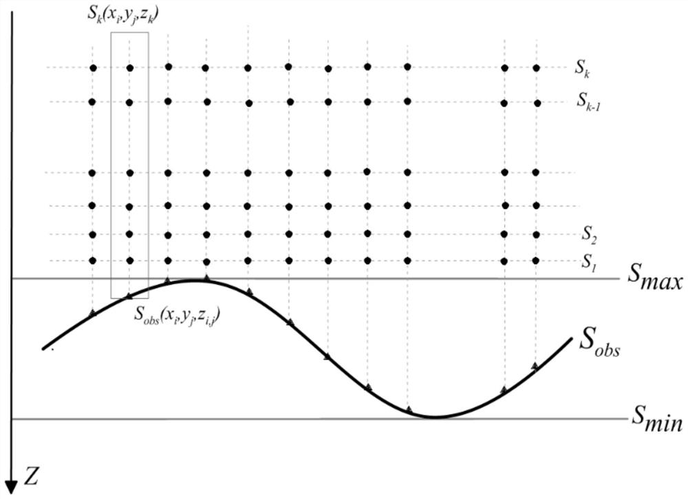
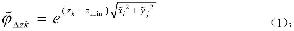
[0064] Step 2, using the frequency-domain rate pseudo-observation surface method to construct the gravity three-dimensional half-space field, specifically includes the following steps:

[0065] Step 2.1, according to the elevation grid file and gravity grid file of the observatio...


PUM


Abstract

The invention discloses a potential field full-automatic extreme point depth estimation method under rugged topography. According to the method, elevation data, gravity observation values and observation point distances of an observation surface are input to generate elevation and gravity grid files, a frequency domain rate pseudo observation surface method is utilized to construct a gravity three-dimensional semi-space field, different order derivative ratios of depth points are calculated according to vertical guide numbers of gravity values of the depth points in the semi-space field, and a constant addition method is combined to invert the gravity three-dimensional semi-space field to obtain an extreme value calculation value of each point in the semi-space field, an extreme value point set of the semi-space field is determined, extreme value points in the extreme value point set is normalized, the normalized extreme value points are utilized to form an image, and extreme value depth points of the gravity three-dimensional semi-space field are analyzed, and the normalized extreme values of the map and each point in the semi-space field are output. According to the method, priori information is not needed, automatic inversion is achieved, gravity data under rugged topography observation can be directly calculated, inversion efficiency and precision are improved, and the method has a wide application prospect.

Description

technical field [0001] The invention belongs to the field of geophysical exploration, and in particular relates to a fully automatic method for estimating the depth of an extreme point of a potential field under undulating terrain. Background technique [0002] As a method that can effectively invert field source parameters, the field source fast imaging method has the advantages of simple algorithm and stable calculation, and does not require too much prior information and iterative calculation in the inversion process, which can provide a basis for establishing prior models. Effective information, field source express imaging methods include correlation imaging method (summarized imaging method), migration imaging method, extreme point depth estimation method (DEXP method) and wavelet continuous transform method, etc. [0003] The extreme point depth estimation method (DEXP method) is a three-dimensional potential field rapid inversion method proposed by Fedi et al., which...

Claims


Application Information

Patent Timeline
Patent Type & Authority Applications(China)
IPC IPC(8): G06F30/20G01V9/00
CPCG06F30/20G01V9/00
Inventor 徐梦龙孙诚业杨亚斌陈亮荆磊
Owner 中国地质科学院地球物理地球化学勘查研究所
Why Eureka
Try Eureka