Building inclination model layered household display method fusing vector house type graph
A display method and a technology of floor plan, applied in the field of urban three-dimensional scene construction, can solve problems such as low efficiency and large labor load, and achieve the effects of simplifying cumbersome operations, improving utilization rate, and improving user interaction
- Summary
- Abstract
- Description
- Claims
- Application Information
AI Technical Summary
Problems solved by technology
Method used
Image
Examples
Embodiment Construction
[0026] The technical solution of the present invention will be described in detail below in conjunction with the accompanying drawings and embodiments.
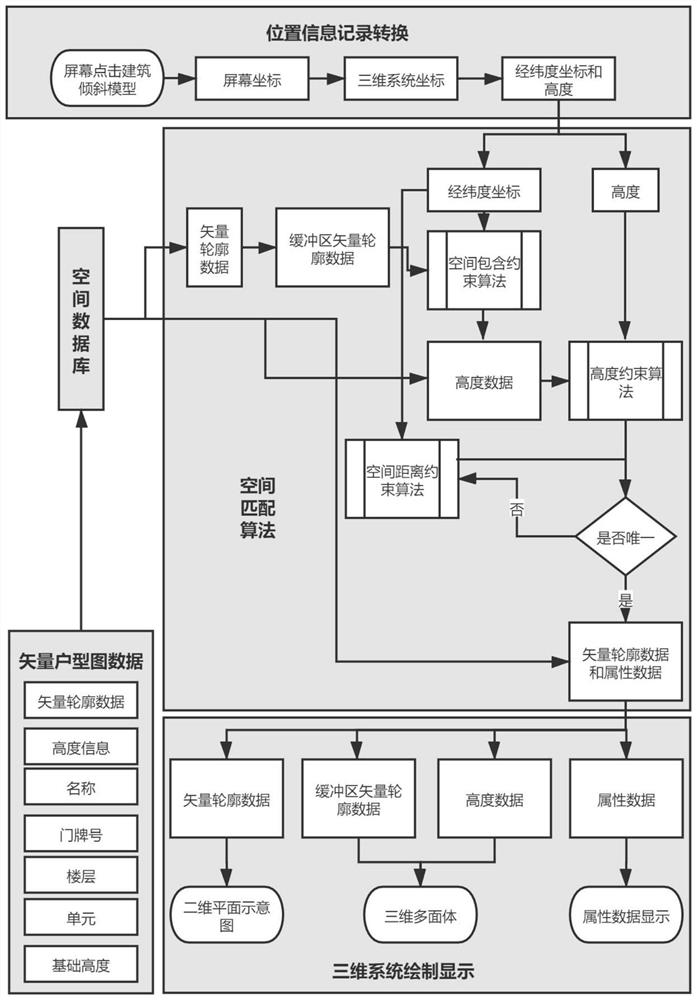
[0027] refer to figure 1 , a kind of method of layered household display of a building tilt model fused with a vector floor plan provided by the embodiment, the steps are as follows:
[0028] first step, such as figure 1 In the vector floor plan data part, collect the building room vector data corresponding to the building tilt model, which is usually vector floor plan data, at least including the vector outline data of the building room and its key attribute information-height information. The vector contour data is in Shapefile format (shp for short, which is an open spatial data format developed by ESRI, an American Environmental Systems Research Institute company), and the coordinate system adopts the WGS84 coordinate system (World Geodetic System1984, which is a coordinate established for the use of GPS global positioni...
PUM
 Abstract
Description
Claims
Application Information
 - R&D
- Intellectual Property
- Life Sciences
- Materials
- Tech Scout
- Unparalleled Data Quality
- Higher Quality Content
- 60% Fewer Hallucinations
Browse by: Latest US Patents, China's latest patents, Technical Efficacy Thesaurus, Application Domain, Technology Topic, Popular Technical Reports.
© 2025 PatSnap. All rights reserved.Legal|Privacy policy|Modern Slavery Act Transparency Statement|Sitemap|About US| Contact US: help@patsnap.com


