Supercharge Your Innovation With Domain-Expert AI Agents!

Method and system for correcting map by using charging pile

A technology of map correction and charging piles, applied in the field of robotics, can solve problems such as the orientation estimated by the robot and the error of the map.

Pending Publication Date: 2021-05-28
AMICRO SEMICON CORP
View PDF8 Cites 0 Cited by
  • Summary
  • Abstract
  • Description
  • Claims
  • Application Information

AI Technical Summary

Problems solved by technology

[0002] Pure inertial navigation robot is a low-cost solution. Generally, this kind of robot only has odometer, gyroscope and infrared sensor. There is a big error between the estimated position and the actual situation

Method used


Image

  • Method and system for correcting map by using charging pile
  • Method and system for correcting map by using charging pile
  • Method and system for correcting map by using charging pile

Examples


Embodiment Construction

[0016] The technical solutions in the embodiments of the present invention will be described in detail below with reference to the drawings in the embodiments of the present invention. It should be understood that the specific embodiments described below are only used to explain the present invention, not to limit the present invention.

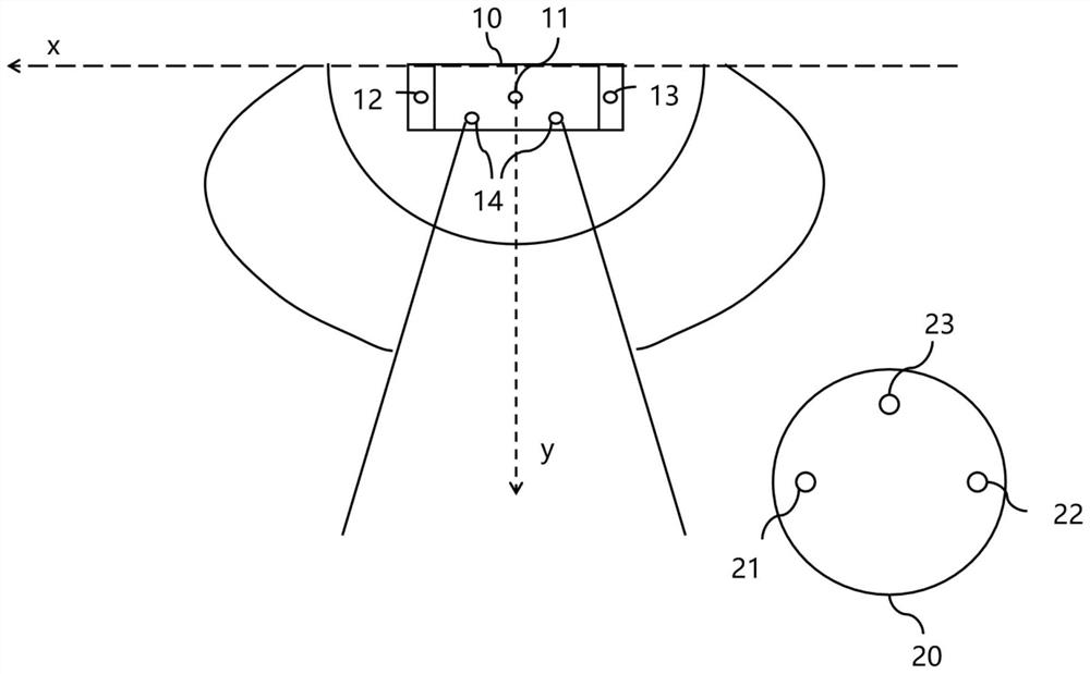
[0017] The robot carrier of the present invention is equipped with a gyroscope for rotation angle angle detection, an odometer for stroke distance detection, and a sensor capable of detecting wall distance is housed, and the sensor for detecting wall distance can be an ultrasonic distance sensor, an infrared intensity detection Sensors, infrared distance sensors, physical switch detection collision sensors, capacitance or resistance change detection sensors, etc.

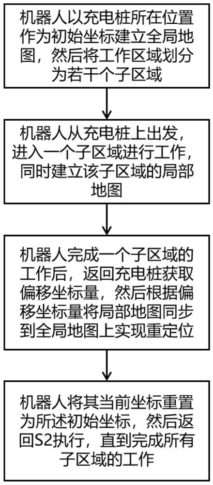
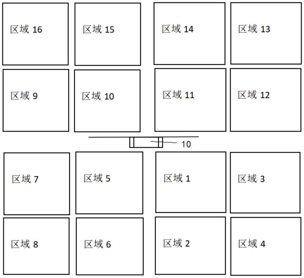
[0018] Such as figure 1 As shown, a method for map correction using charging piles, the method includes the following steps: S1, the robot uses the location of the charging piles ...


PUM


Abstract

The invention discloses a method and system for correcting a map by using a charging pile. The method comprises the steps that S1 a robot builds a global map by using the position of the charging pile as an initial coordinate, and then divides a working region into a plurality of sub-regions; S2 the robot starts from the charging pile and enters a sub-region to work, and a local map of the sub-region is established at the same time; S3 after the robot completes work of one sub-region, the robot returns to the charging pile to obtain offset coordinate quantity, and then synchronizes the local map to the global map according to the offset coordinate quantity; and S4 the robot resets the current coordinates of the robot as the initial coordinates, and then the step S2 is executed until the local maps of all the sub-regions are synchronized to the global map to complete map correction. According to the method and the system, the position of the charging pile is taken as a reference, and the coordinates of the grids on the local maps are adjusted, so that map correction is realized, and positioning and mapping of the robot are more accurate.

Description

technical field [0001] The invention relates to the field of robots, in particular to a method and system for map correction by using charging piles. Background technique [0002] Pure inertial navigation robot is a low-cost solution. Generally, this kind of robot only has odometer, gyroscope and infrared sensor. There is a large error between the estimated position and the actual situation. Contents of the invention [0003] In order to solve the above problems, the present invention provides a method and system for map correction using charging piles, which can realize error correction of maps built by pure inertial navigation robots by using only one charging pile, making the robot's positioning and map building more accurate. Concrete technical scheme of the present invention is as follows: [0004] A method for map correction using a charging pile, the method comprising the following steps: S1, the robot establishes a global map using the location of the charging pi...

Claims


Application Information

Patent Timeline
Patent Type & Authority Applications(China)
IPC IPC(8): G05D1/02
CPCG05D1/0242G05D1/0255G05D1/0225
Inventor 李永勇杨武
Owner AMICRO SEMICON CORP
Features
  • R&D
  • Intellectual Property
  • Life Sciences
  • Materials
  • Tech Scout
  • Unparalleled Data Quality
  • Higher Quality Content
  • 60% Fewer Hallucinations
Learn More