
Multi-machine collaborative target high-precision positioning system and method based on visual navigation

A positioning system and visual navigation technology, applied in the field of image processing, can solve the problems of difficult image retrieval and reference map management, and achieve the effects of improving matching accuracy, reducing complexity, and reducing drift errors

Pending Publication Date: 2021-07-23
AEROSPACE TIMES FEIHONG TECH CO LTD +1
View PDF14 Cites 1 Cited by
  • Summary
  • Abstract
  • Description
  • Claims
  • Application Information

AI Technical Summary

Problems solved by technology

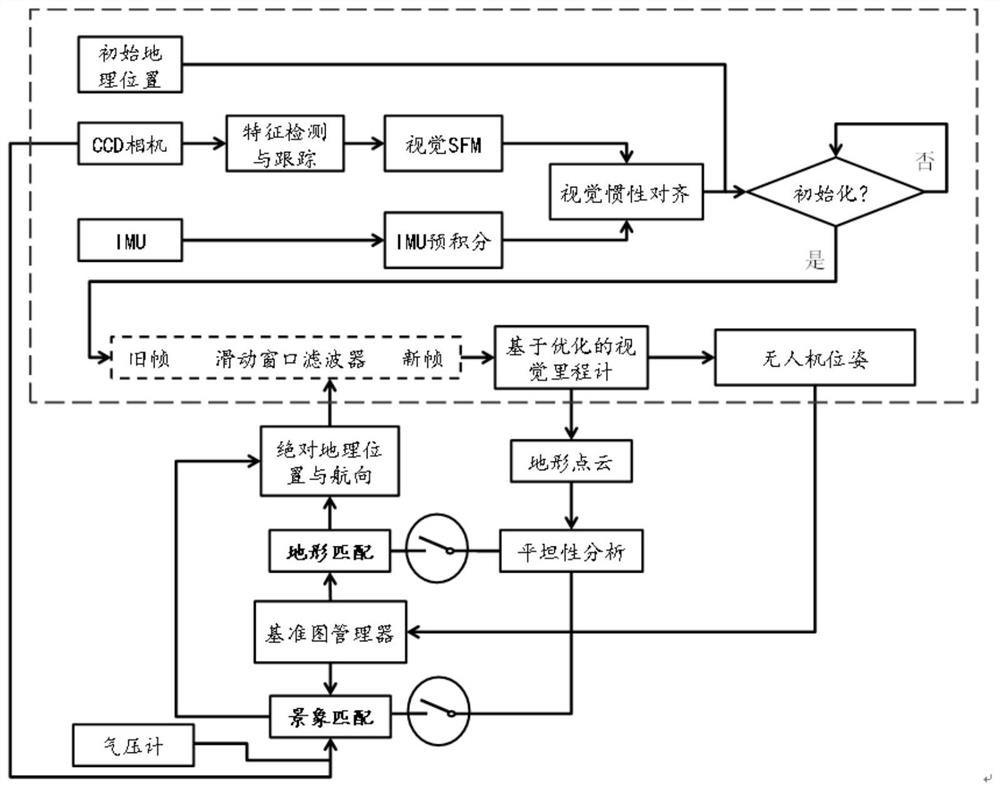
[0004] In view of this, the present invention provides a multi-machine cooperative target high-precision positioning system and method based on visual navigation, which solves many problems of high-precision positioning of battlefield targets in the UAV cluster reconnaissance system, including:
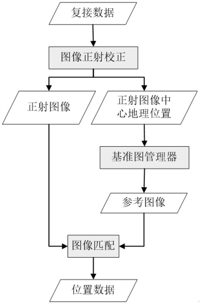
[0008] 4) The difficulty of image retrieval and reference map management brought about by multi-view image scene matching;

Method used


Image

  • Multi-machine collaborative target high-precision positioning system and method based on visual navigation
  • Multi-machine collaborative target high-precision positioning system and method based on visual navigation
  • Multi-machine collaborative target high-precision positioning system and method based on visual navigation

Examples


Embodiment Construction

[0045] In order to better understand the technical solutions of the present invention, the embodiments of the present invention will be described in detail below in conjunction with the accompanying drawings.

[0046] It should be clear that the described embodiments are only some of the embodiments of the present invention, not all of them. Based on the embodiments of the present invention, all other embodiments obtained by persons of ordinary skill in the art without creative efforts all belong to the protection scope of the present invention.

[0047] The terms used in the embodiments of the present invention are only for the purpose of describing specific embodiments, and are not intended to limit the present invention. As used in the embodiments of the present invention and the appended claims, the singular forms "a", "said" and "the" are also intended to include the plural forms unless the context clearly indicates otherwise.

[0048] The present invention provides a mu...


PUM


Abstract

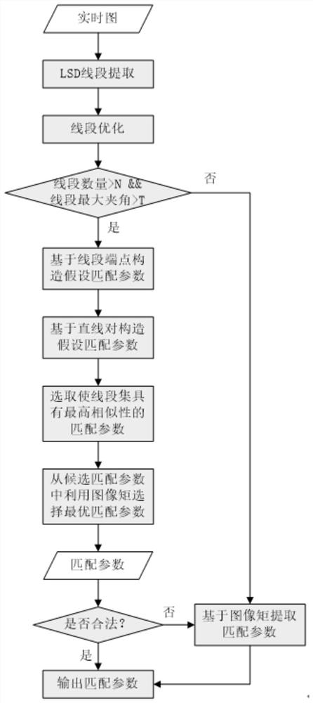
The invention provides a multi-machine cooperative target high-precision positioning system and method based on visual navigation. The system comprises a visual inertial odometer module which is used for fusing the results of visual measurement and inertial measurement through a sliding window filter, stably tracking the pose of an unmanned plane, and obtaining a ground surface point cloud at the same time; a scene matching module which is used for analyzing the surface flatness by analyzing the elevation distribution of the point cloud, and observing the pose of the unmanned aerial vehicle in a geographical environment by adopting scene matching for a flat point cloud; a terrain matching module which is used for analyzing the surface flatness by analyzing the elevation distribution of the point cloud, and observing the pose of the unmanned aerial vehicle in a geographical environment by adopting terrain matching for a fluctuating point cloud; and a reference map management module which is used for realizing storage and effective retrieval of geographic information by utilizing a grid and quadtree mixed index structure, providing map data for scene matching and terrain matching, and extracting stable structures in a real-time map and a reference map through optimized line segments.

Description

【Technical field】 [0001] The present invention relates to the technical field of image processing, in particular to a multi-machine cooperative target high-precision positioning system and method based on visual navigation. 【Background technique】 [0002] At present, the research on UAV multi-machine cooperation mainly focuses on the research on UAV flight control and multi-machine formation decision-making control, and there are few researches on the high-precision positioning of UAV multi-machine cooperation intelligent targets. [0003] Therefore, it is necessary to study a multi-machine cooperative target high-precision positioning system and method based on visual navigation to deal with the deficiencies of the existing technology, so as to solve or alleviate one or more of the above-mentioned problems. 【Content of invention】 [0004] In view of this, the present invention provides a multi-machine cooperative target high-precision positioning system and method based...

Claims


Application Information

Patent Timeline
Patent Type & Authority Applications(China)
IPC IPC(8): G01C21/20
CPCG01C21/20
Inventor 姜梁吴国强马晓军黄坤包文龙
Owner AEROSPACE TIMES FEIHONG TECH CO LTD
Learn More