Three-dimensional reconstruction method for building in single inclined remote sensing image

A remote sensing image and 3D reconstruction technology, applied in the field of 3D modeling of remote sensing images, can solve the problems of not meeting the reconstruction scale accuracy requirements, complex input conditions, etc., achieve good robustness, and reduce the waste of manpower and time

Active Publication Date: 2021-07-30
HARBIN ENG UNIV
View PDF11 Cites 0 Cited by
  • Summary
  • Abstract
  • Description
  • Claims
  • Application Information

AI Technical Summary

Problems solved by technology

[0010] The purpose of the present invention is to provide a method for three-dimensional reconstruction of buildings in a single oblique remote sensing image in order to overcome the problems of complex input conditions and unsatisfactory reconstruction scale accuracy in existing three-dimensional reconstruction methods

Method used


Image

  • Three-dimensional reconstruction method for building in single inclined remote sensing image
  • Three-dimensional reconstruction method for building in single inclined remote sensing image
  • Three-dimensional reconstruction method for building in single inclined remote sensing image

Examples


Embodiment Construction

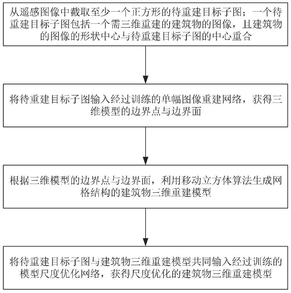
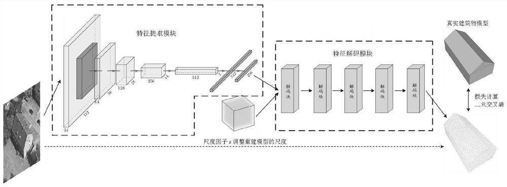
[0050] Step 1: In the whole remote sensing image, select the building target that needs to be reconstructed, and use each building as a separate target, and cut it from the whole image to obtain the sub-image of the target to be reconstructed. Wherein, the shape center of the building should be the image center of the clipped image (target subimage to be reconstructed), and the clipped image should be a square. Then remove the background information from the cropped small image, that is, only keep part of the image of the building, and set the other part to white.

[0051] Step 2: Train a single image reconstruction network (you can use the space occupancy probability reconstruction network Scale-ONet that takes into account the scale, or other network models that can obtain the same results), obtain the optimized network parameter model, use 105 sets of training images and corresponding The real building model is used as the training set to obtain the optimized network parame...


PUM


Abstract

The invention discloses a three-dimensional reconstruction method for a building in a single inclined remote sensing image, relates to the technical field of remote sensing image three-dimensional modeling, and aims to solve the problems that an existing three-dimensional reconstruction method is complex in input condition and does not meet the requirement for reconstruction scale precision. The method specifically comprises the following steps: step 1, intercepting at least one square to-be-reconstructed target sub-image from a remote sensing image, wherein one to-be-reconstructed target sub-image comprises an image of a building needing three-dimensional reconstruction, and the shape center of the image of the building coincides with the center of the to-be-reconstructed target sub-image; step 2, inputting a to-be-reconstructed target sub-image into the trained single image reconstruction network to obtain boundary points and boundary surfaces of the three-dimensional model; and step 3, according to the boundary points and the boundary surfaces of the three-dimensional model, generating a building three-dimensional reconstruction model of a grid structure by using a moving cube algorithm.

Description

technical field [0001] The invention relates to the technical field of three-dimensional modeling of remote sensing images. Background technique [0002] The use of remote sensing images to realize 3D building reconstruction has a very wide range of application requirements in the fields of people's livelihood and national defense. At present, there are still many works that rely on manual drawing models or using drone surveying and mapping methods, which often require a lot of time and human resources. [0003] In the field of remote sensing, many researchers are committed to exploring how to use remote sensing images to realize automatic building reconstruction. According to different input data requirements, these methods can be roughly classified. [0004] The first and most common method is to use stereo matching technology for reconstruction, which often requires two or more remote sensing images that are spaceborne or airborne and satisfy certain intersection angles,...

Claims


Application Information

Patent Timeline
IPC IPC(8): G06T17/20G06N3/04G06N3/08
CPCG06T17/20G06N3/08G06N3/047
Inventor 张弛闫奕名宿南赵春晖
Owner HARBIN ENG UNIV
Why Eureka
Try Eureka