Community personnel management method and device based on Beidou satellite navigation and positioning
A technology of navigation and positioning and Beidou satellite, which is applied in the field of community personnel management methods and devices, and can solve the problems of poor timeliness and low efficiency.
- Summary
- Abstract
- Description
- Claims
- Application Information
AI Technical Summary
Problems solved by technology
Method used
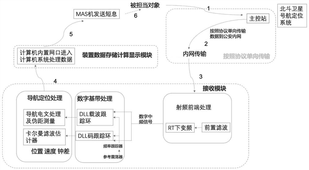
Image

Examples
Embodiment approach
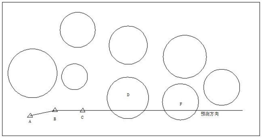
[0052] refer to image 3 , as a preferred embodiment of the present invention, the method also includes,
[0053] Establish a 2D map of the area under the jurisdiction of the intranet of the enterprise and institution according to the pre-divided area, and continuously obtain the position coordinates of the user in the 2D map every threshold time T, and record the position coordinates into the 2D map. When the distance between the coordinates of the three adjacent positions is greater than the first threshold d, it is judged that the user is a potential travel user, and the ray formed by the last two coordinates of the three adjacent coordinates is used as the travel prediction direction of the user, and the 2D In the map, the traffic conditions of the two pre-divided areas closest to the last coordinate of the three adjacent coordinates along the travel prediction direction are pushed to the user.
[0054] exist image 3 , the small triangles A, B, and C respectively repres...
PUM
 Abstract
Description
Claims
Application Information
 - R&D
- Intellectual Property
- Life Sciences
- Materials
- Tech Scout
- Unparalleled Data Quality
- Higher Quality Content
- 60% Fewer Hallucinations
Browse by: Latest US Patents, China's latest patents, Technical Efficacy Thesaurus, Application Domain, Technology Topic, Popular Technical Reports.
© 2025 PatSnap. All rights reserved.Legal|Privacy policy|Modern Slavery Act Transparency Statement|Sitemap|About US| Contact US: help@patsnap.com