A bme-gwr-based mapping method for geochemical anomalies in river sediments

A BME-GWR, water system sediment technology, applied in the field of image processing, can solve problems such as unsatisfactory results

Active Publication Date: 2022-04-22
HEBEI GEO UNIVERSITY
View PDF12 Cites 0 Cited by
  • Summary
  • Abstract
  • Description
  • Claims
  • Application Information

AI Technical Summary

Problems solved by technology

Traditional anomaly identification methods only rely on geochemical data for anomaly identification, and often fail to obtain satisfactory results

Method used


Image

  • A bme-gwr-based mapping method for geochemical anomalies in river sediments
  • A bme-gwr-based mapping method for geochemical anomalies in river sediments
  • A bme-gwr-based mapping method for geochemical anomalies in river sediments

Examples


Embodiment

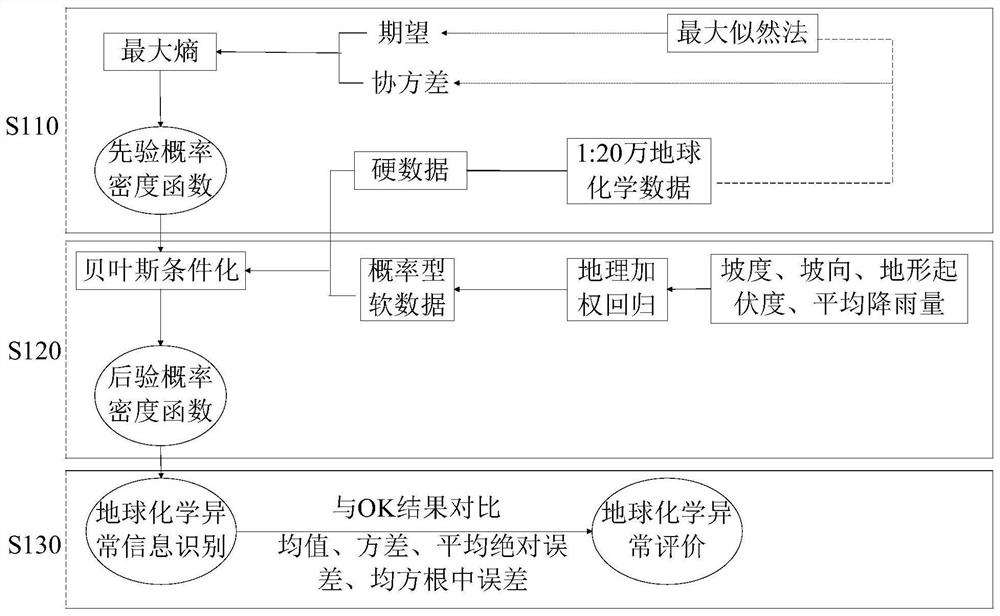
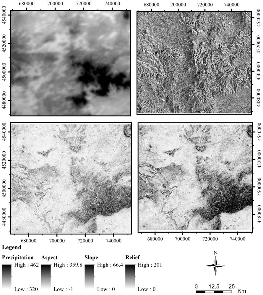
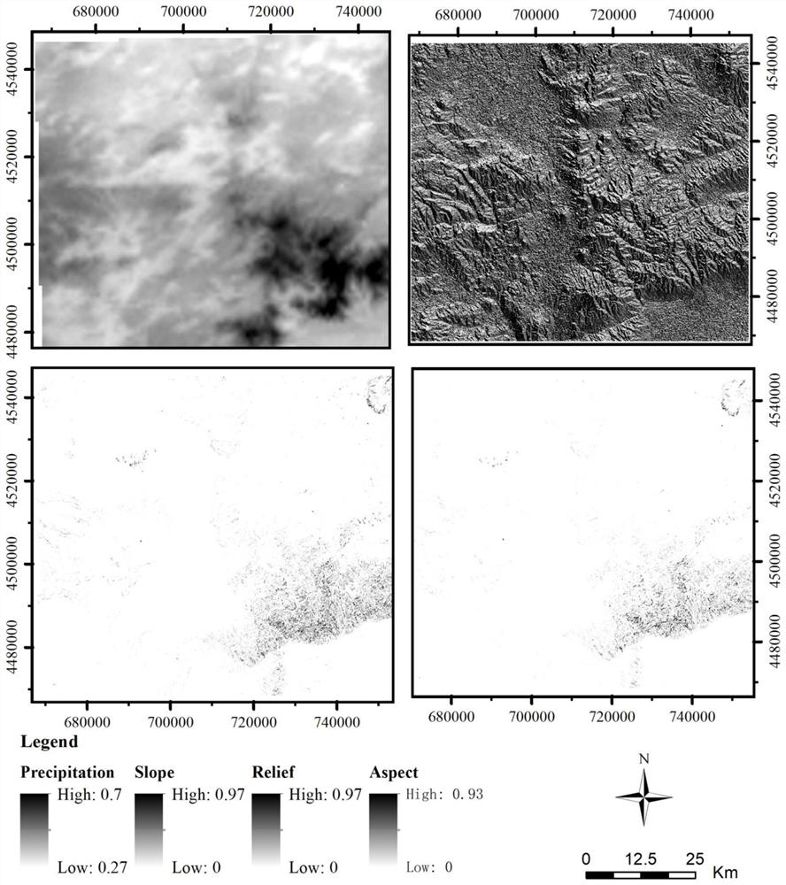
[0064] In this example, the Jining coverage area in Inner Mongolia is taken as the research area, and the 1:200,000 geochemical data of the research area are used as the hard data. The slope, aspect and topographical relief data of the research area are extracted based on ASTGTM2 DEM and the collected research area According to the degree of influence on the formation of secondary halos of river sediments, the slope aspect weights range from 315°-360° and 0°-45°, 45°-135° and 225°- 315°, 135°-225°, sequentially given weight values ​​within 0-1. The slope and average rainfall data were normalized to obtain the normalized spatial distribution of the river sediment topography and climate influencing factors in the study area. The probabilistic soft data of the above variables are constructed based on the geographic weighted regression method. Taking the 1:200,000 sedimentary geochemical data as the hard data, the probability density distribution function of the unsampled points ...


PUM


Abstract

The invention discloses a BME-GWR-based method for mapping geochemical anomalies of water system sediments, comprising the following steps: extracting topographic factors based on ASTGTM2DEM data, the topographic factors including slope, slope aspect and topographic relief information; based on the GWR method, the extracted The probabilistic soft data model of the study area was constructed based on topographical factors and average rainfall information in the study area; the hard data was based on the 1:200,000 drainage sedimentary geochemical data, and the established probabilistic soft data model and hard data were identified based on the BME method Geochemical anomalies of water system sediments; compare the identified geochemical anomalies of water system sediments with the Pkriging interpolation results, and evaluate the interpolation accuracy and uncertainty. The present invention adopts a BME‑GWR-based mapping method for geochemical anomalies of water system sediments with the above structure, which improves the identification accuracy of geochemical anomalies of water system sediments and reduces uncertainty.

Description

technical field [0001] The invention relates to the technical field of image processing, in particular to a BME-GWR-based mapping method for geochemical anomalies of water system sediments. Background technique [0002] Geochemical anomaly identification method is one of the hotspots in geochemical exploration research. Comprehensive information integration and fusion of data information related to mineralization is one of the effective ways to solve the problem of missing and incomplete geochemical information in coverage areas. Information identification is of great significance. Traditional anomaly identification methods rely only on geochemical data for anomaly identification, and often fail to obtain satisfactory results. The anomalous distribution of geochemical elements in water system sediments is affected by the surface geochemical landscape. Therefore, it is of great significance for geochemical exploration to identify geochemical anomalies by combining informatio...

Claims


Application Information

Patent Timeline
Patent Type & Authority Patents(China)
IPC IPC(8): G06F30/10G06F30/20G06F17/18G06F111/08G06F111/10
CPCG06F30/10G06F30/20G06F17/18G06F2111/08G06F2111/10
Inventor 汪海城
Owner HEBEI GEO UNIVERSITY
Why Eureka
Try Eureka