A Fusion Method Based on Multi-source Heterogeneous Spatial Planning Data
A spatial planning, multi-source heterogeneous technology, applied in structured data retrieval, database update, database management system, etc., can solve the problems of land spatial planning data format, coordinate reference, attribute structure difference, etc.
- Summary
- Abstract
- Description
- Claims
- Application Information
AI Technical Summary
Problems solved by technology
Method used
Image
Examples
Embodiment Construction
[0030] In order to make the object, technical solution and advantages of the present invention more clear and definite, the present invention will be further described below with reference to the accompanying drawings and examples. Based on the embodiments of the present invention, all other embodiments obtained by persons of ordinary skill in the art without making creative efforts belong to the protection scope of the present invention.
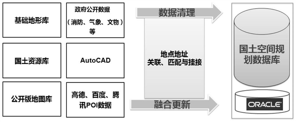
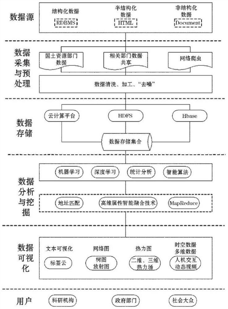
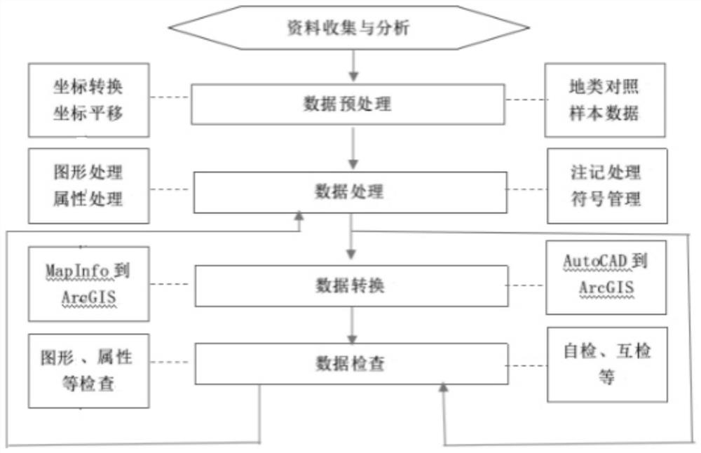
[0031]Aiming at the problem of differences in formats, coordinate references, attribute structures, etc. of land space data from different sources, the present invention provides a planning data fusion method based on multi-source heterogeneous space, which is mainly applied to land space planning data. The method is mainly after data access and before data application, based on the existing national land resource database, public map database, basic surveying and mapping database and other self-owned data, data cleaning and fusion are carri...
PUM
 Abstract
Description
Claims
Application Information
 - R&D
- Intellectual Property
- Life Sciences
- Materials
- Tech Scout
- Unparalleled Data Quality
- Higher Quality Content
- 60% Fewer Hallucinations
Browse by: Latest US Patents, China's latest patents, Technical Efficacy Thesaurus, Application Domain, Technology Topic, Popular Technical Reports.
© 2025 PatSnap. All rights reserved.Legal|Privacy policy|Modern Slavery Act Transparency Statement|Sitemap|About US| Contact US: help@patsnap.com


