Coordinate acquisition device based on geographic information and use method thereof
What is Al technical title?
Al technical title is built by PatSnap Al team. It summarizes the technical point description of the patent document.
A technology for acquiring devices and geographic information, applied in the field of surveying and mapping, can solve problems such as damage to coordinate instruments, increased costs, and troublesome leveling, and achieve the effects of increasing the scope of use, increasing the cost of use, and improving the accuracy rate
Pending Publication Date: 2022-01-21
袁犁
View PDF9 Cites 1 Cited by
Summary
Abstract
Description
Claims
Application Information
AI Technical Summary
This helps you quickly interpret patents by identifying the three key elements:
Problems solved by technology
Method used
Benefits of technology
Problems solved by technology
[0004] The main purpose of the present invention is to provide a coordinate acquisition device based on geographical information and its use method, which can effectively solve the problem of background technology. It is often impossible to adjust, and its stability cannot be guaranteed. When obtaining coordinates, leveling is very important, but often the existing leveling is more troublesome, and there are no protective measures for the coordinate instrument, which is easy to damage the coordinate instrument and increase the cost. The problem
Method used
Image
Click on the blue label to locate the original text in one second.
Reading with bidirectional positioning of images and text.
Examples
Embodiment Construction
[0037] In order to make the techniques, creative characteristics of the present invention, it is easy to understand that the present invention is further illustrated in connection with the specific embodiments.
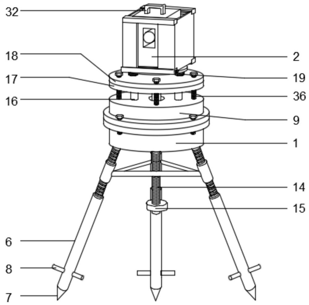
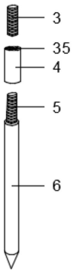
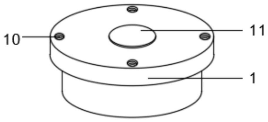
[0038]In the description of the present invention, it is to be noted that the terms "upper", "lower", "within", "outside" "front end", "backend", "two end", "one end", "other end" The orientation or positional relationship of the indication is based on the orientation or positional relationship shown in the drawings, which is only for ease of describing the invention and simplified description, rather than indicating or implying that the device or element must have a specific orientation. The orientation is constructed and operated, so it is not understood to limit the limitations of the invention. Moreover, the term "first", "second" is for description purposes only, and cannot be understood as an indication or implies relative importance.
[0039] In the description of ...
PUM
Abstract
The invention discloses a coordinate acquisition device based on geographic information and a use method thereof, and relates to the technical field of surveying and mapping. The coordinate acquisition device comprises a mounting base and a coordinatograph body, the bottom of the mounting base is provided with a supporting mechanism, the top of the mounting base is provided with a leveling mechanism, the peripheral surface of the coordinatograph body is provided with a protection mechanism, the supporting mechanism comprises a first screw rod, an adjusting sleeve, a second screw rod, a supporting leg, a plug pin and a pedal plate, the leveling mechanism comprises an adjusting top seat, a fixed shaft, a ball body, a balancing weight, a fixed column and a fixed table, and the protection mechanism comprises a first fixed block, a second fixed block, a screw rod, a bearing, a movable block, a first connecting rod, a shielding plate, a sliding rod, a second sliding block and a second connecting rod. According to the coordinate acquisition device based on geographic information and the use method thereof, the stability of the coordinatograph body during use is ensured, the coordinatograph body is ensured to be in a horizontal state all the time, the coordinate acquisition accuracy is improved, protection is carried out on the coordinatograph body when the coordinatograph body is not used or under special conditions, and damage is avoided.
Description
Technical field [0001] The present invention relates to the field of surveying and mapping, and in particular, to a coordinate acquisition apparatus based on geographic information and a method of use. Background technique [0002] Mapping refers to the measurement, collected and drawing the shape, size, spatial position, and attributes of natural geographic elements or surface manual facilities. Specifications and translational research and calculate the geometric position, geometric position of the ground point, the earth shape and the earth gravity field, and measure the geometric distribution of the natural shape and artificial facilities of the earth, and combine geographical distribution of certain social information and natural information, and to prepare global and local Maps and topic maps of various scales of the region. Measurement is also known as measurement. It includes two main contents of measurement and drawing. The surveying and mapping has a wide range of appli...
Claims
Application Information
Patent Timeline
Application Date:The date an application was filed.
Publication Date:The date a patent or application was officially published.
First Publication Date:The earliest publication date of a patent with the same application number.
Issue Date:Publication date of the patent grant document.
PCT Entry Date:The Entry date of PCT National Phase.
Estimated Expiry Date:The statutory expiry date of a patent right according to the Patent Law, and it is the longest term of protection that the patent right can achieve without the termination of the patent right due to other reasons(Term extension factor has been taken into account ).
Invalid Date:Actual expiry date is based on effective date or publication date of legal transaction data of invalid patent.