

Map augmented reality system
An augmented reality, map technology, applied in graphics reading, image data processing, 3D modeling and other directions, can solve the problems of single virtual 3D model and no virtual 3D model fusion, etc., to improve user experience, improve effectiveness and identification degree of effect
- Summary
- Abstract
- Description
- Claims
- Application Information
AI Technical Summary
Problems solved by technology
Method used
Image

Examples
Embodiment Construction
[0018] The present invention will be further described in detail below in conjunction with the accompanying drawings and specific embodiments.
[0019] Specific embodiments of the map augmented reality system of the present invention:
[0020] The software and hardware environments and tools involved in the development of the map augmented reality system of the present invention are as follows:
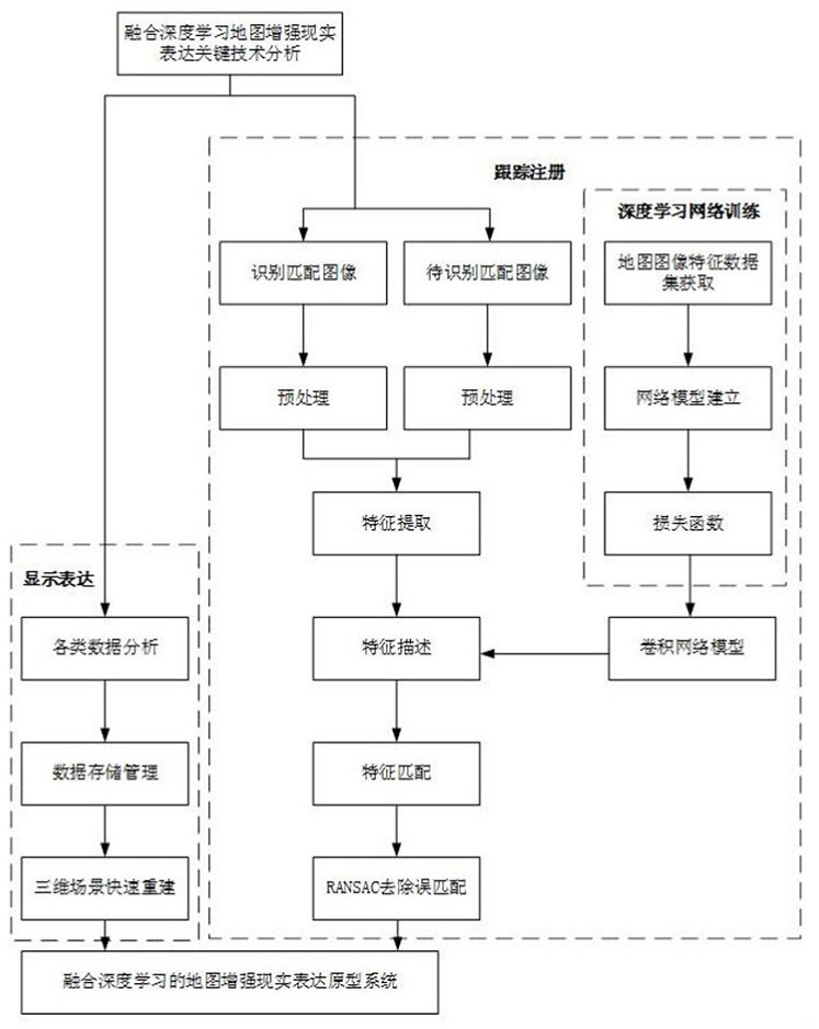
[0021] The system is developed using OpenCV, OpenGL ES, Android SDK, OpenCV for Android SDK and other tools. The 3D terrain model used in the system is made with 3D Max, and the database uses MySQL database.
[0022] OpenCV (Open Source Computer Vision Library) is a computer vision library used to implement functions such as image matching and pose calculation in prototype systems, and OpenGL ES (Open Graphics Library for Embedded Systems) is a development tool for three-dimensional graphics rendering for mobile electronic devices. To run the map augmented reality system on the mobil...
PUM
 Abstract
Description
Claims
Application Information